Weather
Tropical Threat Along Southeast Coast Could Impact MD
A homebrew storm may form this weekend a few hundred miles off the southeastern U.S. coastline. See the latest Maryland forecast.


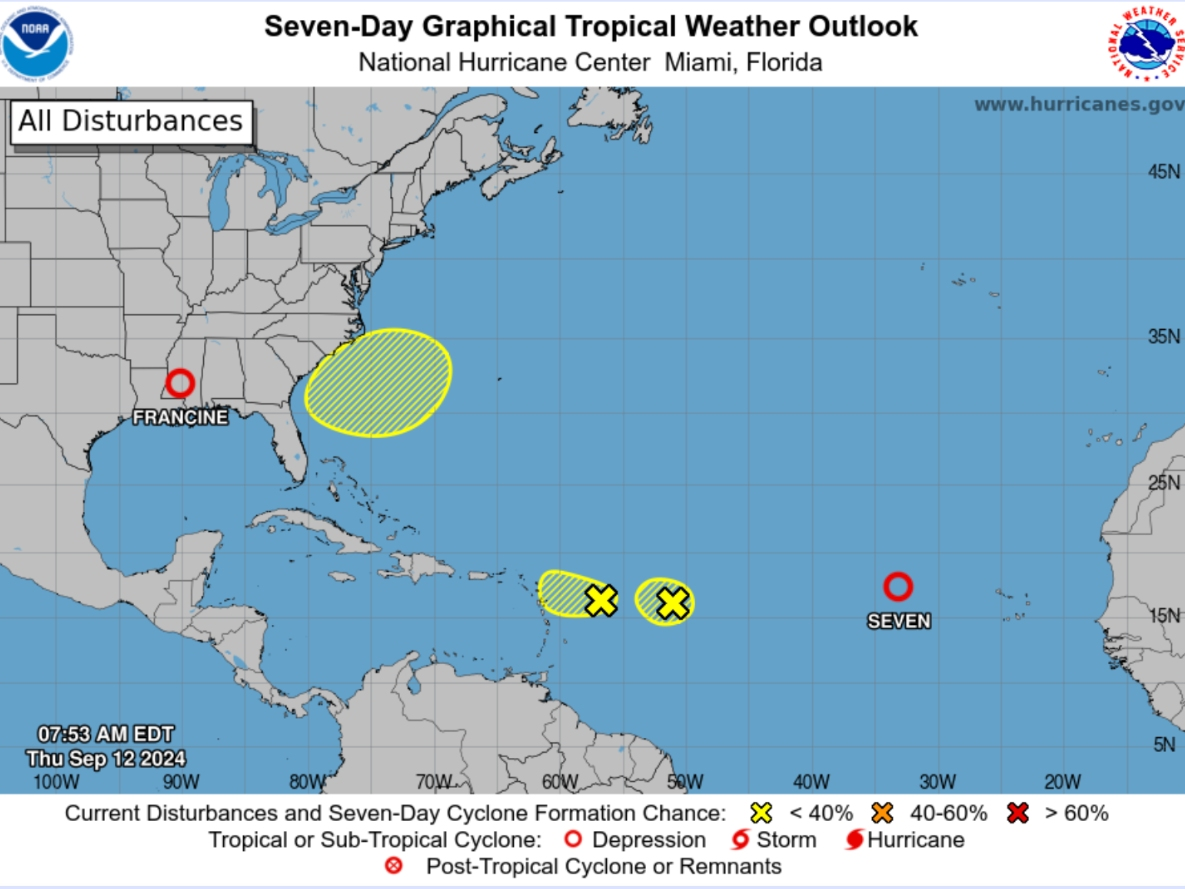
MARYLAND — A new tropical threat could develop off the southeastern U.S. coast this weekend and bring rain and winds to parts of Maryland, according to forecasters.
The "homebrew" development is expected to form this weekend into early next week just days after Francine made landfall in Louisiana as a Category 2 hurricane, knocking out power to hundreds of thousands of homes and businesses and sending storm surge rushing into coastal communities along the Gulf of Mexico.
According to AccuWeather meteorologists, a "homebrew" storm refers to a system that forms close to a U.S. coastline. They said this activity is usual during the early stages of hurricane season, which spans June 1 through Nov. 30.
Find out what's happening in Annapolisfor free with the latest updates from Patch.
"We continue to monitor the area just off the Carolina and Georgia coasts for tropical development this weekend to early next week," AccuWeather Lead Hurricane Expert Alex DaSilva said. "This system has the potential to spread heavy rain to the Carolinas and perhaps the lower part of the mid-Atlantic as it drifts to the west and northwest."
The system most likely won't have enough strength to become a hurricane, but there is a chance is could develop into a tropical depression or tropical storm, AccuWeather forecasters said.
Find out what's happening in Annapolisfor free with the latest updates from Patch.
The National Hurricane Center is also monitoring the system's possible development. In its Thursday morning forecast, NHC officials said the system has a 30 percent chance of forming in the next seven days.
Also Read: ‘Highly Active’ Atlantic Hurricane Season Expected As Peak Looms: NOAA
News of a potential tropical development comes as the NHC continued to monitor Tropical Depression 7 in the Atlantic, where it is expected to remain for the next several days.
As of 5 a.m. Thursday, the NHC said TD 7 was blowing 35 mph sustained winds and was located about 600 miles west of Cabo Verde Islands in West Africa. The storm was moving west-northwest and should maintain its speed of 17 mph before slowing down.
The next two names on the hurricane list are Gordon and Helene, with Gordon possibly going to TD 7 this week, AccuWeather said.
Related: Forecasters Downgrade 2024 Hurricane Season Predictions
Get more local news delivered straight to your inbox. Sign up for free Patch newsletters and alerts.