Weather
Dense Fog Advisory Extended, Driver Visibility Impaired: MD Weather
Dense fog has cut visibility across portions of Maryland and hampered driving. Rain should end late Saturday night.


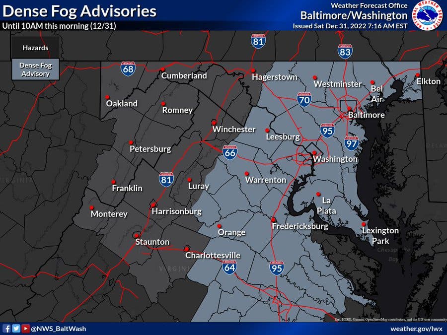
MARYLAND — Fog has cut visibility across portions of Maryland and hampered driving conditions. The National Weather Service has extended a dense fog advisory until 4 p.m. Saturday.
The advisory covers Anne Arundel, Cecil, Baltimore and Harford counties, including the cities of Elkton, Baltimore, Aberdeen, Glen Burnie, Annapolis, Severn, South Gate, Severna Park, Arnold, and Odenton.
Visibility is around one-quarter mile or less in areas of dense fog. Expect hazardous driving conditions due to low visibility, the weather service said.
Find out what's happening in Bel Airfor free with the latest updates from Patch.
If driving, slow down, use your headlights, and leave plenty of distance ahead of you.
A hazardous weather outlook is posted for the Maryland portion of the Chesapeake Bay, Tidal Potomac River, and I-95 corridor through central Maryland, northern Virginia, and District of Columbia.
Find out what's happening in Bel Airfor free with the latest updates from Patch.
Temperatures are expected to remain mild throughout the long holiday weekend, forecasters are predicting. Rain will move in Saturday afternoon and continue through the evening, but the sun will shine on Sunday, Jan. 1, according to the National Weather Service.
The city of Annapolis postponed its New Year’s Eve fireworks due to rain in the forecast on New Year's Eve. Early Saturday morning, rain and gusty winds are expected to move into the area around 4 a.m. and continue through 4 a.m. on Sunday. The fireworks display will instead take place at 5:30 p.m. on New Year’s Day, Jan. 1, in the Annapolis Harbor.
Temperatures will be 50, 60 and even 70 degrees Fahrenheit higher this weekend compared to the sub-zero conditions during Christmas weekend, according to AccuWeather.com.
Any time a flow of warm, moist air occurs over snow cover, cold ground or chilly bodies of water, there is the potential for fog. Some of these conditions will be present in portions of the central Appalachians, the mid-Atlantic and New England regions from Saturday through Saturday night.
AccuWeather Chief On-Air Meteorologist Bernie Rayno urged drivers who will be headed out to ring in the new year to be extra careful. "Lots of fog will be present around the Northeast region Saturday night," he said.
Here's the latest Maryland weather forecast:
Saturday: Showers, mainly after 1pm. Patchy fog. High near 56. South wind 3 to 5 mph. Chance of precipitation is 80%. New precipitation amounts between a tenth and quarter of an inch possible.
Saturday Night: Showers likely, mainly before 1am. Patchy fog before 2am. Otherwise, cloudy, then gradually becoming partly cloudy, with a low around 49. Calm wind becoming west around 5 mph after midnight. Chance of precipitation is 70%. New precipitation amounts between a tenth and quarter of an inch possible.
New Year's Day: Sunny, with a high near 58. Northwest wind 3 to 6 mph.
Sunday Night: Partly cloudy, with a low around 40. Calm wind.
Monday: Partly sunny, with a high near 59. Light and variable wind.
Monday Night: Mostly cloudy, with a low around 46.
Tuesday: A chance of rain. Mostly cloudy, with a high near 63. Chance of precipitation is 40%.
Tuesday Night: A chance of rain. Cloudy, with a low around 56. Chance of precipitation is 50%.
Get more local news delivered straight to your inbox. Sign up for free Patch newsletters and alerts.


