Weather
Harford Weather Warnings: Flash Flood, Severe Thunderstorm
BREAKING: Flash flooding, severe thunderstorms are possible in Harford County Friday evening, the National Weather Service warns.


HARFORD COUNTY, MD — There are multiple watches and warnings in effect in Harford County Friday evening. A flash flood warning is in effect for Harford County and east-central Baltimore County until 9:45 p.m.
Up to 2 inches of rain had already fallen in Fallston by 5:45 p.m., the National Weather Service reported, and heavy rain was continuing. Flash flooding was expected to begin shortly.
554pm: Particularly dangerous situation unfolding from Baltimore City into Harford County MD. Multiple rounds of extremely heavy rain will lead to life-threatening flash flooding. AVOID FLOODED AREAS!
— NWS DC/Baltimore (@NWS_BaltWash) July 27, 2018
A flash flood warning means that flooding is imminent or occurring. Residents near streams and creeks should take immediate precautions to protect life and property and move to higher ground.
Find out what's happening in Bel Airfor free with the latest updates from Patch.
Locations that may experience flooding include Pikesville, Middle River, Cockeysville, Aberdeen, Havre de Grace, Aberdeen Proving Ground, Towson, Bel Air South, Bel Air North, Carney, Perry Hall, Rossville, Mays Chapel, Timonium, White Marsh, Fallston, Riverside, Hampton, Kingsville and Pleasant Hills.
The weather service called out these areas as particularly flood prone:
Find out what's happening in Bel Airfor free with the latest updates from Patch.
- Green Road at Little Gunpowder Falls
- Kelso Road at Stemmers Run near Golden Ring Road
- Montreal Drive at Grays Run
- Bush Chapel Road at Cranberry Run
- Mitchell Lane at Pulaski Highway
- Old Philadelphia Road at Route 715
- Erie Street at Pulaski Highway
- Juniata Street and Otsego Street
- Bel Air Road at Little Gunpowder Falls
- Route 7 at Hall Street
- Patterson Mill Road at Wheel Road
- Philadelphia Road near James Run
- Sandy Hook Road near Deer Creek
- Darlington Road at Deer Creek Road
- Conowingo Road near Bynum Run
- Southampton Road at Bynum Run
- Moores Mill Road at Bynum Run
- Foxborough Drive
- Plumtree Road at Plumtree Run
Other warnings and watches for Harford County from the National Weather Service:
(PREVIOUS REPORT - EXPIRED WARNING): People should go inside immediately to stay safe from wind and lightning, sheltering away from windows. A severe thunderstorm warning is in effect until 6:45 p.m. for Harford County.
The National Weather Service issued the warning after 5:30 p.m. when a severe thunderstorm was detected over Carney that was moving northeast at 25 mph.
Radar indicated the storm was accompanied by 70 mph wind gusts and half-dollar-sized hail.
Roads may become blocked by trees, unsecured objects could go flying and power outages are possible.
Locations impacted include Baltimore, Middle River, Cockeysville, Aberdeen, Havre de Grace, Aberdeen Proving Ground, Towson, Bel Air South, Essex, Parkville, Bel Air North, Carney, Perry Hall, Rosedale, Rossville, Mays Chapel, Timonium, White Marsh, Fallston and Bowleys Quarters.
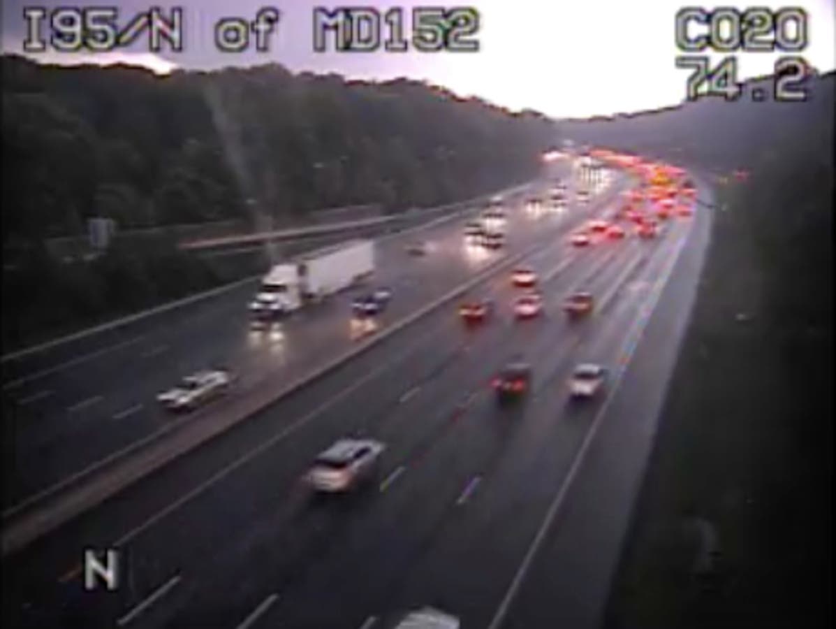
Still from CHART traffic camera on I-95 at MD 152 at 5:50 p.m. and I-95 north of MD 24 at 6 p.m.
Get more local news delivered straight to your inbox. Sign up for free Patch newsletters and alerts.