Weather
Flood Warning In Effect For Harford County
The National Weather Service has placed Harford County under a flood warning.

HARFORD COUNTY, MD — A flood warning has been issued for Harford County Friday night. The National Weather Service issued the warning, which is in effect until 9:15 p.m.
About 1 to 3 inches of rain had fallen by 7:50 p.m., the weather service said.
These areas may experience flooding, officials said: Bel Air North, Fallston, Jarrettsville, Jacksonville, Hydes, Long Green, Baldwin, Bentley Springs, Maryland Line and Freeland.
Find out what's happening in Bel Airfor free with the latest updates from Patch.
Authorities advise drivers to turn around — don’t drown — if encountering water-covered roads.
These roads may flood, officials said: Long Green Pike at Long Green Creek, Freeland Road at Beetree Run near Maple Avenue and Green Road at Little Gunpowder Falls.
Find out what's happening in Bel Airfor free with the latest updates from Patch.
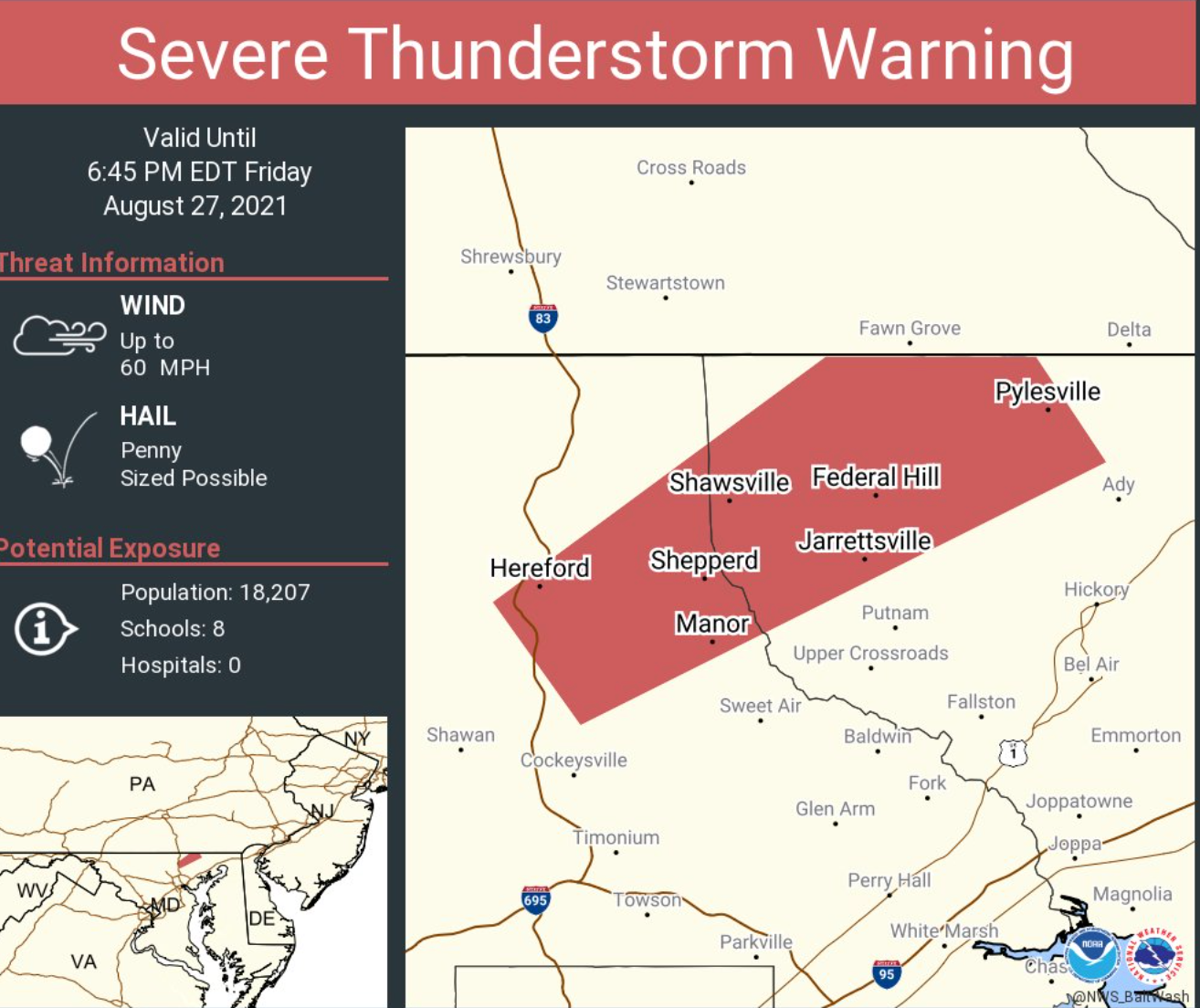
Earlier, a severe thunderstorm warning was issued after a severe storm was located near Cockeysville at 5:52 p.m. and was moving northeast at 10 mph. Radar indicated the storm had 60 mph winds.
At 6:16 p.m., officials said a severe thunderstorm was near Jarrettsville that was moving north at 20 mph.
These areas may be impacted, according to the warning: Cockeysville, Bel Air North, Fallston, Kingsville, Pleasant Hills, Jarrettsville, Pylesville, Fork, Cardiff, Benson, Norrisville, Baldwin, Long Green, Hydes, Forest Hill, Chrome Hill, Bynum, Street, Rocks and Jacksonville.
The severe thunderstorm warning expired at 7 p.m.
During the severe thunderstorm warning period, people were advised to go inside to an interior room on the lowest floor to stay safe.
Wind may cause trees and large branches to fall, injuring people outside and damaging homes and vehicles. Roads could become blocked by fallen trees, and power outages are possible.
Torrential rainfall was accompanying the storms, according to authorities.
While forecasters expected 1 to 2 inches of rain Friday afternoon and evening across central and northeastern Maryland, officials said heavier rain of 2 to 3 inches an hour may cause some areas to see localized totals of 3 to 5 inches of rain.
A flash flood watch was to be in effect until 1 a.m. Saturday but it was canceled.
See the latest forecast from the National Weather Service.
Get more local news delivered straight to your inbox. Sign up for free Patch newsletters and alerts.


