Community Corner
National Weather Service Issues Alert for PG County
County road crews will begin treating streets Sunday at 7:30 a.m. to keep ahead of a mix of snow, sleet and freezing rain.


>>Want more news? Get the daily Bowie email newsletter.
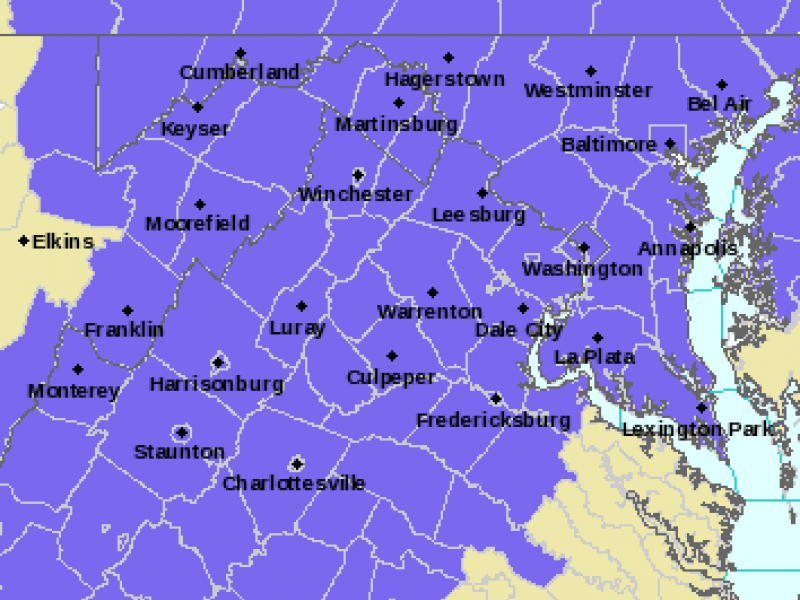
IMAGE: National Weather Service map of area, in purple, under Winter Weather Advisory beginning Sunday at 7 a.m. Map updated by NWS at 4:07 p.m. Saturday.
__________________
Find out what's happening in Bowiefor free with the latest updates from Patch.
Here we go again: Driving could be treacherous Sunday into Monday morning.
The National Weather Service has issued a Winter Weather Advisory for Prince George’s County that goes into effect Sunday at 7 a.m. and continues until Monday at 3 a.m.
Find out what's happening in Bowiefor free with the latest updates from Patch.
The advisory predicts a messy mix of snow, sleet and freezing rain. The weather service advisory covers Washington, D.C., Prince George’s County, and most of Montgomery County, including the cities of Rockville and Germantown.
The NWS expects accumulations of a coating to 1 to 3 inches of snow and sleet in the northern and western DC suburbs, plus 1/10th of an inch of ice on the roadways and sidewalks.
The timing of the wintry mix:
- Snow is expected to start falling between 7-10 a.m. on Sunday morning.
- Snow will eventually change over to sleet and freezing rain, probably between noon and 3 p.m., the weather forecasters say.
- The precipitation is expected to end as freezing rain Sunday night, according to the weather service.
The National Weather Service says that roads will be covered in snow and ice Sunday and Sunday night, warning that “traveling will be dangerous at this time.”
Road Crews to Deploy
Prince George’s County will have an estimated 200 vehicles hit the roads at 7:30 a.m. Sunday in preparation for the wintry mix. Crews will treat the primary and major collector roadways first and then move into the residential areas.
Forecasters are predicting snow to begin Sunday morning with an accumulation of up to one inch before it changes to sleet around 1 p.m. Freezing rain is expected to begin in late afternoon and will change to rain that evening before the precipitation ends Sunday night.
“The wintry mix and freezing temperatures could cause icy road conditions,” said Darrell Mobley, director of the Department Public Works and Transportation. “Motorists are encouraged to stay off the roadways. If you must drive, please stay alert for icy patches, add extra time for travel and use caution when traveling over bridges, ramps and overpasses.”
Forecast
Temperatures on Sunday are expected to rise through the 20s in the morning and into the upper 30s by the afternoon into Sunday night, the weather forecasters say.
The high on Monday is expected to hit 46 degrees across the area, according to the National Weather Service.
Get more local news delivered straight to your inbox. Sign up for free Patch newsletters and alerts.