Weather
MD Winter Weather Advisory Extended, Hour-By-Hour Snow Forecast
The winter weather advisory for much of Maryland has been extended. See the hour-by-hour snow forecast.


BALTIMORE, MD — As snow has slowly moved into Maryland Saturday morning, with an inch on the ground at BWI Airport by 11 a.m., a winter weather advisory for the Baltimore-Washington area has been extended until 9 p.m. Predictions of 3 to 5 inches of snow wereenough to have several school districts cancel Saturday activities, including Anne Arundel County Public Schools, Baltimore County Public Schools, Carroll County Public Schools, and Howard County Public Schools.
Snow accumulations may be between 2 to 4 inches, with locally higher amounts possible, according to the weather service. Areas included in the advisory are Washington, D.C., plus Baltimore, Prince George's, Anne Arundel, Charles, Calvert, Montgomery, Howard, and Harford counties.
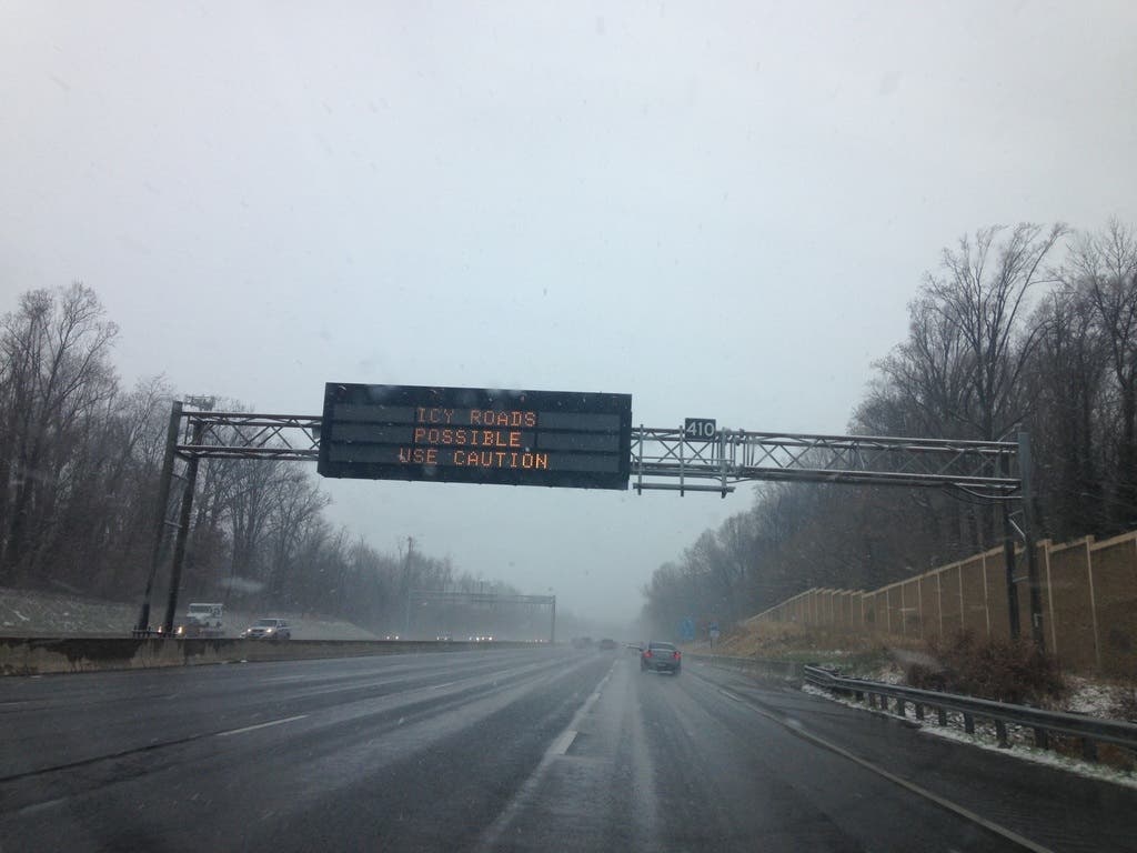
The weather service warns drivers to plan on slippery road conditions in the District of Columbia, Baltimore and surrounding portions of Maryland and Virginia.
Find out what's happening in Columbiafor free with the latest updates from Patch.
A Winter Weather Advisory for snow means periods of snow will cause primarily travel difficulties. Be prepared for snow covered roads and limited visibilities, and use caution while driving, forecasters warn. The latest road conditions for the state you are calling from can be obtained by calling 5 1 1.

Southern Maryland and the Eastern Shore will see the heaviest snow, and St. Mary's County is under a winter storm warning until 9 p.m. Saturday.
Find out what's happening in Columbiafor free with the latest updates from Patch.
Moderate to heavy wet snow expected in the winter storm warning area. Rain and sleet may occasionally mix with snow overnight, especially south and east of Salisbury. Plan on slippery travel conditions. Total wet snow accumulations of 4 to 6 inches are expected tonight into Saturday. Locally higher amounts are possible.
When a winter storm warning is issued, it means that severe winter weather conditions are expected. Drivers should keep extra food, water and a flashlight in their vehicles.
Snow began southeast of D.C. Friday evening mixed with rain. It had stopped Saturday, then started again as the advisory was extended.
The high temperature Saturday will be near 35 degrees, so the snow won't stick around long. It will be sunny and 40 degrees on Sunday, and climb to a high of 45 on Monday.

The Washington Post's Capital Weather Gang says that they believe snow totals will lean toward the low end of predictions. "Snow will stick, especially on grass and elevated surfaces. Localized heavier bands of snow could develop. Anyone that gets under a persistent heavier band will stand a chance for higher-end totals," the forecasters say.
The prime time for snowfall should from around now into the afternoon.
Check out the latest snow total predictions and an hour-by-hour forecast below:
- noon: 100 percent chance of snow
- 1 p.m.: 86 percent chance of snow
- 2 p.m.: 86 percent chance of snow
- 3 p.m.: 86 percent chance of snow
- 4 p.m.: 66 percent chance of snow
- 5 p.m.: 66 percent chance of snow
- 6 p.m.: 66 percent chance of snow
- 7 p.m.: 25 percent chance of snow
- 8 p.m.: 25 percent chance of snow
- 9 p.m.: 25 percent chance of snow
- 10 p.m.: 25 percent chance of snow
- 11 p.m.: 25 percent chance of snow
- midnight: 25 percent chance of snow
A winter weather advisory means that snow may cause travel difficulties. Drivers should expect slippery conditions on the roads with limited visibility. The weather service said that roads could remain slick through early Sunday, due to below-freezing temperatures. The winter weather advisory spans the I-95 corridor from northern Maryland to Fredericksburg, Virginia.
Anne Arundel, Baltimore, Calvert, Charles, Harford, Howard, Montgomery, Prince George's and St. Mary's counties are under the advisory. The District of Columbia and parts of Virginia are also included.
There is a separate winter weather advisory for Caroline, Cecil, Kent, Queen Anne's and Talbot counties calling for 2 to 4 inches of snow from 7 p.m. on Friday, Dec. 8, to noon on Saturday, Dec. 9.
Patch staff photo; graphic courtesy of the National Weather Service
Get more local news delivered straight to your inbox. Sign up for free Patch newsletters and alerts.