Weather
Flash Flood Warning Issued for Montgomery County
Two inches of rain has fallen across parts of Montgomery County and the National Weather Service says to expect flooding soon.

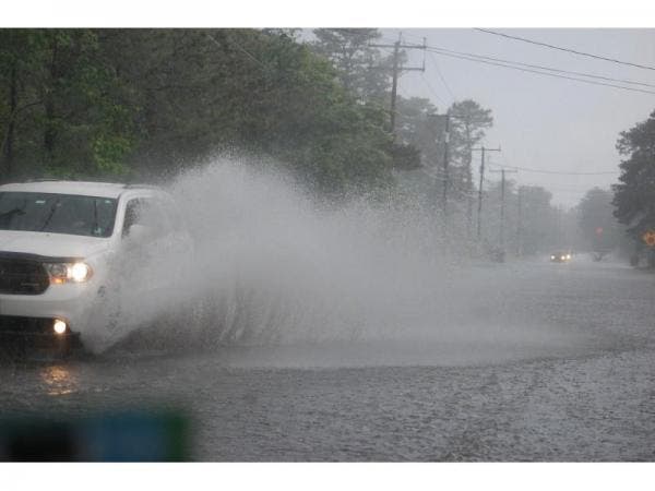
Heavy rain falling across Montgomery County has prompted a flash flood warning for the area until 7:30 p.m.
Up to two inches of rain have already fallen across the county, says the National Weather Service, and up to two more inches of rainfall is possible. Flash flooding is expected to begin shortly.
Some locations that are expected to experience flooding include: Rockville, Bethesda, Gaithersburg, Olney, Fort Totten, American Legion Bridge, Aspen Hill, Potomac, North Bethesda,North Potomac, Redland, Takoma Park, Great Falls, Kemp Mill, Chevy Chase, North Kensington, South Kensington, Forest Glen, Martin’s Additions and North Chevy Chase.
Find out what's happening in Rockvillefor free with the latest updates from Patch.
The Weather Service has already posted a Flash Flood Watch for most of the state through 11 a.m. Friday. The watch area includes Washington, D.C., Northern Virginia and most of Maryland.
"Several rounds of showers and thunderstorms developing in the afternoon will continue into Friday morning," according to a weather service statement. "Given ample moisture and instability, showers and thunderstorms will be capable of producing torrential downpours with rainfall rates of an inch or two per hour at times."
Find out what's happening in Rockvillefor free with the latest updates from Patch.
National Weather ServiceThe heavy rain may result in flash flooding of small streams, creeks and urban areas.
The weather service warns residents to monitor forecasts and be prepared to take action if flood warnings are issued.
The latest forecast, according to the weather service:
Thursday Afternoon: A chance of showers and thunderstorms. Some storms could be severe, with damaging winds and heavy rain. Mostly cloudy, with a high near 93. Heat index values as high as 101. South wind around 6 mph. Chance of precipitation is 50%.
Tonight: Showers and thunderstorms likely, then showers and possibly a thunderstorm after 11pm. Some storms could be severe, with damaging winds and heavy rain. Low around 74. East wind around 5 mph becoming south after midnight. Chance of precipitation is 80%. New rainfall amounts between a quarter and half of an inch possible.
Friday: Showers likely and possibly a thunderstorm before 11am, then a chance of showers and thunderstorms after 11am. Mostly cloudy, with a high near 86. Northwest wind 7 to 11 mph. Chance of precipitation is 60%. New rainfall amounts between a quarter and half of an inch possible.
Get more local news delivered straight to your inbox. Sign up for free Patch newsletters and alerts.