Weather
Snowy Shot Of Winter Precedes Weekend Warmup In Latest MA Forecast
After a cold stretch this week temperatures are expected to rebound well above normal by this upcoming weekend.

MASSACHUSETTS — While it could begin to look a lot like Christmas during a cold stretch with a shot of snow across the state over the next couple of days, the forecast of a weekend warmup could have things feeling a lot more like early fall than less than two weeks before the official start of winter.
After a nice Monday and seasonable Tuesday, things will turn colder Tuesday night as a chance of snow moves in after midnight. The National Weather Service is calling for a 40 percent chance of widespread snow showers that could be enhanced along the coast with ocean-effect snow.
While it could be too warm for the white stuff on the outer Cape, the National Weather Service said the best chance of getting up to an inch of snow will be in the Greater Boston area.
Find out what's happening in Across Massachusettsfor free with the latest updates from Patch.
That will pave the way for a cold Thursday with a high temperature of 35 before a nice weekend warmup.
The National Weather Service is forecasting a high of 44 degrees as winds shift around to the southwest on Friday, then a high of 53 degrees on a partly sunny Saturday and 57 degrees with a chance of rain on Sunday.
Find out what's happening in Across Massachusettsfor free with the latest updates from Patch.
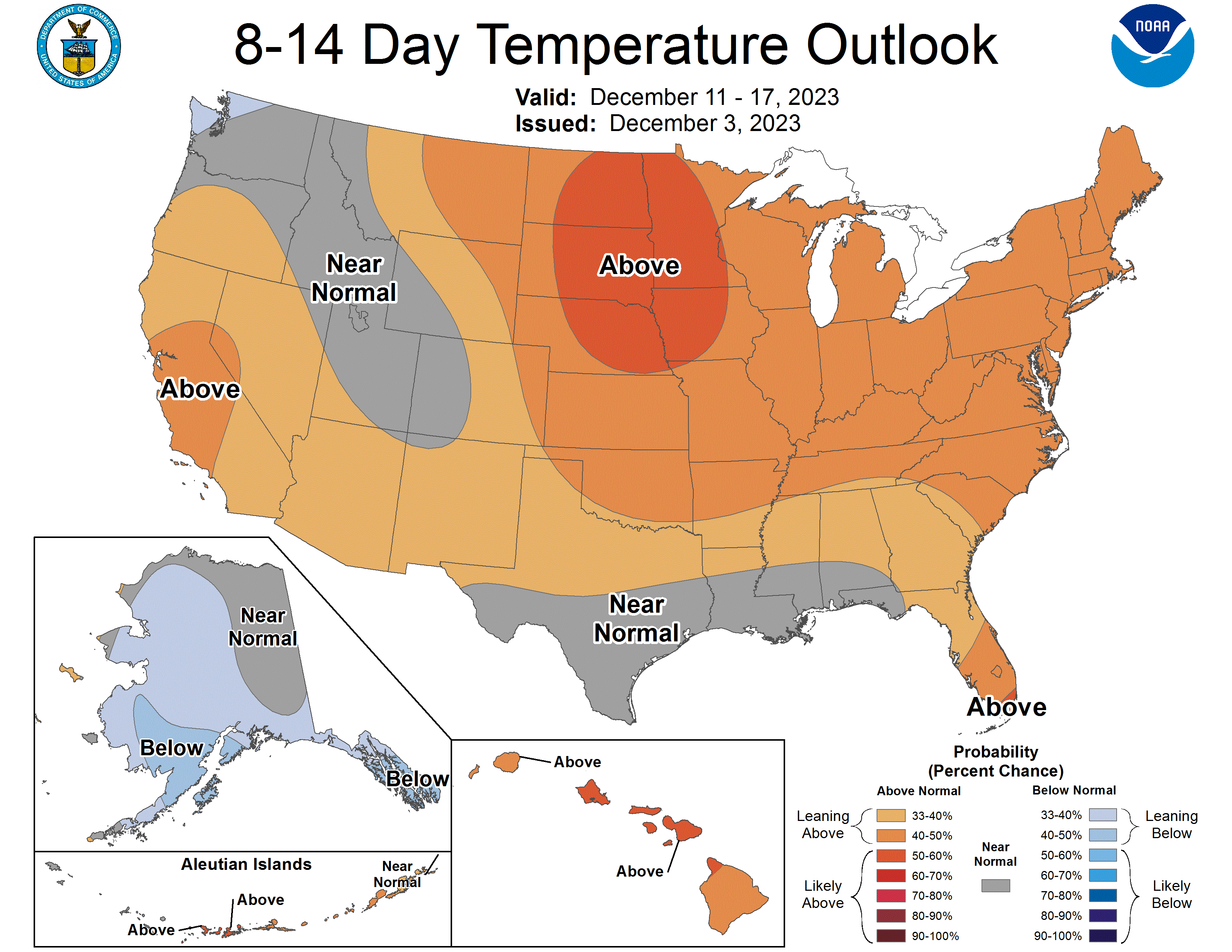
Even better news for those who are not ready to bundle up for the season is that the 8-14 day temperature outlook suggests New England will have above-normal temperatures from Dec. 11 to Dec. 17 with no frigid cold expected anywhere across the country except for the far Northwest and Alaska.
Get more local news delivered straight to your inbox. Sign up for free Patch newsletters and alerts.