Community Corner
A Very White Christmas in Danvers?
Stormy winter weather patterns on their way to New England.

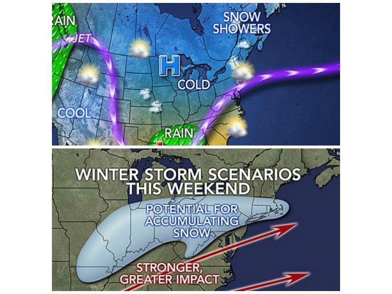
As many as three major storms that could deliver snow, ice, rain, and thunderstorms in the Northeast will hit this week the and Christmas week.
What that means for the prospects for Danvers having a white Christmas is not yet solidified, but here is what you need to know about those upcoming weather systems.
Find out what's happening in Danversfor free with the latest updates from Patch.
“While details including timing, track and exact precipitation type for the storms have yet to be determined, the storms will bring enough precipitation to slow travel as they move along,” according Alex Sosnowski, expert senior meteorologist for AccuWeather.com.
The first storm is expected to hit the mid-Atlantic states on Sunday and run north. The storm is expected to strengthen but it is unknown how for north the storm will travel.
Find out what's happening in Danversfor free with the latest updates from Patch.
A second albeit weaker storm is expected to bring snow and freezing rain from Washington, D.C., to Boston early next week. If the storm becomes stronger, it could unload heavy snow through interior New England with wind and freezing rain on the coast.
Another storm is expected to hit just before Christmas.
According to long-range expert Mark Paquette, “While not all of these storms will be a snow threat for the major travel hubs in the Midwest and Northeast, there does not have to be arctic air in place for them to bring at least some snow and ice problems.”
Graphics courtesy of AccuWeather.com.
Get more local news delivered straight to your inbox. Sign up for free Patch newsletters and alerts.