Business & Tech
Map: What Are the Richest Parts of the Vineyard?
The map below shows the median income in blocks across the Vineyard as reported by the U.S. Census Bureau.

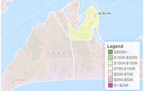
The map above shows the median income in areas across Martha's Vineyard.
Data are from the 2010 United States Census Bureau. Household income is defined as the income of the householder and all other individuals 15 years old and over in the household, whether they are related to the householder or not.
The median is defined by dividing the income distribution into two equal parts: one-half of households in each census tract fall below the median income and one-half are above the median.
Using your cursor, you can hover over any census tract – the geographic region defined by U.S. Census – and see the median household income in the box in the upper right hand corner of the map.
One of the most-read Martha's Vineyard posts of the past year was our recent look at inequality on the island. Do you see that debate differently after looking at this data?
Which parts of the island surprise you? Tell us in a comment or a blog post.
Get more local news delivered straight to your inbox. Sign up for free Patch newsletters and alerts.