Community Corner
How Much Heavy, Wet Snow is Expected to Hit Area on Saturday?
The latest forecasts predict potentially hazardous travel and possible power outages.

By Les Masterson (Patch Staff)
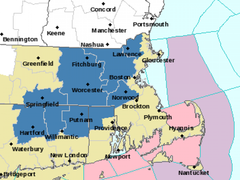
Photo credit: National Weather Service.
The snowstorm headed our way is not expected to bring anywhere near a foot of snow on Saturday, but it will be the biggest snowfall of the winter.
Find out what's happening in North Andoverfor free with the latest updates from Patch.
The storm will also cause hazardous driving and possible power outages.
CBSBoston is predicting 3-6 inches for most of Greater Boston and Central Massachusetts. Boston, the North Shore and the South Shore are expected to get 1-3 inches of snow. Cape Cod and the Islands may get rain with a trace amount of snow.
Find out what's happening in North Andoverfor free with the latest updates from Patch.
The National Weather Service called for a Winter Storm Watch for most of Greater Boston and Central Massachusetts and predicted 4-7 inches of snow for that area on Saturday.
The snow should begin in the morning, may mix with rain at midday and then turn back to snow in inland Massachusetts.
The storm watch will begin at 7 a.m. Saturday and run through 11 p.m. Saturday. The rest of Massachusetts is under the less severe Hazardous Weather Outlook.
The heavy, wet snow could make for hazardous driving on Saturday and could bring down tree limbs and power lines.
“Plan to have travel completed Saturday morning. Driving conditions may be difficulty Saturday afternoon and evening,” said the NWS.
Get more local news delivered straight to your inbox. Sign up for free Patch newsletters and alerts.