Schools
Giant Traveling Map Makes Stop at Stoughton's O'Donnell Middle School, Giving Students Hands-on Learning Experience
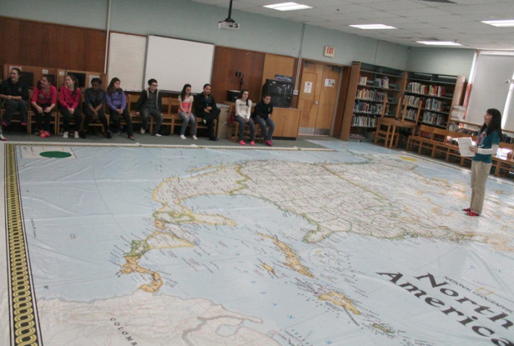
Seventh graders at the O'Donnell Middle School got the chance to explore North America with a map from National Geographic measuring 35 feet by 26 feet. The map was set up in the school's media center.


Instead of squinting to see a map scaled down to fit on part of a page in a textbook, seventh grade students at the O'Donnell Middle School in Stoughton had the chance to explore North America in a big way - with one of the largest maps of the continent.
The map, measuring 35 feet by 26 feet gave students a fun, interactive experience through rich content and exciting activities that enliven the study of geography.
The brightly colored, smooth vinyl surface of the map accurately illustrates North America’s oceans, seas, rivers, mountains, countries and capitals.
Find out what's happening in Stoughtonfor free with the latest updates from Patch.
Seventh graders in Rachel Killion's seventh period social studies class spent last Wednesday afternoon in the OMS Media Center, where the map was laid out on the floor, covering much of the back of the room.
"When I asked the students about their experience the common responses were: "it was awesome/great!" and of course "it was really big!" They were able to get a better sense of detail shown on the map. They could better see the curve of the lines of latitude and longitude. They said they better understood the location and size of Alaska and Hawaii," Killion wrote in an email.
Find out what's happening in Stoughtonfor free with the latest updates from Patch.
The map was at the OMS from March 13-15 as part of National Geographic’s Giant Traveling Maps program, organized by National Geographic Live, the public programming division of the National Geographic Society. The middle school was able to have access to the maps through a grant from Southeast Massachusetts Geography Network (SEMAGNET) out of Bridgewater State University.
"As a teacher, it can be difficult to teach students the concept of going from 3-D (real world) to two dimensional maps," Killion wrote in an email. "Textbook maps are limited to small representation of a continent or country. Programs like Google Earth are great and allow you to see detail if you zoom in, but then you loose the rest of the surrounding area. This large scale map enabled the students to see more details on individual countries or states, yet still see how that smaller portion related to the larger continent. We were able to practice our map skills using movement and games which engaged all of the students."
"The world today is more connected than ever," she continued, "and students need to understand geography to help them learn about other cultures, communicate with other people, care for their planet, and to be better informed global citizens."
OMS Principal Matt Colantonio added that at the middle school "we really emphasize experiential learning. This traveling map is a perfect example of how a hands-on learning activity can make a more meaningful experience for students - plus they get to have fun as they learn."
Portions of a press release were used in this report.