Weather
Multiple Storm Threats Amid Dangerous Heat Across Detroit Area: Timeline
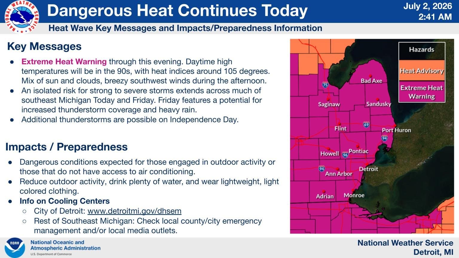
An extreme heat warning remains in effect for the metro Detroit area through Friday.

Thunderstorms are possible across the Detroit area Thursday as heat indices climb over triple digits again, according to the National Weather Service.
The scattered thunderstorms could move into the region during the afternoon and evening hours when highs reach the upper 90s with the real feel climbing up to 107 degrees, according to NWS.
Forecasters warned any storm that pops up could produce heavy downpours, large hail and winds up to 60 miles per hour.
Find out what's happening in Detroitfor free with the latest updates from Patch.
Friday will remain hot and humid with a better chance for showers and storms, according to NWS.
Highs on Friday will again reach the upper 90s with heat index values climbing to as high as 107 degrees across the area, according to NWS.
Find out what's happening in Detroitfor free with the latest updates from Patch.
Forecasters said the showers and storms will likely move into the region sometime after 5 p.m. and continue into the nighttime hours.
An extreme heat warning remains in effect for the metro Detroit area through Friday.
Saturday, Independence Day, will again see highs in the 90s with increasing storm chances throughout the day, according to NWS.
More showers and storms are likely across the Detroit area on Sunday when highs finally fall below 90 degrees, according to NWS.
Temperatures will stay in the upper 80s to start next week with plenty of sunshine, according to NWS.
Here is the full NWS forecast for the Detroit area:
Friday: Showers/Storms; High 97, Low 72
Saturday: Showers/Storms; High 91, Low 68
Sunday: Rain; High 86, Low 66
Monday: Sunny; High 86, Low 66
Tuesday: Sunny; High 88, Low 68
Get more local news delivered straight to your inbox. Sign up for free Patch newsletters and alerts.