Weather
'Dangerously Hot Conditions' Hit Twin Cities — More Heat, Storms To Come
Throughout the week, heat index values are expected to reach 95-100 degrees daily as hot and humid conditions continue.

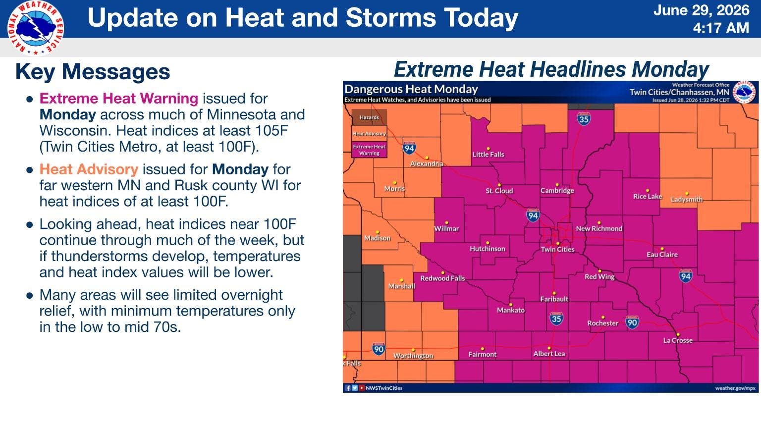
The Twin Cities are under an extreme heat warning and should expect “dangerously hot conditions” through Monday night, with a chance of severe thunderstorms looming throughout the week, according to authorities.
Monday’s warning expires at midnight, transitioning to a heat advisory that will be in place through 9 p.m. Tuesday for portions of central and southeast Minnesota, including the Twin Cities, plus parts of western Wisconsin, according to the National Weather Service.
Heat index values of up to 100 degrees are expected Monday, with the weather service predicting a high near 94 degrees at the Minneapolis-St. Paul International Airport, where heat index values were predicted to top out at 107 degrees.
Find out what's happening in Across Minnesotafor free with the latest updates from Patch.
“Drink plenty of fluids, stay in an air-conditioned room, stay out of the sun, and check up on relatives and neighbors,” the extreme heat warning said.
Throughout the week, heat index values are expected to reach 95-100 degrees daily as hot and humid conditions continue, according to a hazardous weather outlook from the service.
Find out what's happening in Across Minnesotafor free with the latest updates from Patch.
The heat index is what the temperature feels like when relative humidity is combined with air temperature, according to the service.
Chances of thunderstorms are forecast through most of the week, with severe storms and heavy rainfall possible, according to the service.
Get more local news delivered straight to your inbox. Sign up for free Patch newsletters and alerts.