Community Corner
Fridley Has 'Close Call' with May Storm That Decided to Dump Snow Elsewhere
Nearly a foot of snow will fall in places south and east of Fridley, according to the National Weather Service.

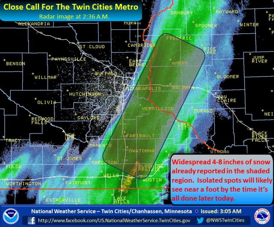
Fridley avoided the brunt of a rare May snowstorm overnight that the National Weather Service says will leave nearly 12 inches of snow in areas to the south and east, where a Winter Storm Warning remains in effect:
Close call for the Twin Cities. A 30 mile wide heavy snow band continues to stream moisture northeast overnight. This snow band has seen very little movement over the past few hours and has produced widespread 4-8" snowfall amounts. Isolated locations in the shaded region will see near a foot of snow by the time it's all said and done
If you're curious about snow totals, check the National Weather Service-Twin Cities map.
Find out what's happening in Fridleyfor free with the latest updates from Patch.
Here is Fridley's forecast for Thursday:
A slight chance of snow between 9am and noon. Cloudy, with a high near 44. North wind around 10 mph. Chance of precipitation is 20%.
Find out what's happening in Fridleyfor free with the latest updates from Patch.
Get more local news delivered straight to your inbox. Sign up for free Patch newsletters and alerts.