Health & Fitness
A Day on my Bike Exploring the Mississippi River and Its Parks
I wrote this article for the City of Lilydale's Fall Newsletter and thought readers of the Mendota Heights Patch might like to read it.


I really cannot believe I have lived in Minnesota for nearly 40 years, but only discovered Minnehaha Falls fairly recently. I guess I have the excuse that it was because I lived in Rochester until 3 years ago. Upon moving to Lilydale I found that I not only was living within a national park, the Mississippi National River and Recreation Area or MNRRA for short, but that there were 6 other parks within the national park, all within moderately easy biking distance of my condo.
On this particular Fall day I set out on my bike to explore at least 2 of them, and maybe 4 if I had the stamina: Minnehaha and Ft. Snelling for sure and maybe, Hidden Falls, and Crosby Parks, as well. The 4 parks I listed are the closest to me in location and the other two out of the six, Mississippi Gorge and Lilydale-Harriet Island Regional Parks are further north or east of where I was going. There are actually over 20 miles of interconnected trails in the St. Paul bike system. For future reference, Minnehaha Park is also connected to the Minnehaha Creek Bike Trail which follows the creek bed all the way to Lake Harriet and is also connected to the Mississippi River Trail which leads north to the Univ. of Minn. But for this today my plan was to stay on the St. Paul bike trails and reach Minnehaha Falls Park first and then maybe Hidden Falls and Crosby Parks, too, via the Ford Parkway Bridge, and back to Lilydale via the 35E bridge. I thought this was a reasonable goal.
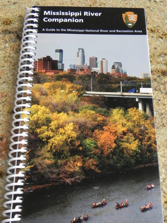
I did not have my usual 'leader' and friend on bike rides, as he was recovering from neck surgery and definitely could not risk falling off a bike. So, out of necessity, I was inspired to use another guide -- the Mississippi River Companion, a 100-page Guide to the Mississippi National River and Recreation Area, which I found to be an incredible resource in showing me how to do it. This spiral guidebook is available free at . Since I work there part-time and now that I know how valuable this book is, I can make sure plenty of copies are kept in stock for anyone interested. The book contains 26 maps along with biking, hiking and other trail information set in a glossy- color format and like I said, it's FREE!
Find out what's happening in Mendota Heightsfor free with the latest updates from Patch.
I started my bike ride mid-morning on a crisp fall October day from Lilydale. I had my fleece headband, a jacket, and my camera, and also a credit card in my fanny pack because I hoped to eat lunch on the patio at the Sea Salt eatery in Minnehaha Park. I started where the Big Rivers Regional Trail begins, by a parking lot near the (which has no yachts). The Big Rivers Trail follows the limestone bluffs and I could look down on the river and see the confluence of the Minnesota and Mississippi Rivers. The paved trail came out on the east side of Mendota where it crosses Hwy. 13 and went behind Axel's and Lucky's Restaurants. Sunshine started to appear on the trail and I knew it would be a delightful day. I crossed over Sibley Memorial Hwy. to the trail which would take me across the half-mile Mendota- Hwy. 55 Bridge. Once across the Minnesota River I stayed to the left rather than going downhill into the lower part of Fort Snelling State Park. I wanted to stay up high so I could see the old historic fort where it sat on the bluff and on this particular day, I even saw a barge come along on the Mississippi. Usually at the confluence the barges go up the Minnesota River. A couple of miles further on I then went past a magnificent river overlook near a pedestrian bridge that crosses to the old Soldier's Home.
Within Minnehaha Park itself I came upon an interesting pergola which I walked my bike through and saw several statues and historic plaques. One was a mask of Chief Little Crow, positioned near Minnehaha Falls, and commemorating the chief who was killed in the year following the 1862 Dakota conflict, and is in an area considered sacred to Native Americans. And then there was the quaint and historic Minnehaha Depot, built in 1875, and the Col. John H. Stevens House, the oldest house in the Twin Cities. Most impressive was seeing the waterfall spilling over the 53-foot tall cliff. After locking up my bike and eating delicious calamari tacos at Sea Salt Eatery, one of the best places in the Twin Cities for seafood, I went down the steps to the bottom of the falls and found the scenic walking path along Minnehaha Creek to the river.
Find out what's happening in Mendota Heightsfor free with the latest updates from Patch.
I followed the creek to the river with many interesting sites on the way, including some interesting stone sculptures in the creek itself, causing me to clamber into the middle of the creek and get some pictures. At the river I crossed a stone bridge allowing me to make a loop back to the falls. I wanted to find the famous statue of Hiawatha carrying the Indian Princess, Minnehaha, which I knew was in the creek somewhere by the falls. Having once had a cabin in northern Minnesota, by Big Sandy Lake, I remember participating in a reading of the poem, "Song of Hiawatha," around the campfire, so it was stirring to finally see the life-size statue of Hiawatha with the Indian maiden, Minnehaha, in his arms . Then I walked to the overlook of the falls and could see a Tuscan-style fountain a short distance to the southeast. It was worth the walk because the fountain was surrounded by a stone wall in which a portion of the famous poem was cut into stone along with detailed art sketches . There were also perennials, grasses and roses. I'll definitely re-visit this area next spring and summer as I love gardens and on top of this, one can hear the sound of the falls in the background -- a perfect setting on a fine day!
By now, it was almost mid-afternoon and it was time to continue my bike ride if I hoped to get back to Lilydale before dinner. From Minnehaha Park I followed Godrey Parkway to the Ford Bridge where there are bike paths that take you across safely. Immediately across the bridge, I turned south onto Mississippi Blvd. I soon came to the sign for Hidden Falls Park. I decided I still had enough stamina to take this diversion to Hidden Falls and knew that the path would also lead to Crosby Farm Park. The park is named for the "hidden" falls which are small and spring-fed and are in an area with picturesque stone walls and steps built by the WPA in the Thirties. I later learned that Hidden Falls Park was founded in 1887 and was one of the four original parks in St. Paul. I continued on to Crosby Park and realized fall is the best time to take this bike ride because otherwise I'd probably be biking through flood waters covering the trail. I saw lots of tall cottonwoods in floodplain forests and kept following the paths through these quiet forests, stopping to take photos of the unusual trees that obviously had survived many floods. It was a very peaceful ride -- I only saw two people walking and one person fishing, probably for panfish.
As I came to Crosby Park, I first came to the Marina and then saw Crosby Lake off to the left. Also, near this point I could see the Lexington Riverside Condos and other condo buildings across the river, so, of course, stopped to take a photo of where I lived. On I went, tired as could be, and soon approached a hill where there was major construction obliterating the path I needed to be on to get to the 35E bridge. I decided to just walk my bike up the dirt area and through all the road construction and soon came out in what was to be a new parking area for recreationists like me just off Shepard Road. I proceeded on and found my way going through a tunnel under the freeway to the other side and found the bike path which would take me across the river on the 35E bridge and on into Lilydale, coming out by the . I was nearly home so rode west on the highway and took a right at 1077 Sibley Memorial Hwy. and on into the condo garage using the garage door opener I luckily remembered to bring.
I was happy knowing I had done well and now knew a lot more about the bike paths around Lilydale. But I was happy most of all in knowing I had a great bike ride to look forward to next Spring, when I could bring my friend, Dick, with me. I'll bet we'll be sharing a platter of oysters on the half shell with a glass of wine at the Sea Salt Eatery. It will re-open in April for the season.