Weather
6-12 Inches Of Snow Could Fall In Upcoming Storm: MN Weather
Here's the latest update on the snowstorm set to hit the Twin Cities metro area and beyond, starting Wednesday.


TWIN CITIES, MN — The upcoming snowstorm will dump between 6 and 12 inches of snow in the Twin Cities metro area, according to the latest forecast.
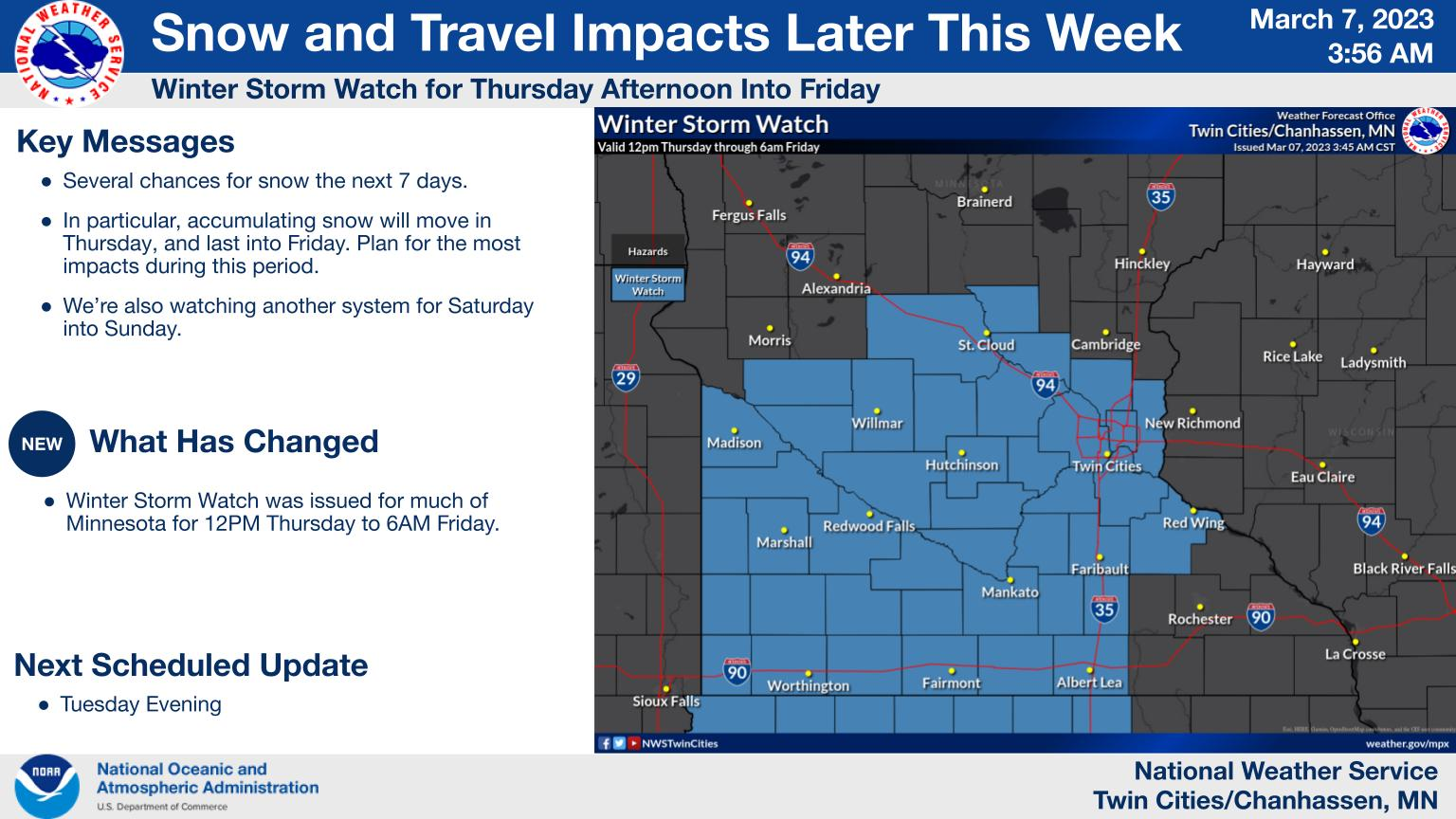
"There is a good chance for at least 6 inches of snow across much of southern Minnesota Thursday into Friday, with the highest likelihood along and south of I-94," the National Weather Service said.

Here's the specific NWS forecast from the Minneapolis-St. Paul Airport:
Find out what's happening in Minneapolisfor free with the latest updates from Patch.
Tuesday: Mostly cloudy, with a high near 37. East wind 5 to 10 mph.
Tuesday Night: Mostly cloudy, with a low around 28. East southeast wind 10 to 15 mph.
Find out what's happening in Minneapolisfor free with the latest updates from Patch.
Wednesday: A 30 percent chance of snow, mainly after noon. Cloudy, with a high near 37. East southeast wind 10 to 15 mph.
Wednesday Night: A 50 percent chance of snow. Cloudy, with a low around 29. East wind 10 to 15 mph. New snow accumulation of less than one inch possible.
Thursday: Snow likely, mainly after noon. Patchy blowing snow between 2pm and 3pm. Cloudy, with a high near 35. Breezy, with an east wind 15 to 20 mph, with gusts as high as 30 mph. Chance of precipitation is 70%. New snow accumulation of 1 to 3 inches possible.
Thursday Night: Snow. The snow could be heavy at times. Widespread blowing snow, mainly before 7pm. Low around 27. Breezy, with an east northeast wind 15 to 20 mph, with gusts as high as 30 mph. Chance of precipitation is 100%. New snow accumulation of 3 to 7 inches possible.
Friday: A 40 percent chance of snow before noon. Mostly cloudy, with a high near 35. North northeast wind 10 to 15 mph.
Friday Night: Mostly cloudy, with a low around 22. North wind 5 to 10 mph becoming east after midnight.
Saturday: A 30 percent chance of snow after noon. Mostly cloudy, with a high near 34. East southeast wind around 10 mph.
Saturday Night: Snow likely. Mostly cloudy, with a low around 27. East southeast wind around 10 mph. Chance of precipitation is 60%.
Sunday: A 30 percent chance of snow. Mostly cloudy, with a high near 36. Southeast wind around 10 mph becoming west in the afternoon.
Sunday Night: A 20 percent chance of snow. Mostly cloudy, with a low around 23. West wind around 10 mph.
Monday: Partly sunny, with a high near 34. Northwest wind 10 to 15 mph.
Get more local news delivered straight to your inbox. Sign up for free Patch newsletters and alerts.


