Weather
Forecasted Snow Totals Drop, But Storm Still Packs Punch: MN Weather
The storm will still pack a punch for much of the south Twin Cities metro area. Also, there's another system coming Saturday.


TWIN CITIES, MN — The trajectory of the upcoming snowstorm has shifted slightly southward and overall snow totals have dropped, according to the latest forecast from the National Weather Service.
However, the storm will still pack a punch for much of the south Twin Cities metro area.
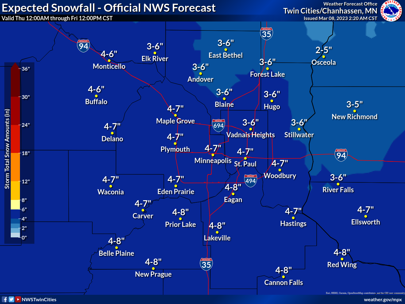
"While forecast snow amounts did trend downwards slightly, there is moderately high confidence in at least 3-4 inches of snow across much of the area, especially south of I-94," the National Weather Service said.
Find out what's happening in Minneapolisfor free with the latest updates from Patch.
"Higher end amounts in excess of 6 inches are most likely across southern Minnesota."
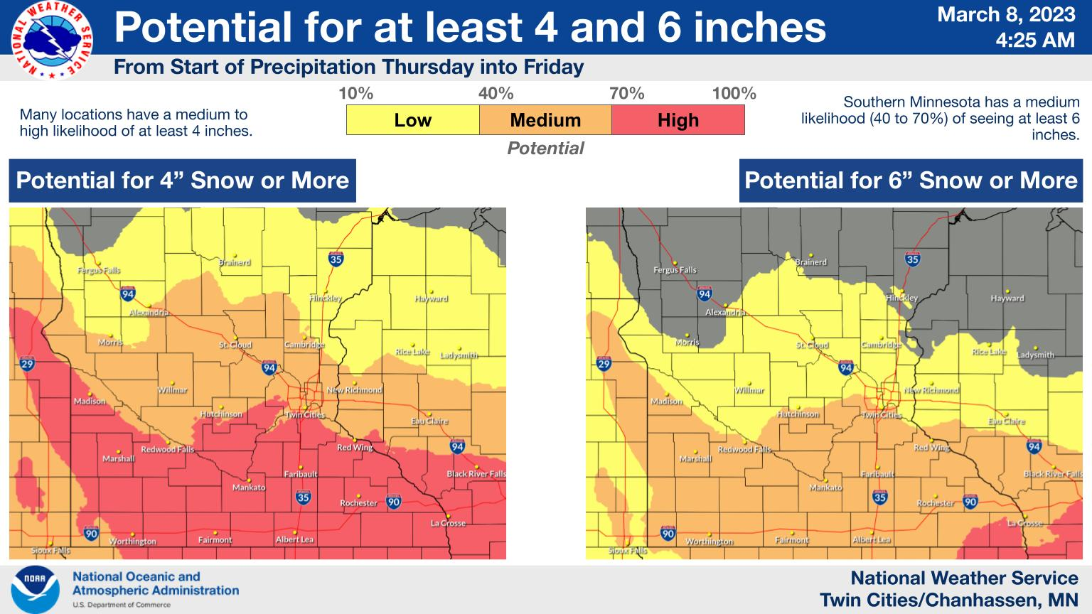
Here's a closer look at predicted snowfalls for the Twin Cities metro area:
Find out what's happening in Minneapolisfor free with the latest updates from Patch.
Another snow system is set to arrive Saturday.
Here's the specific NWS forecast from the Minneapolis-St. Paul Airport:
Wednesday: A 50 percent chance of snow, mainly after noon. Cloudy, with a high near 36. East southeast wind around 10 mph. Total daytime snow accumulation of less than one inch possible.
Wednesday Night: A slight chance of snow before 8pm, then a chance of snow after midnight. Mostly cloudy, with a low around 30. East wind 5 to 10 mph. Chance of precipitation is 30%.
Thursday: Snow, mainly after noon. High near 35. East wind 10 to 15 mph. Chance of precipitation is 80%. New snow accumulation of 1 to 3 inches possible.
Thursday Night: Snow. Low around 25. Northeast wind 10 to 15 mph. Chance of precipitation is 90%. New snow accumulation of 1 to 3 inches possible.
Friday: Mostly cloudy, with a high near 34. North northeast wind 5 to 10 mph.
Friday Night: Mostly cloudy, with a low around 23. East wind 5 to 10 mph.
Saturday: Snow likely, mainly after noon. Mostly cloudy, with a high near 32. East southeast wind 10 to 15 mph. Chance of precipitation is 60%.
Saturday Night: Snow. Low around 28. East southeast wind 10 to 15 mph. Chance of precipitation is 80%.
Sunday: A 50 percent chance of snow. Mostly cloudy, with a high near 36. Southeast wind around 10 mph becoming west in the afternoon.
Sunday Night: A 30 percent chance of snow, mainly before midnight. Mostly cloudy, with a low around 24. Northwest wind around 10 mph.
Monday: Partly sunny, with a high near 33. North northwest wind 10 to 15 mph.
Monday Night: Partly cloudy, with a low around 17. Northwest wind around 10 mph.
Tuesday: Mostly sunny, with a high near 33. North northwest wind 5 to 10 mph becoming southwest in the afternoon.
Get more local news delivered straight to your inbox. Sign up for free Patch newsletters and alerts.


