Weather
'Excessive Heat Warning' Issued For Twin Cities Metro: MN Weather
The heat index could reach 105 degrees across central Minnesota, according to the National Weather Service.


MINNEAPOLIS — The National Weather Service has issued an "excessive heat warning" that will take effect at 12 p.m. Thursday in the Twin Cities metro and across central Minnesota.
Counties included in the warning are Hennepin, Anoka, Ramsey, Washington, Sibley, Carver, Scott, Dakota, Nicollet, Le Sueur, and Blue Earth.
The heat index could reach 105 degrees in places across central Minnesota, the NWS warns.
Find out what's happening in Minneapolisfor free with the latest updates from Patch.
"Extreme heat and humidity will significantly increase the potential for heat related illnesses, particularly for those working or participating in outdoor activities," the NWS said.
"Drink plenty of fluids, stay in an air-conditioned room, stay out of the sun, and check up on relatives and neighbors. Young children and pets should never be left unattended in vehicles under any circumstances."
Find out what's happening in Minneapolisfor free with the latest updates from Patch.
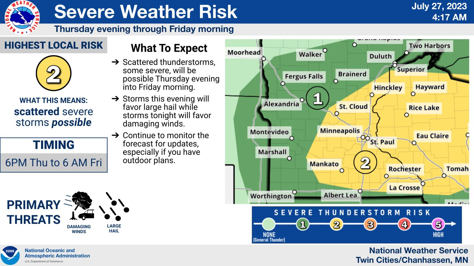
Scattered thunderstorms are possible Thursday evening and into Friday morning, according to the latest forecast.
Here's the specific NWS forecast from the Minneapolis-St. Paul Airport:
Thursday: A 20 percent chance of showers and thunderstorms after 3pm. Mostly sunny and hot, with a high near 97. Heat index values as high as 100. South southeast wind 5 to 15 mph.
Thursday Night: A 50 percent chance of showers and thunderstorms, mainly before 4am. Some of the storms could produce heavy rainfall. Partly cloudy, with a low around 72. South southwest wind 5 to 10 mph becoming east northeast after midnight. New rainfall amounts between three quarters and one inch possible.
Friday: A slight chance of showers and thunderstorms before 7am, then a chance of showers and thunderstorms after 8am. Partly sunny, with a high near 89. East northeast wind 5 to 10 mph. Chance of precipitation is 30%.
Friday Night: A 30 percent chance of showers and thunderstorms, mainly before 8pm. Mostly clear, with a low around 66. North northeast wind 5 to 10 mph.
Saturday: Sunny, with a high near 84. North wind 5 to 10 mph.
Saturday Night: Mostly clear, with a low around 63. North wind 5 to 10 mph becoming east after midnight.
Sunday: Sunny, with a high near 85. East wind 5 to 10 mph becoming north in the afternoon.
Sunday Night: A 20 percent chance of showers and thunderstorms after 2am. Partly cloudy, with a low around 65. Northeast wind 5 to 10 mph becoming southeast after midnight.
Monday: A 20 percent chance of showers and thunderstorms before 8am. Mostly sunny, with a high near 86. South southeast wind 5 to 10 mph.
Monday Night: A 20 percent chance of showers and thunderstorms after 2am. Partly cloudy, with a low around 67. East southeast wind around 10 mph.
Tuesday: A 20 percent chance of showers and thunderstorms. Mostly sunny, with a high near 88. Southeast wind around 10 mph.
Tuesday Night: Partly cloudy, with a low around 68. South southeast wind around 10 mph.
Wednesday: Mostly sunny, with a high near 91. South wind 10 to 15 mph becoming west in the afternoon.
Get more local news delivered straight to your inbox. Sign up for free Patch newsletters and alerts.


