Weather
How Long Will The Warmth Last? MN Weather
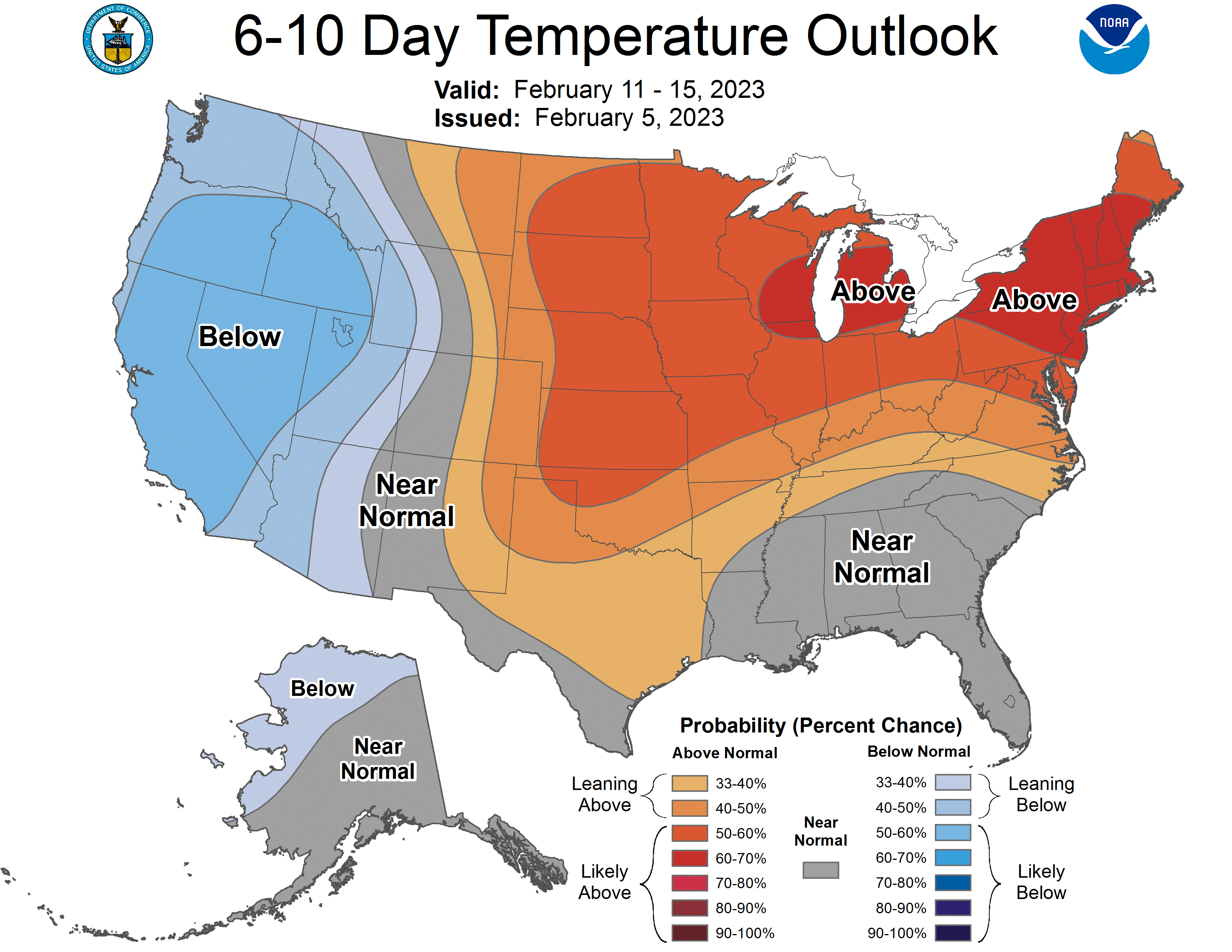
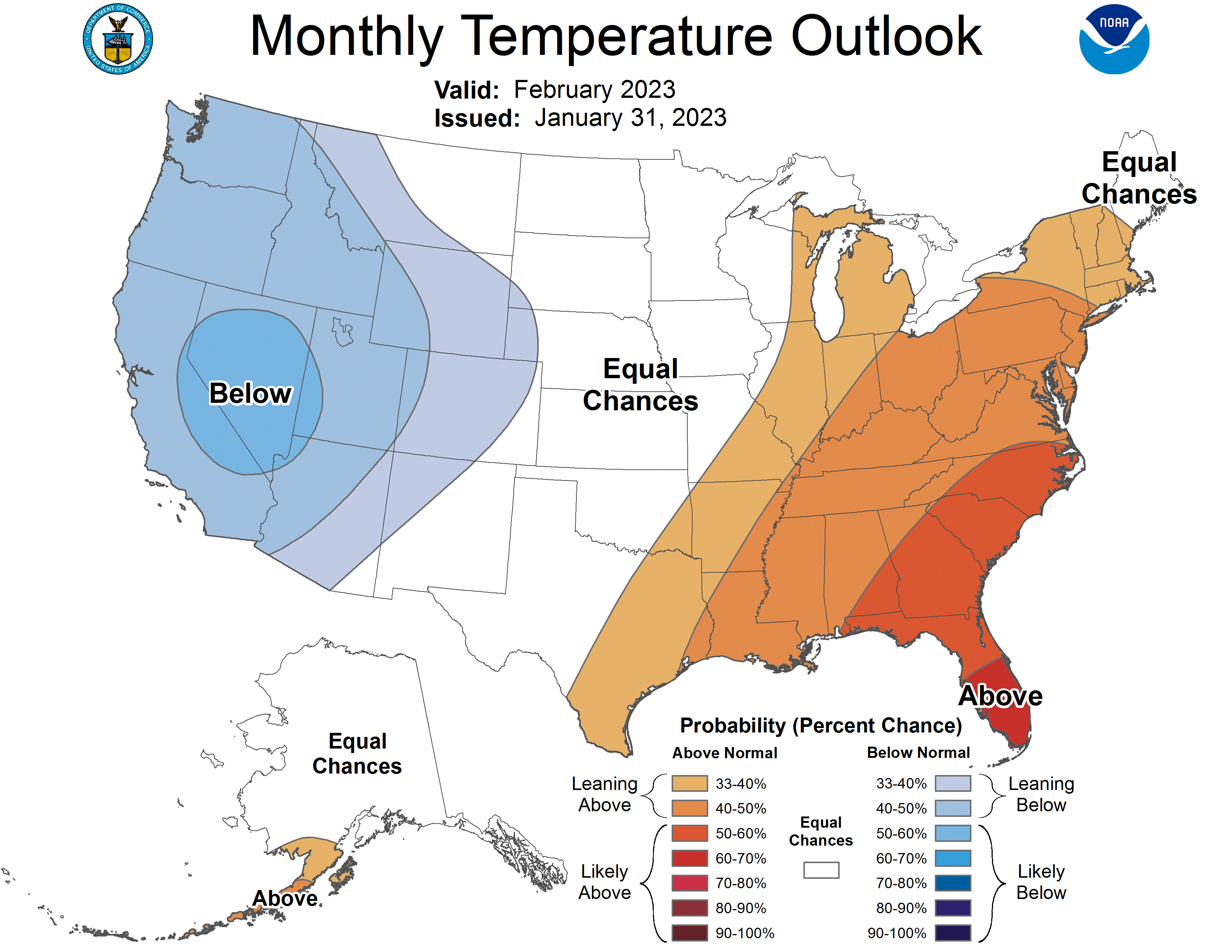
Minnesotans can trust that above-normal temperatures will stay for at least the next week, if not longer.

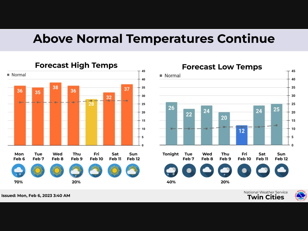
TWIN CITIES, MN — Temperatures will remain relatively warm for at least the next week in the region. "The above normal temperatures will continue through the next week with just one day, Friday, a little cooler," the National Weather Service said.
"Wintry mix likely today and a chance for some snow on Thursday. Thursday's snow will be more likely in southeast Minnesota and western Wisconsin."
Check out the latest long-range temperature outlooks below:
Find out what's happening in Minneapolisfor free with the latest updates from Patch.
Here's the full NWS forecast from the Minneapolis-St. Paul Airport:
Monday: Rain likely before 4pm, then rain and snow likely. Mostly cloudy, with a high near 36. Breezy, with a south southeast wind 10 to 15 mph increasing to 15 to 20 mph in the morning. Winds could gust as high as 30 mph. Chance of precipitation is 70%. Little or no snow accumulation expected.
Find out what's happening in Minneapolisfor free with the latest updates from Patch.
Monday Night: Rain and snow likely, mainly before 10pm. Cloudy, with a low around 26. Breezy, with a south wind 15 to 20 mph becoming west northwest after midnight. Winds could gust as high as 30 mph. Chance of precipitation is 60%. Little or no snow accumulation expected.
Tuesday: Mostly sunny, with a steady temperature around 30. Blustery, with a west northwest wind 15 to 20 mph decreasing to 5 to 10 mph in the afternoon. Winds could gust as high as 25 mph.
Tuesday Night: Mostly clear, with a low around 22. South southwest wind around 5 mph.
Wednesday: Sunny, with a high near 38. South wind around 5 mph.
Wednesday Night: Mostly cloudy, with a low around 24. South southeast wind around 5 mph becoming north after midnight.
Thursday: A 20 percent chance of snow after noon. Mostly cloudy, with a high near 36. North northwest wind 5 to 15 mph.
Thursday Night: A 20 percent chance of snow before midnight. Cloudy, then gradually becoming partly cloudy, with a low around 20. North northwest wind 10 to 15 mph.
Friday: Mostly sunny, with a high near 28. North northwest wind around 10 mph.
Friday Night: Mostly clear, with a low around 12. West northwest wind 5 to 10 mph becoming south southwest after midnight.
Saturday: Sunny, with a high near 32. South wind 10 to 15 mph.
Saturday Night: Partly cloudy, with a low around 24. South southwest wind 10 to 15 mph.
Sunday: Mostly cloudy, with a high near 37. West southwest wind around 10 mph.
Get more local news delivered straight to your inbox. Sign up for free Patch newsletters and alerts.


