Weather
How Much Snow Fell In MN Sunday?
Minnesotans will be digging out Monday from Sunday's epic spring snowstorm.

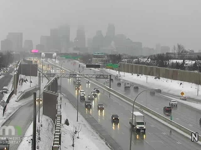
TWIN CITIES, MN — Minnesotans will be digging out Monday from Sunday's epic spring snowstorm.
Storm total snowfall as of 7 a.m. Monday, March 25, per the National Weather Service:
- Minneapolis-St. Paul Airport: 8 inches
- NWS Office In Chanhassen, MN: 8.5 inches
- St. Cloud, MN: 7.1 inches
- Eau, Claire, WI: 10.0 inches
The storm wreaked havoc on roads, with 396 crashes, 339 spinouts, and 14 jackknifed semis reported.
Find out what's happening in Minneapolisfor free with the latest updates from Patch.
The rest of the week will feature rain and clouds, with highs in the 30s and 40s, and lows in the 20s and teens.
Here's the specific NWS forecast from the Minneapolis-St. Paul Airport:
Find out what's happening in Minneapolisfor free with the latest updates from Patch.
Monday: Rain. High near 41. East wind 10 to 15 mph. Chance of precipitation is 100%. New precipitation amounts between a quarter and half of an inch possible.
Monday Night: Rain and possibly a thunderstorm. Low around 28. Northeast wind around 10 mph. Chance of precipitation is 90%. New precipitation amounts between a half and three quarters of an inch possible.
Tuesday: Rain and sleet before 8am, then snow and freezing rain between 8am and 10am, then snow after 10am. Patchy blowing snow before 2pm, then patchy blowing snow after 4pm. High near 31. Blustery, with a northwest wind 15 to 25 mph, with gusts as high as 30 mph. Chance of precipitation is 90%. Little or no ice accumulation expected. New snow and sleet accumulation of around an inch possible.
Tuesday Night: A 50 percent chance of snow before 8pm. Patchy blowing snow before 8pm. Mostly cloudy, with a low around 18. Blustery, with a west northwest wind 15 to 25 mph, with gusts as high as 35 mph. New snow accumulation of less than a half inch possible.
Wednesday: Mostly sunny, with a high near 30. West wind 10 to 15 mph, with gusts as high as 30 mph.
Wednesday Night: Partly cloudy, with a low around 14. Breezy, with a west wind 15 to 20 mph decreasing to 5 to 10 mph after midnight. Winds could gust as high as 30 mph.
Thursday: Sunny, with a high near 39. West wind 5 to 10 mph.
Thursday Night: Mostly clear, with a low around 22. West northwest wind 5 to 10 mph becoming east after midnight.
Friday: A slight chance of snow between 8am and 11am, then a slight chance of rain after 11am. Partly sunny, with a high near 49. East wind around 10 mph. Chance of precipitation is 20%.
Friday Night: A 30 percent chance of rain, mainly between 8pm and 2am. Mostly cloudy, with a low around 33. East wind around 10 mph becoming north northeast after midnight.
Saturday: A 20 percent chance of rain. Mostly cloudy, with a high near 47. North wind around 10 mph.
Saturday Night: A 20 percent chance of rain. Mostly cloudy, with a low around 30. North wind around 10 mph.
Sunday: A chance of rain and snow. Mostly cloudy, with a high near 46. North wind 10 to 15 mph. Chance of precipitation is 30%.
Get more local news delivered straight to your inbox. Sign up for free Patch newsletters and alerts.


