Weather
'Long-Duration Winter Storm' Set To Arrive In Twin Cities
Snow accumulation totals are still uncertain, but there's little doubt there will be a nosedive in temperatures as arctic air moves in.


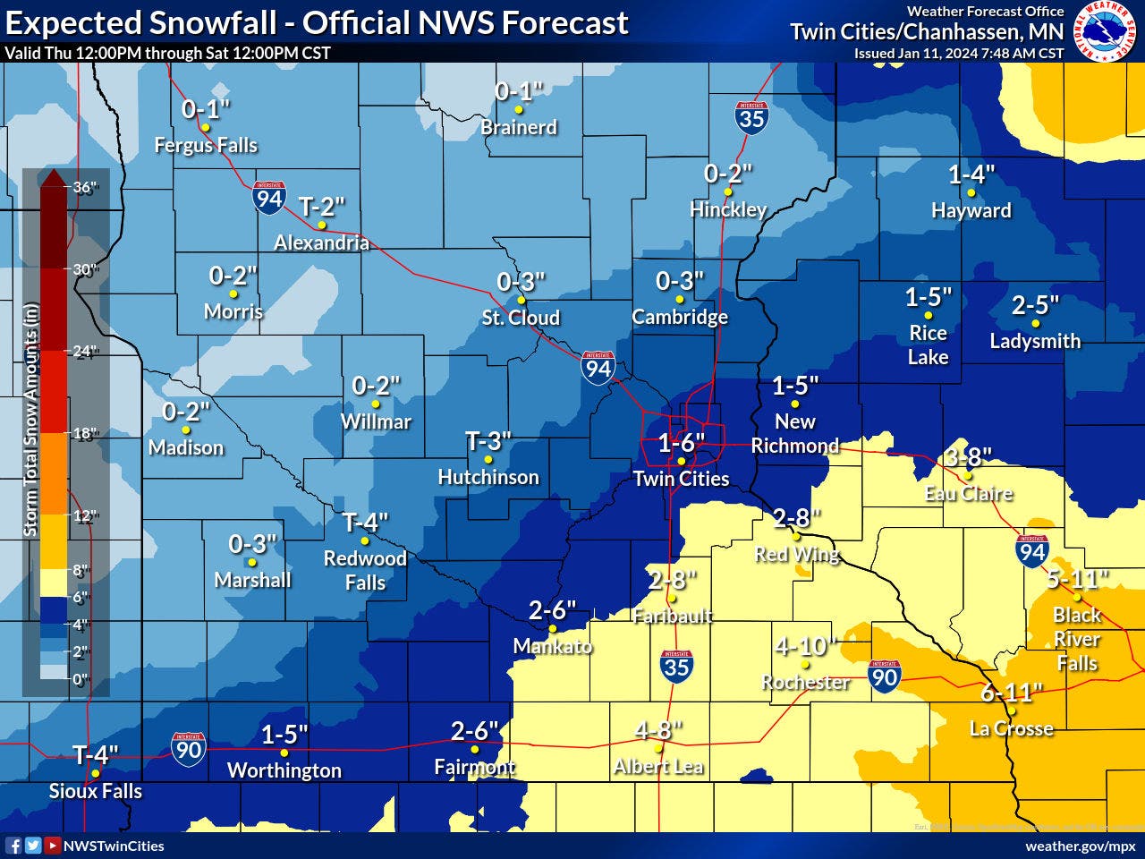
MINNEAPOLIS — A "long-duration winter storm" will arrive Thursday night and last through Saturday, bringing blowing snow and arctic temperatures, the National Weather Service said.
Snow accumulation totals are still widely uncertain because of snow-to-liquid ratios and the track of the system.
However, there is "high confidence" in wind chills reaching 20 to 30 degrees below zero by Saturday morning, and 30 to 40 degrees below zero by Sunday morning.
Find out what's happening in Minneapolisfor free with the latest updates from Patch.
Here's the specific NWS forecast from the Minneapolis-St. Paul Airport:
Thursday: Partly sunny, with a high near 22. West wind around 10 mph.
Find out what's happening in Minneapolisfor free with the latest updates from Patch.
Thursday Night: A 40 percent chance of snow, mainly after 2am. Mostly cloudy, with a low around 11. West northwest wind 5 to 10 mph becoming north after midnight.
Friday: Snow, mainly after 7am. Patchy blowing snow after 1pm. High near 21. Blustery, with a north wind 10 to 15 mph increasing to 15 to 20 mph in the afternoon. Winds could gust as high as 30 mph. Chance of precipitation is 90%. New snow accumulation of 1 to 3 inches possible.
Friday Night: Snow. Areas of blowing snow before 10pm. Low around 9. Blustery, with a north wind around 20 mph, with gusts as high as 35 mph. Chance of precipitation is 90%. New snow accumulation of 1 to 2 inches possible.
Saturday: Snow likely, mainly before 7am. Patchy blowing snow after 4pm. Mostly cloudy, with a temperature falling to around 8 by 5pm. Blustery, with a northwest wind 15 to 20 mph, with gusts as high as 30 mph. Chance of precipitation is 60%. New snow accumulation of less than a half inch possible.
Saturday Night: A 30 percent chance of snow before 7pm. Patchy blowing snow. Mostly cloudy, with a low around -8. Blustery, with a northwest wind 20 to 25 mph, with gusts as high as 40 mph.
Sunday: Patchy blowing snow before 9am. Mostly cloudy and cold, with a high near -2. Blustery, with a west northwest wind 15 to 20 mph, with gusts as high as 30 mph.
Sunday Night: Mostly cloudy, with a low around -10. West northwest wind around 15 mph.
M.L.King Day: Partly sunny and cold, with a high near -1. West wind around 15 mph.
Monday Night: Mostly cloudy, with a low around -8. West wind around 15 mph.
Tuesday: Mostly sunny, with a high near 7. West wind 10 to 15 mph.
Tuesday Night: Partly cloudy, with a low around -1. West southwest wind 10 to 15 mph.
Wednesday: Partly sunny, with a high near 14. West wind 10 to 15 mph.
Get more local news delivered straight to your inbox. Sign up for free Patch newsletters and alerts.


