Weather
MN Summer Temps Have Equal Chances Of Being Below, Above Average: NOAA
Check out the latest long-range forecast for the National Oceanic and Atmospheric Administration.

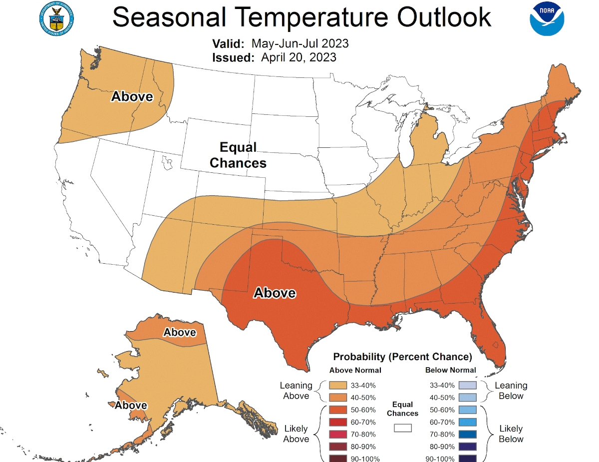
MINNEAPOLIS — The first couple of months of summer temperatures have equal chances of being above and below average, according to the latest long-range forecast for the National Oceanic and Atmospheric Administration.
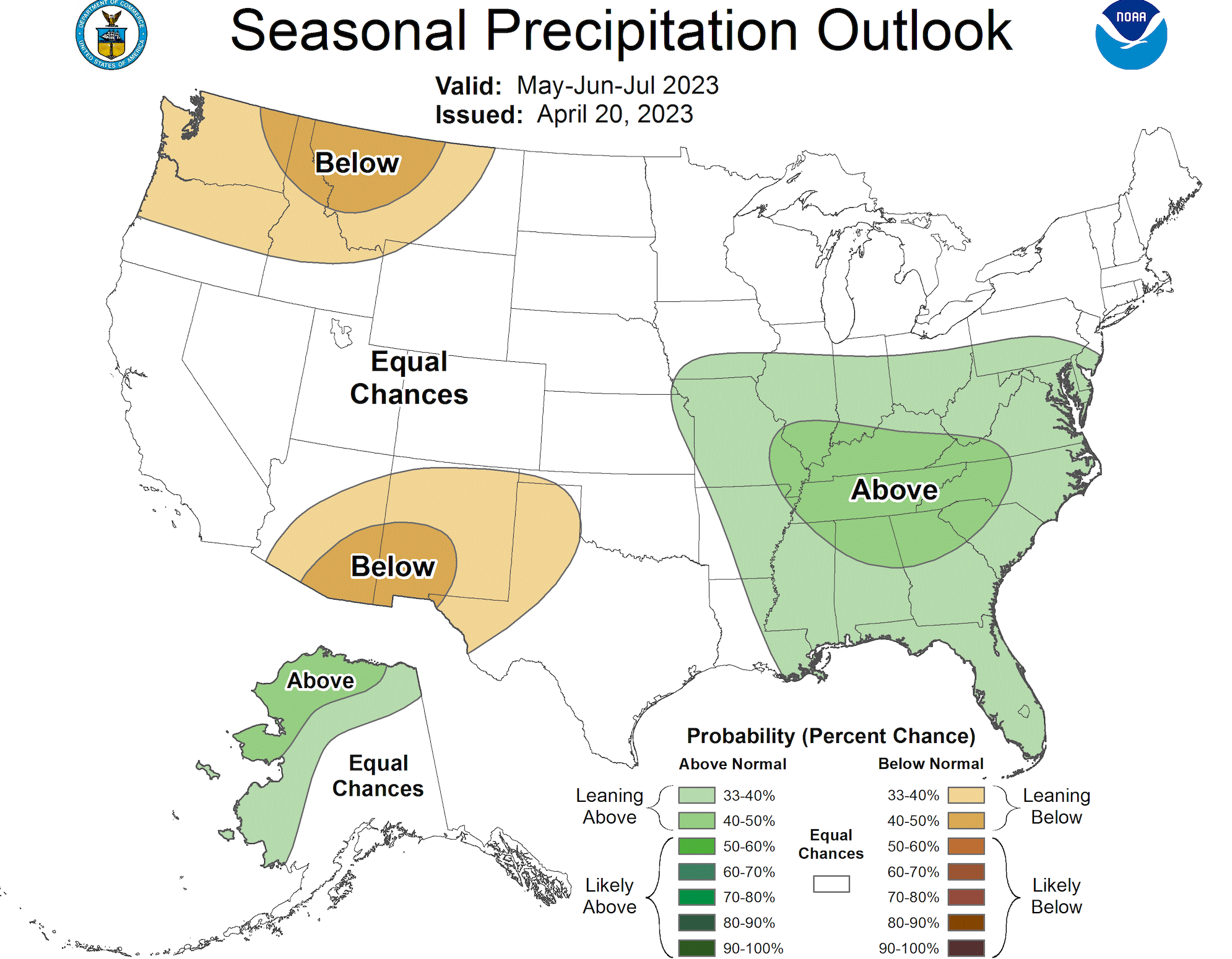
The same can be said for the seasonal precipitation outlook:
In the short term, however, the Twin Cities metro area can expect several chances for rain through the weekend.
Find out what's happening in Minneapolisfor free with the latest updates from Patch.
"A slow moving system will bring multiple chances for showers overnight and through the weekend," the National Weather Service.
"These storms could produce pockets of heavy rain, and a few storms late Thursday could be strong to severe."
Find out what's happening in Minneapolisfor free with the latest updates from Patch.
Here's the specific NWS forecast from the Minneapolis-St. Paul Airport:
Wednesday: Mostly sunny, with a high near 80. South southeast wind 5 to 10 mph.
Wednesday Night: A 40 percent chance of showers and thunderstorms, mainly after 1am. Partly cloudy, with a low around 61. South southeast wind 5 to 10 mph.
Thursday: A 50 percent chance of showers and thunderstorms. Partly sunny, with a high near 79. South southeast wind 5 to 10 mph.
Thursday Night: A chance of showers and thunderstorms before 10pm, then a chance of showers between 10pm and 1am, then a chance of showers and thunderstorms after 1am. Mostly cloudy, with a low around 62. East southeast wind 5 to 10 mph. Chance of precipitation is 40%.
Friday: Showers likely, with thunderstorms also possible after 4pm. Mostly cloudy, with a high near 76. East wind 5 to 10 mph. Chance of precipitation is 60%. New rainfall amounts of less than a tenth of an inch, except higher amounts possible in thunderstorms.
Friday Night: Showers likely and possibly a thunderstorm. Mostly cloudy, with a low around 62. East wind 10 to 15 mph. Chance of precipitation is 70%. New rainfall amounts between a quarter and half of an inch possible.
Saturday: Showers likely and possibly a thunderstorm before 7am, then showers likely between 7am and 1pm, then showers likely and possibly a thunderstorm after 1pm. Mostly cloudy, with a high near 71. Breezy, with an east wind 15 to 20 mph, with gusts as high as 30 mph. Chance of precipitation is 70%. New rainfall amounts between a quarter and half of an inch possible.
Saturday Night: A chance of showers and thunderstorms. Mostly cloudy, with a low around 53. East northeast wind around 15 mph. Chance of precipitation is 50%.
Sunday: A 20 percent chance of showers before 1pm. Partly sunny, with a high near 64. Northeast wind around 15 mph.
Sunday Night: Partly cloudy, with a low around 49. Northeast wind 5 to 10 mph becoming north northwest after midnight.
Monday: Sunny, with a high near 76. West northwest wind 5 to 10 mph.
Monday Night: Mostly clear, with a low around 58. West wind around 10 mph.
Tuesday: Sunny, with a high near 73. North northwest wind 10 to 15 mph.
Get more local news delivered straight to your inbox. Sign up for free Patch newsletters and alerts.


