Weather
MN Weather: More Heat Tuesday, Plus Possible Thunderstorms
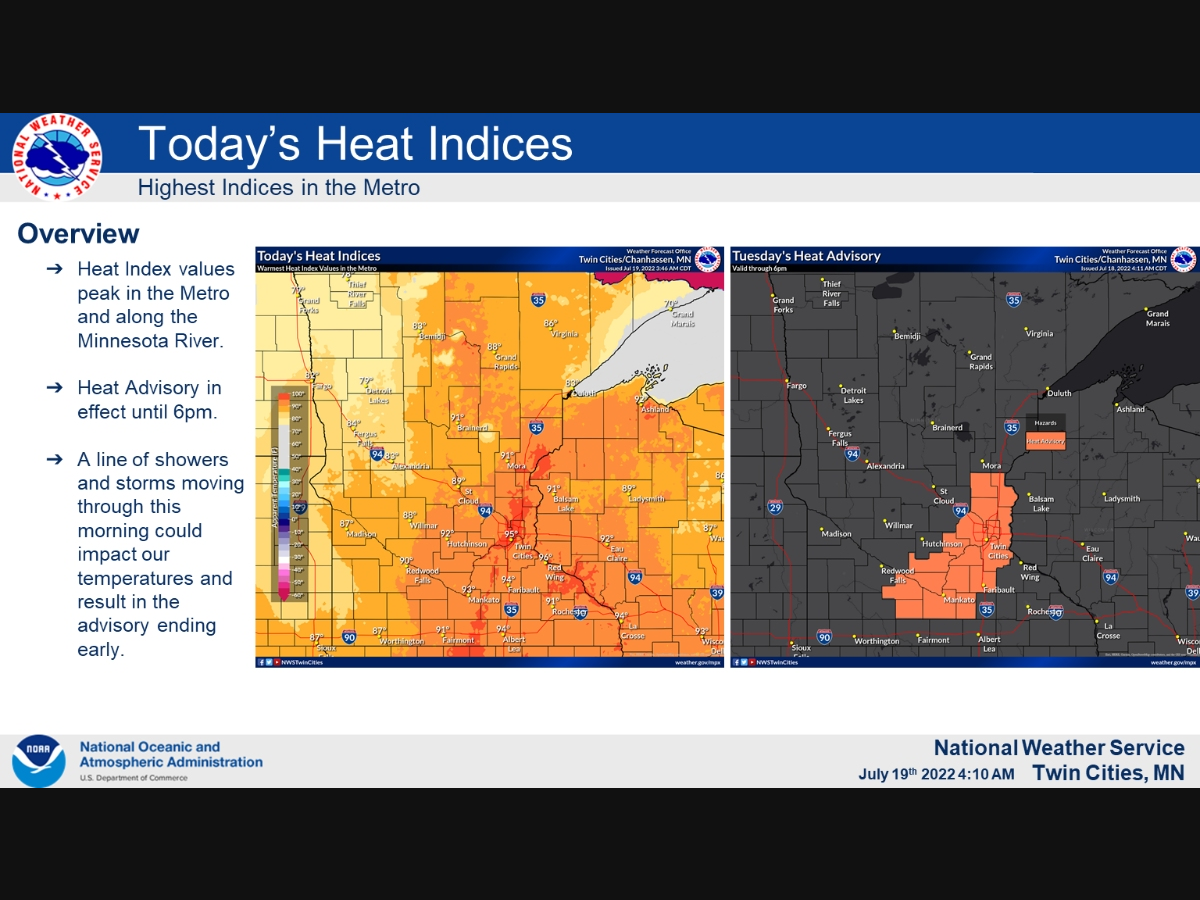
"Heat index values peak in the mid to upper 90s today, with a heat advisory in place until 6pm," the National Weather Service said.

TWIN CITIES, MN — The Minneapolis-St. Paul metro area will be blanketed in more hot weather Tuesday. Possible showers and thunderstorms could cool things down a bit Tuesday morning.
"Heat index values peak in the mid to upper 90s today, with a heat advisory in place until 6pm," the National Weather Service said. "Morning showers and thunderstorms could end up impacting our temperatures for the day."
Tuesday: Showers and thunderstorms before 10am, then a chance of showers between 10am and 11am. High near 93. Breezy, with a south wind 10 to 20 mph becoming west southwest in the afternoon. Winds could gust as high as 30 mph. Chance of precipitation is 80%.
Find out what's happening in Minneapolisfor free with the latest updates from Patch.
Tuesday Night: Increasing clouds, with a low around 71. Breezy, with a west northwest wind 15 to 20 mph, with gusts as high as 30 mph.
Wednesday: Mostly sunny, with a high near 89. Breezy, with a northwest wind 15 to 20 mph, with gusts as high as 35 mph.
Find out what's happening in Minneapolisfor free with the latest updates from Patch.
Wednesday Night: Clear, with a low around 71. West northwest wind 10 to 15 mph decreasing to 5 to 10 mph after midnight. Winds could gust as high as 25 mph.
Thursday: Sunny, with a high near 90. Northwest wind 5 to 15 mph.
Thursday Night: Mostly clear, with a low around 68. Northwest wind 5 to 10 mph becoming southwest after midnight.
Friday: Sunny and hot, with a high near 93. South southwest wind 5 to 10 mph becoming west in the afternoon.
Friday Night: A slight chance of showers and thunderstorms, then a chance of showers after 1am. Partly cloudy, with a low around 69. North wind 5 to 10 mph becoming east after midnight. Chance of precipitation is 30%.
Saturday: A chance of showers, with thunderstorms also possible after 1pm. Mostly sunny, with a high near 88. East wind 5 to 10 mph becoming south in the afternoon. Chance of precipitation is 30%.
Saturday Night: A 40 percent chance of showers and thunderstorms. Mostly cloudy, with a low around 67. East wind 5 to 10 mph becoming north after midnight.
Sunday: A 20 percent chance of showers. Mostly sunny, with a high near 87. East northeast wind 5 to 10 mph.
Sunday Night: Partly cloudy, with a low around 68. North northeast wind 5 to 10 mph becoming south southeast after midnight.
Monday: Mostly sunny, with a high near 90. South southwest wind 5 to 10 mph becoming west northwest in the afternoon.
Get more local news delivered straight to your inbox. Sign up for free Patch newsletters and alerts.


