Weather
Timing, Amounts For Sunday Snowstorm: MN Weather
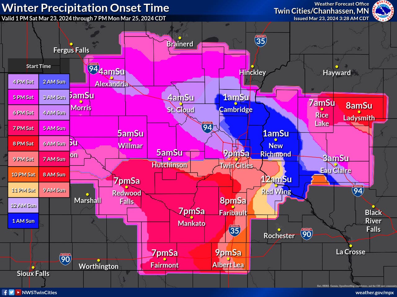
The snowstorm will arrive around 9 p.m. Saturday for the Twin Cities metro, but the heaviest stuff won't fall until noon on Sunday.


TWIN CITIES, MN — The National Weather Service has issued a winter storm warning for the Twin Cities metro area, effective from 10 a.m. Sunday through 4 p.m. Monday.
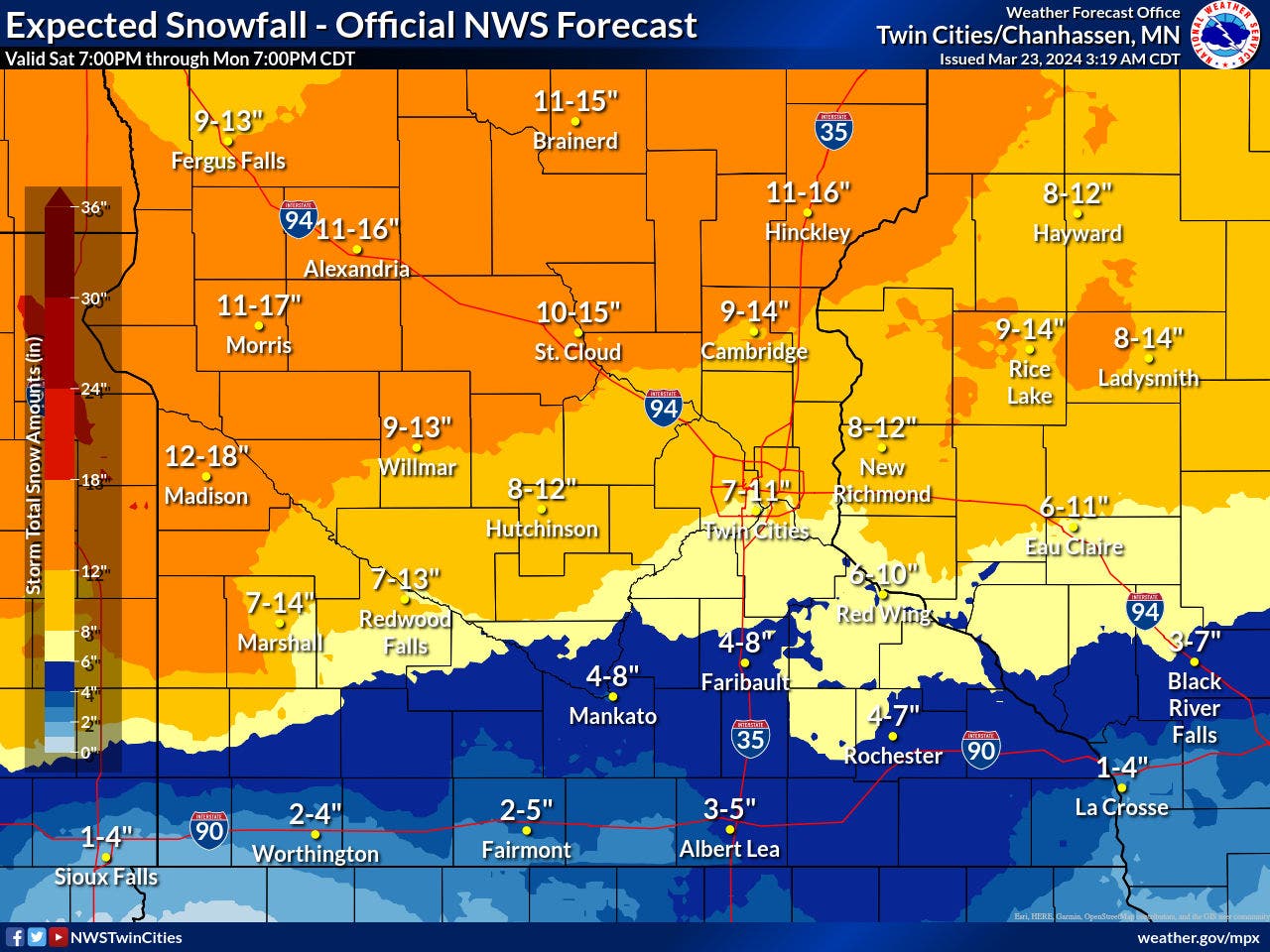
The metro could see anywhere from 7 to 11 inches of snow during that time.
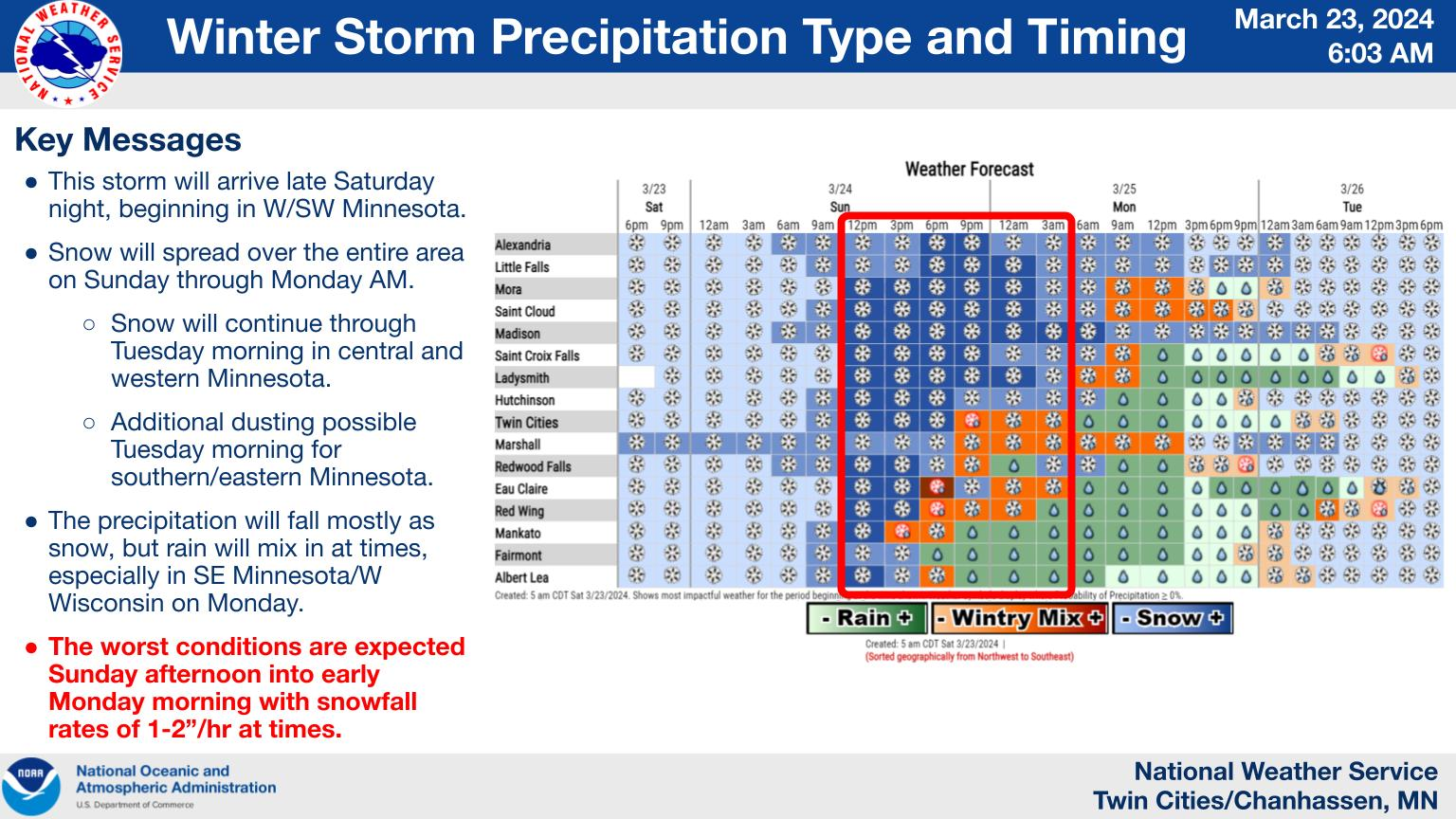
"This storm will arrive late Saturday night, beginning in W/SW Minnesota," the NWS said.
Find out what's happening in Minneapolisfor free with the latest updates from Patch.
"Snow will spread over the entire area on Sunday through Monday AM. Snow will continue through Tuesday morning in central and western Minnesota with rain changing back over to snow further south and east."
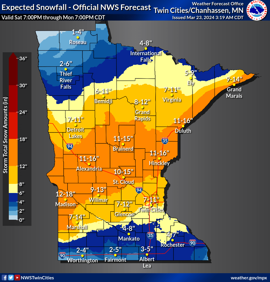
The snowstorm will arrive around 9 p.m. Saturday for the metro, but the heaviest stuff won't fall until noon on Sunday.
Find out what's happening in Minneapolisfor free with the latest updates from Patch.

Here's the specific NWS forecast from the Minneapolis-St. Paul Airport:
Sunday Morning: Snow likely, mainly after 5am. Cloudy, with a low around 26. East southeast wind 5 to 10 mph. Chance of precipitation is 60%. New snow accumulation of less than a half inch possible.
Sunday: Snow. The snow could be heavy at times. Patchy blowing snow after 1pm. High near 33. Breezy, with an east southeast wind 15 to 20 mph, with gusts as high as 30 mph. Chance of precipitation is 100%. New snow accumulation of 3 to 5 inches possible.
Sunday Night: Rain, possibly mixed with snow. The snow could be heavy at times. Patchy blowing snow before midnight. Low around 32. East wind around 15 mph, with gusts as high as 30 mph. Chance of precipitation is 100%. New snow accumulation of 3 to 5 inches possible.
Monday: Rain, possibly mixed with snow, becoming all rain after 9am. High near 42. East wind around 15 mph, with gusts as high as 25 mph. Chance of precipitation is 100%. New snow accumulation of less than a half inch possible.
Monday Night: Rain before 1am, then rain and snow. Low around 31. Northeast wind 10 to 15 mph becoming north northwest after midnight. Chance of precipitation is 90%. New snow accumulation of less than a half inch possible.
Tuesday: Snow, mainly before 1pm. Steady temperature around 31. West northwest wind around 15 mph, with gusts as high as 25 mph. Chance of precipitation is 80%.
Tuesday Night: Mostly cloudy, with a low around 15. West northwest wind around 15 mph, with gusts as high as 25 mph.
Wednesday: Mostly sunny, with a high near 30. West wind around 15 mph, with gusts as high as 25 mph.
Wednesday Night: Partly cloudy, with a low around 13. West wind 5 to 15 mph.
Thursday: Sunny, with a high near 39. Southwest wind 5 to 10 mph.
Thursday Night: Mostly cloudy, with a low around 25. East wind around 10 mph.
Friday: A chance of rain and snow. Mostly cloudy, with a high near 47. East wind 10 to 15 mph. Chance of precipitation is 30%.
Get more local news delivered straight to your inbox. Sign up for free Patch newsletters and alerts.


