Weather
Twin Cities Now Under Winter Weather Advisory: Snow Forecast Grows
Close to 2 inches of snow had already fallen in the Twin Cities metro area by noon Monday. Here's what to expect this evening.

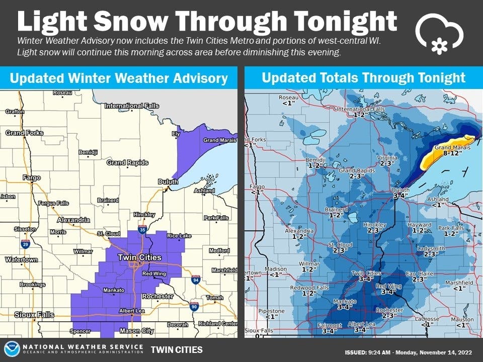
MINNEAPOLIS — The National Weather Service issued a winter weather advisory for the Twin Cities metro area. The advisory was issued just before 1 p.m. Monday.
Between 2 to 4 inches of additional snow could fall through 6 p.m. Monday evening.
"Slow down and use caution while traveling," the NWS said. "The latest road conditions for the state you are calling from can be obtained by calling 5 1 1."
Find out what's happening in Minneapolisfor free with the latest updates from Patch.
Find the details from the snow advisory below:
WHAT: Snow. Total snow accumulations of 2 to 4 inches.
WHERE: Portions of central, east central, south-central, and
southeast Minnesota and northwest and west central Wisconsin.
WHEN: Until 6 PM CST this evening.
IMPACTS: Plan on slippery road conditions. The hazardous
conditions could impact the evening commute.
The following Minnesota and Wisconsin counties are under the winter weather advisory: Sherburne, Isanti, Chisago, Wright, Hennepin, Anoka, Ramsey, Washington, Carver, Scott, Dakota, Le Sueur, Rice, Goodhue, Waseca, Steele, Faribault, Freeborn, Polk, Barron, St. Croix, Pierce, Dunn, and Pepin.
Find out what's happening in Minneapolisfor free with the latest updates from Patch.
Here's how much snow fell between the time it began overnight through noon:
- Minneapolis-St. Paul Airport: 1.9 inches
- Chanhassen NWS office: 1.8 inches
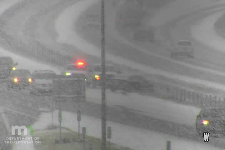
This morning, the Minnesota State Patrol was called to the scene of 322 crashes, including 25 with injuries. Additionally, there were 67 vehicle spin-outs and three jackknifed semis.
Find the full NWS forecast below:
Monday Afternoon: Snow. High near 30. East southeast wind around 10 mph. Chance of precipitation is 100%. Total daytime snow accumulation of 1 to 3 inches possible.
Monday Night: A chance of snow and freezing rain before 1am, then a chance of snow. Cloudy, with a low around 28. East southeast wind 5 to 10 mph. Chance of precipitation is 50%. Little or no ice accumulation expected. New snow accumulation of less than one inch possible.
Tuesday: Snow, mainly after 10am. High near 33. East wind around 5 mph. Chance of precipitation is 90%. New snow accumulation of around an inch possible.
Tuesday Night: Snow. Low around 28. North northeast wind around 5 mph. Chance of precipitation is 90%. New snow accumulation of 1 to 2 inches possible.
Wednesday: A 50 percent chance of snow, mainly before 7am. Cloudy, with a high near 33. North northwest wind 5 to 10 mph. New snow accumulation of less than a half inch possible.
Wednesday Night: Mostly cloudy, with a low around 19. West wind 5 to 10 mph.
Thursday: A 30 percent chance of snow, mainly between 7am and 1pm. Cloudy, with a high near 25. West northwest wind 5 to 15 mph, with gusts as high as 25 mph.
Thursday Night: A 20 percent chance of snow before 7pm. Mostly cloudy, with a low around 12. West northwest wind 10 to 15 mph, with gusts as high as 25 mph.
Friday: Mostly cloudy, with a steady temperature around 15. West wind 10 to 15 mph.
Friday Night: Mostly cloudy, with a low around 10. West wind around 10 mph.
Saturday: Partly sunny, with a high near 20. West wind 10 to 15 mph.
Saturday Night: Partly cloudy, with a low around 9. West wind 5 to 10 mph.
Sunday: Mostly sunny, with a high near 25. West southwest wind 5 to 10 mph.
Patch will continue to provide updated forecasts as the snowstorm evolves.
Get more local news delivered straight to your inbox. Sign up for free Patch newsletters and alerts.


