Weather
Wind Chills Up To 50 Below Zero Arrive Tonight: Minnesota Weather
The National Weather Service says the coldest air in years arrives tonight, with life-threatening conditions lasting through Saturday.

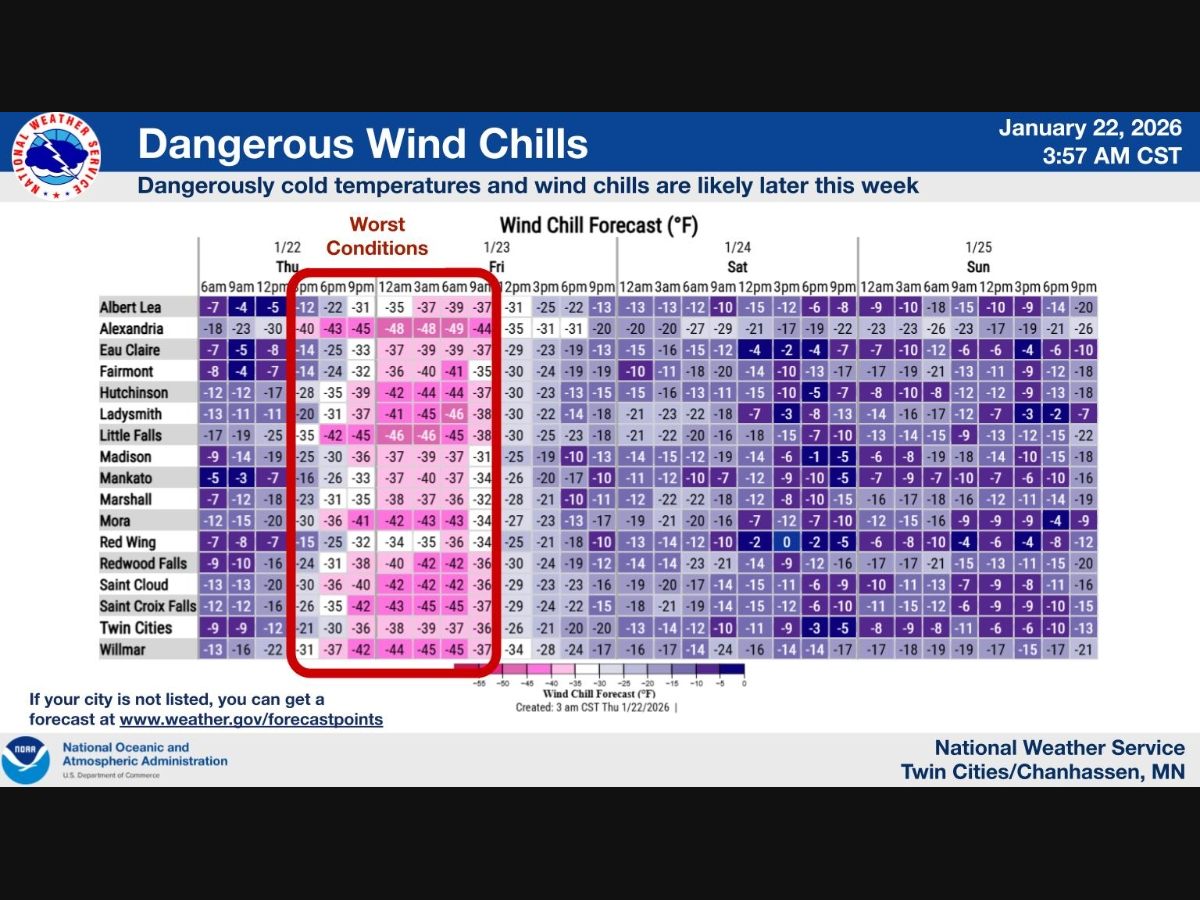
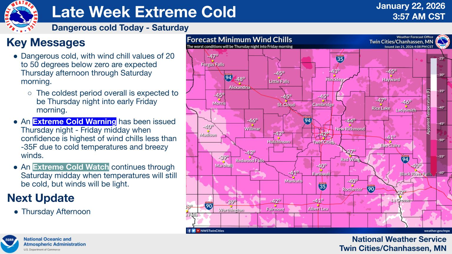
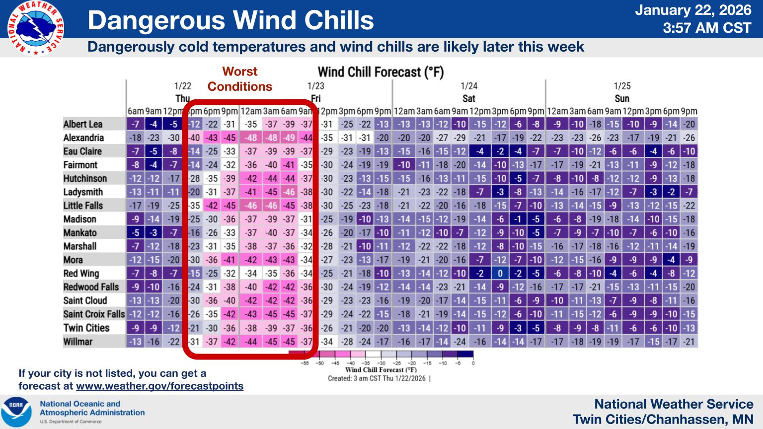
MINNEAPOLIS, MN — The coldest air Minnesota has experienced in at least several years is arriving tonight, with dangerously low wind chills expected to plunge as cold as 45 to 50 degrees below zero by early Friday morning, according to the National Weather Service Twin Cities/Chanhassen.
An Extreme Cold Warning is now in effect from 9 p.m. Thursday through noon Friday across much of central and southern Minnesota and western Wisconsin.
An Extreme Cold Watch follows from Friday afternoon through Saturday morning as the arctic air mass lingers.
Find out what's happening in Minneapolisfor free with the latest updates from Patch.
Forecasters say the worst conditions will occur from late Thursday night into early Friday, when bitter cold temperatures combine with strong winds to produce life-threatening wind chills. Frostbite on exposed skin could occur in as little as 10 minutes.
Current conditions early Thursday morning at Minneapolis-St. Paul International Airport showed temperatures near 6 degrees, but readings will fall sharply through the day as winds increase. Gusts could reach 35 mph this afternoon, driving wind chills toward 30 below zero before sunset.
Find out what's happening in Minneapolisfor free with the latest updates from Patch.
Tonight, temperatures are expected to drop to around 19 below zero in the Twin Cities, with wind chills sinking as low as 41 below. Friday will bring little relief, with highs near 7 below zero and wind chills remaining dangerously cold through the day.
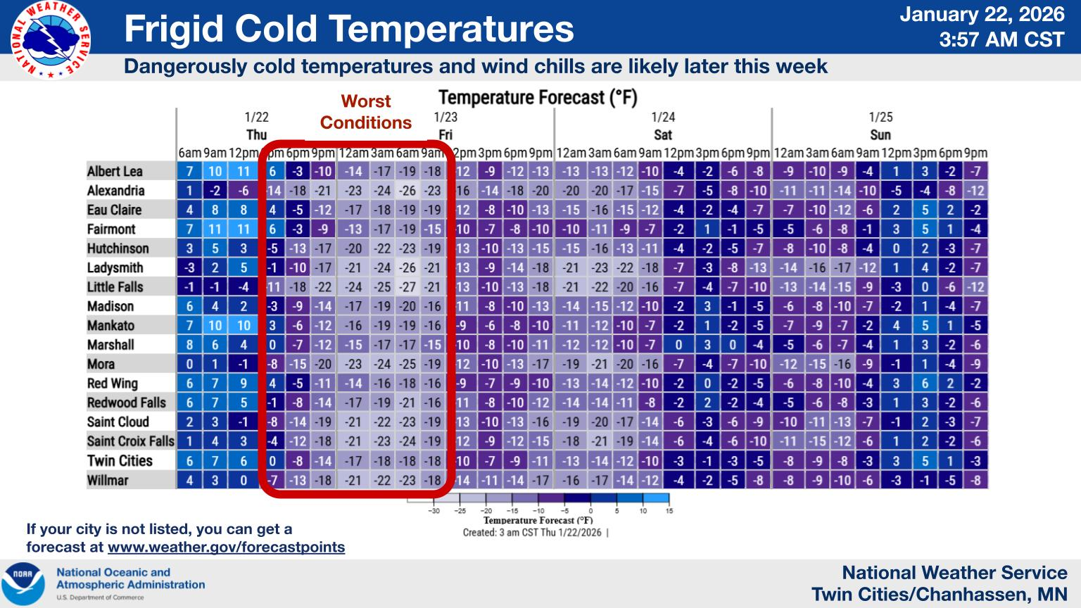
Conditions will improve only gradually, with highs remaining below zero into the weekend and a slow warmup beginning Sunday.
Officials urge residents to limit time outdoors, dress in multiple layers, cover exposed skin, and keep pets indoors. Travel may become hazardous due to blowing snow and reduced visibility, especially Thursday afternoon and evening.
Here's the full NWS forecast from the Minneapolis-St. Paul Airport:
Today: A slight chance of flurries. Patchy blowing snow between 1pm and 5pm. Mostly sunny, with a temperature rising to near 8 by 10am, then falling to around -5 during the remainder of the day. Wind chill values as low as -29. Blustery, with a west northwest wind 15 to 20 mph, with gusts as high as 35 mph.
Tonight: Partly cloudy, with a low around -19. Wind chill values as low as -41. Blustery, with a northwest wind 15 to 20 mph, with gusts as high as 30 mph.
Friday: Sunny and cold, with a high near -7. Wind chill values as low as -41. West northwest wind 10 to 15 mph.
Friday Night: Mostly cloudy, with a low around -15. Wind chill values as low as -26. West northwest wind around 5 mph becoming calm after midnight.
Saturday: Partly sunny and cold, with a high near -1. Calm wind becoming south around 5 mph in the afternoon.
Saturday Night: Partly cloudy, with a low around -10. South southeast wind around 5 mph.
Sunday: Mostly sunny and cold, with a high near 4. Southeast wind around 5 mph becoming northwest in the afternoon.
Sunday Night: Mostly clear, with a low around -12. Northwest wind around 5 mph becoming west southwest after midnight.
Monday: Mostly sunny, with a high near 11. Southwest wind 5 to 10 mph.
Monday Night: Partly cloudy, with a low around 2. West wind 5 to 10 mph.
Tuesday: Mostly sunny, with a high near 15. West northwest wind 5 to 10 mph.
Tuesday Night: Partly cloudy, with a low around 1. West northwest wind around 10 mph.
Wednesday: Partly sunny, with a high near 11. Northwest wind around 10 mph.
Get more local news delivered straight to your inbox. Sign up for free Patch newsletters and alerts.


