Weather
340 Crashes Across Minnesota in Season's First Snowstorm
The Minnesota State Patrol has reported 340 crashes across Minnesota since Thursday night, with 37 injuries and two fatalities.


Old Man Winter made an abrupt entrance into the state Friday, with the once green and brown landscapes now hidden under a thick layer of snow. Some towns in the north and west are seeing an excess of a foot of snow today, including Beauty Lake, which recorded a snowfall total of 13.8" within about six hours.
After creating blizzard and whiteout conditions in parts of western and northern Minnesota Friday, the season's first snowstorm has moved into the Twin Cities. Traffic began to jam-up on major freeways in the west metro at about 3 p.m. Motorists should prepare for a slow commute home Friday evening.
Since 10 p.m. Thursday, the Minnesota State Patrol (MSP) has reported 340 crashes across Minnesota so far, with 37 injuries and two fatalities.
Find out what's happening in Minneapolisfor free with the latest updates from Patch.
Most of the snow for the western and norther parts of the state accumulated before 3 p.m. Residents and travelers in that area should expect windy conditions and blowing snow, with a north-northwest wind 30 to 35 mph and gusts as strong as 50 mph. Travel is expected to become very difficult or impossible.
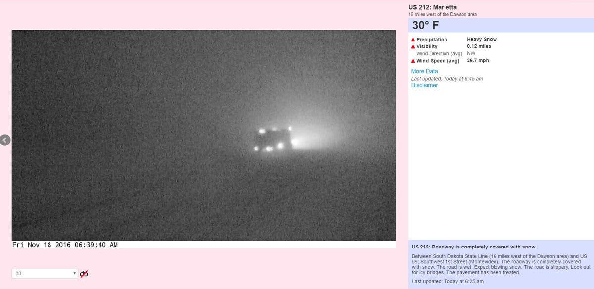
By 8:25 a.m., several roads in northern and western Minnesota were already snow covered. The NWS is warning all Minnesotans to "please take this storm seriously."
Find out what's happening in Minneapolisfor free with the latest updates from Patch.
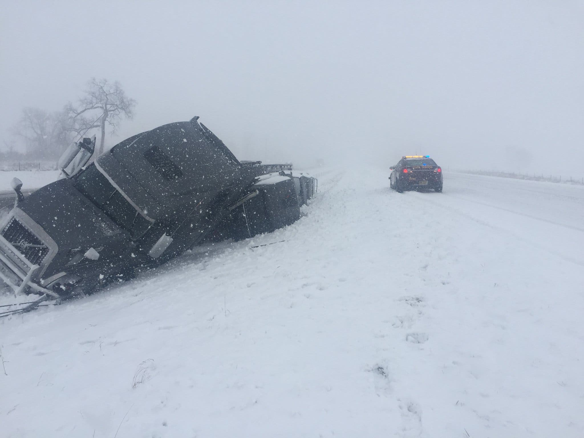
MSP reported there were no injuries in a semi roll-over on Interstate 94 west bound between Albany and Freeport. Officials remind motorists to drive according to weather conditions and to use your headlights.

Large hail was reported falling at 7:50 a.m. in Montgomery, just south of the metro, along with thunder and lightning.
Twin Cities
Snow has began to slow accumulate in parts of the west metro after thunderstorms rolled through the Twin Cities Friday morning, moving north at 60 mph. The rain turned to snow at about 2 p.m. Total daytime snow accumulation of 1 to 2 inches in the area is possible.
The metro will see a northwest wind 10 to 20 mph increasing to 20 to 30 mph in the afternoon. Winds could gust as high as 45 mph.
Light snow will continue tonight, mainly before 8 p.m. New snow accumulation of less than 1 inch is possible.
Stay with Patch for more winter storm coverage Friday.
Image via Minnesota State Patrol
Get more local news delivered straight to your inbox. Sign up for free Patch newsletters and alerts.