Business & Tech
Roseville-based GIS Rangers Mapping Tornado Damage
Company helps Fridley find storm-damaged trees.
After the May 22 tornado cut a north to northwest path through Fridley, city officials put cutting-edge, digital technology to work to help it assess the damage.
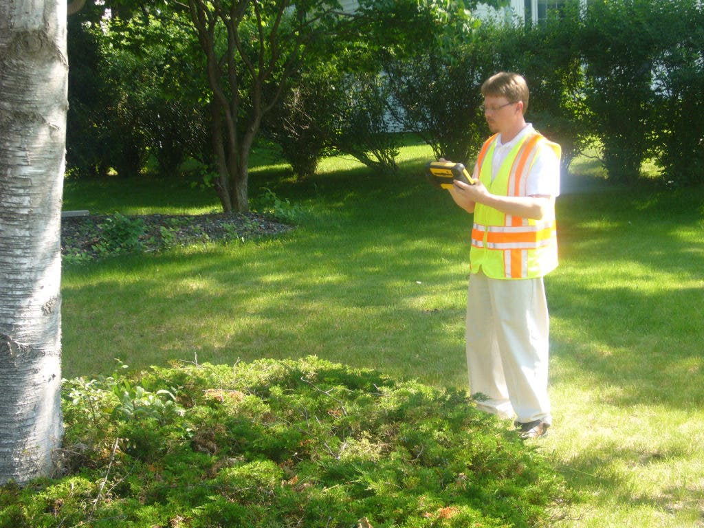
The city used the technology- called Geographic Information Systems (GIS), and provided by Roseville-based GIS Rangers LLC- to create a tornado-damage map. The company has been helping Fridley's engineering department track damaged trees.
GIS technology has been around for decades, but its capabilities have grown steadily due to developments in computing power, GPS software and hand-held devices. A geographic information system (GIS) is a tool that combines the use of software, hardware, and location-linked data for analyzing, interpreting, and displaying relationships and patterns.
Find out what's happening in Rosevillefor free with the latest updates from Patch.
GIS Rangers has been providing the technology under contract to Fridley for about the past decade, according to City Manager Bill Burns. The city shares the cost of GIS Rangers' services under an arrangement with two other metro suburbs: Columbia Heights and Andover.
A GIS employee staffs a desk in the Fridley city engineering department three days per week.
Find out what's happening in Rosevillefor free with the latest updates from Patch.
“It's been a good program for us,” Burns says. “We used to have our own GIS staff, but it's more efficient to contract it out as a joint venture with the two other cities.”
Modern GIS technologies use digital information, for which various digitized data creation methods are used. The most common method of data creation is digitization, where a hard copy map or survey plan is transferred into a digital medium through the use of a computer-aided design (CAD) program, and geo-referencing capabilities.
Any variable that can be located spatially (in space), and increasingly also temporally (in time), can be referenced using a GIS. These GIS coordinates may represent other systems of temporo-spatial (time and space) reference -- for example, highway mile marker, surveyor benchmark, building address, street intersection etc.
According to GIS Rangers President Blaine Hackett, using GIS “you can map locations, map quantities, map densities and more. But GIS does more than create a map; it can capture, manage, analyze, and display any form of geographically-referenced information.”
Fridley Public Works Director Jim Kosluchar says GIS Rangers has helped the city with “all kinds of infrastructure and other mapping – zoning maps, maps of city property, election maps.”
Not only for storms or other emergency situations, Kosluchar says GIS is also a useful tool for routine matters.
“They made us a digital map of all of the parcels in the city," he says. "For example, if there is a special use hearing or a hearing for a variance, we have to notify all of the property owners within a certain distance. It's very simple to put in a query (saying) 'Give me a map of all properties within 300 feet of a certain location.' It's much faster and easier than doing it by hand on a (paper) map.”
GIS can display all kinds of attributes.” It's also useful for routine infrastructure maintenance," Kosluchar says. “I can say 'Show us all the sewer mains that have been lined within the past 20 years' and it will filter the results and display them.”