Weather
10 Inches And Counting As Snowstorm Hammers Twin Cities: MN Weather
Both St. Paul and Minneapolis held off on declaring snow emergencies Tuesday, with officials knowing the storm would be a two-day event.

MINNEAPOLIS — The Twin Cities metro area had already seen 10 inches of new snow by 6 a.m. on Wednesday, according to the National Weather Service. The snow continues to pound the region through the morning commute.
The evening commute will also be hazardous, according to the forecast. The current winter weather advisory for the region is set to expire at 6 p.m.
Both St. Paul and Minneapolis held off on declaring snow emergencies Tuesday, knowing the storm would be a two-day event.
Find out what's happening in Southwest Minneapolisfor free with the latest updates from Patch.
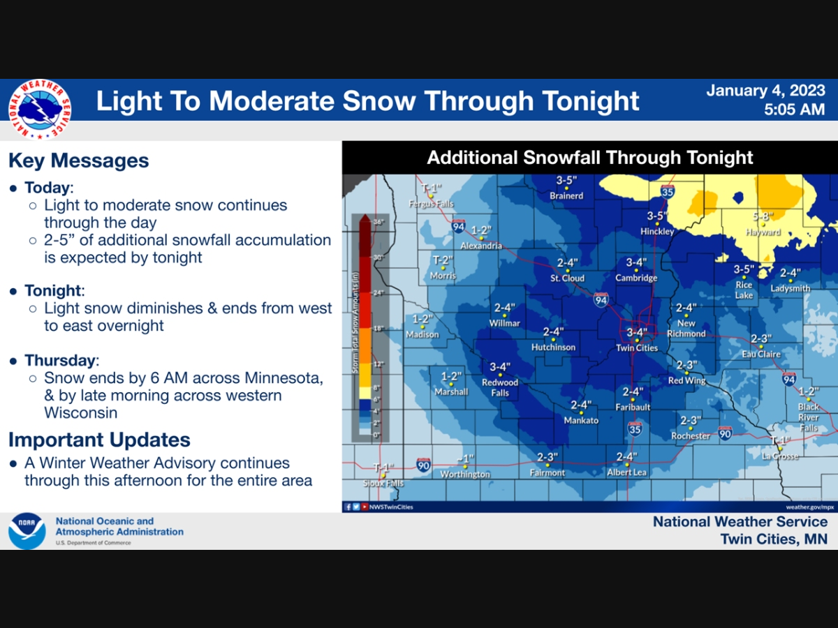
Here were the snow totals as of 6 a.m. Wednesday, per the NWS:
- MSP Airport: 10.0 inches
- NWS Chanhassen: 9.4 inches
- St. Cloud: 6.8 inches
- Eau Claire: 1.8 inches
Below is the localized forecast for the Twin Cities metro Wednesday:
Find out what's happening in Southwest Minneapolisfor free with the latest updates from Patch.

Check out the full NWS forecast from the Minneapolis-St. Paul Airport:
Wednesday: Snow. High near 33. North northeast wind around 10 mph. Chance of precipitation is 100%. Total daytime snow accumulation of 3 to 5 inches possible.
Wednesday Night: Snow, mainly before 3am. Low around 25. North wind around 10 mph. Chance of precipitation is 80%. New snow accumulation of less than one inch possible.
Thursday: A 20 percent chance of snow before 9am. Mostly cloudy, with a high near 29. North wind around 10 mph.
Thursday Night: Partly cloudy, with a low around 8. West northwest wind around 5 mph.
Friday: Mostly sunny, with a high near 19. West wind around 5 mph becoming calm in the morning.
Friday Night: Partly cloudy, with a low around 5. Calm wind becoming north around 5 mph after midnight.
Saturday: Mostly sunny, with a high near 19. North wind around 5 mph becoming east southeast in the afternoon.
Saturday Night: Partly cloudy, with a low around 8. South southwest wind around 5 mph.
Sunday: Mostly sunny, with a high near 23. Southwest wind around 5 mph.
Sunday Night: Partly cloudy, with a low around 15. West southwest wind around 5 mph.
Monday: Mostly sunny, with a high near 27. Southwest wind around 5 mph.
Monday Night: Mostly cloudy, with a low around 17. South wind around 5 mph.
Tuesday: Partly sunny, with a high near 28. South wind 5 to 10 mph becoming west southwest in the afternoon.
Get more local news delivered straight to your inbox. Sign up for free Patch newsletters and alerts.


