Weather
Hail Expected In The Metro Thursday, Severe Storm Warning Issued
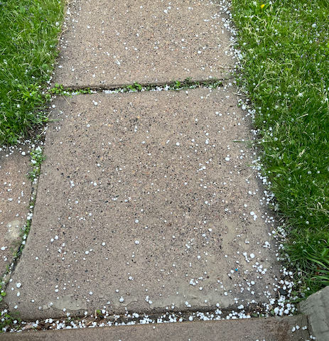
The storm is bringing quarter-sized hail, and some damage to vehicles is "expected," officials said.

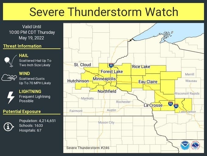
TWIN CITIES, MN — A severe thunderstorm warning has been issued for Hennepin, Ramsey, and Washington County and much of the Twin Cities metro area.
A severe thunderstorm moving northeast arrived in Minneapolis at about 3:30 p.m. going at 55 mph, according to the National Weather Service.
The storm is bringing quarter-sized hail, and some damage to vehicles is "expected," officials said.
Find out what's happening in Southwest Minneapolisfor free with the latest updates from Patch.
The severe thunderstorm will be near:
- Roseville around 345 PM CDT.
- St. Paul, Shoreview, New Brighton, Mounds View and Arden Hills around 350 PM CDT.
- Maplewood, Oakdale, White Bear Lake and Vadnais Heights around 355 PM CDT.
- Lake Elmo and Mahtomedi around 400 PM CDT.
This is a breaking news story. Patch will update this article as more information becomes available.
Find out what's happening in Southwest Minneapolisfor free with the latest updates from Patch.
Get more local news delivered straight to your inbox. Sign up for free Patch newsletters and alerts.


