Weather
Minnesota Weather: Flash Flood Watch Issued For Twin Cities Metro
Heavy rain pounded the Minneapolis-St. Paul metro area for hours overnight, and it hasn't stopped yet.

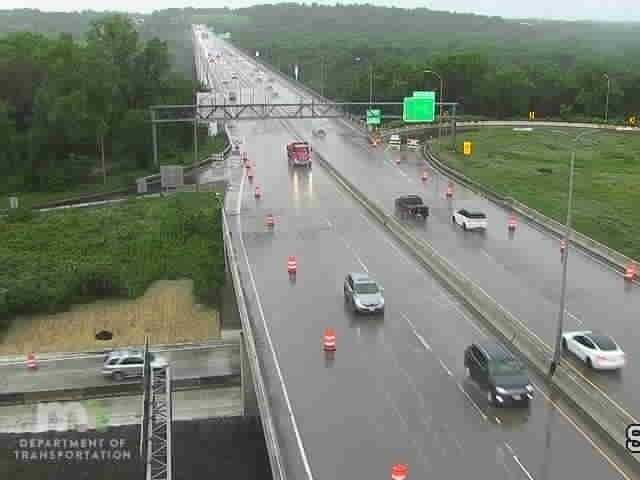
MINNEAPOLIS-ST. PAUL, MN — Following massive downpours that continued through the night, the National Weather Service has issued a "flash flood watch" that's effect across the Twin Cites metro area Monday morning. Dakota, Washington, Hennepin, and Ramsey counties are all included.
Four inches of rain fell overnight in the metro, and the storms haven't stopped yet. Parts of western Wisconsin saw more than 8 inches of rain.
Parts of Lakeville have picked up over 4" of rain overnight...Baldwin, WI has seen about 8" with road closures this morning due to flooding. Rain will end and then it will be steamy later with temperatures near 90 and high humidity. https://t.co/p747yYcrF6
— ken barlow (@kbarlowkstp) June 29, 2020
Reminder: do not drive through a flooded road.
Find out what's happening in Southwest Minneapolisfor free with the latest updates from Patch.
"Heavy rain is expected with localized amounts of 3 to 6 inches or more possible within the Flash Flood Watch," states the NWS.
When the rain stops, expect an especially hot and humid week into July 4.
Find out what's happening in Southwest Minneapolisfor free with the latest updates from Patch.
"Warmth and humidity will return for this week, along with occasional storm chances," says the NWS. "Please remember to stay hydrated and take breaks from the heat. Looking ahead, the hot weather should stay with us through the 4th of July weekend."
Gerdine & 167th pic.twitter.com/1EnW9FtnD6
— Lakeville Police (@LakevillePD_MN) June 29, 2020
Here's the NWS forecast through July 4 weekend in the Twin Cities:
Monday: Showers and thunderstorms likely before noon, then a slight chance of showers and thunderstorms after 4pm. Some of the storms could produce heavy rain. Partly sunny, with a high near 86. Heat index values as high as 95. South southeast wind 10 to 15 mph. Chance of precipitation is 70%. New rainfall amounts between a quarter and half of an inch possible.
Monday Night: A 30 percent chance of showers and thunderstorms, mainly before 1am. Partly cloudy, with a low around 71. South southeast wind 5 to 10 mph.
Tuesday: A 20 percent chance of showers and thunderstorms after 4pm. Mostly sunny, with a high near 88. Southeast wind 10 to 15 mph.
Tuesday Night: A slight chance of showers and thunderstorms before 7pm, then a slight chance of showers and thunderstorms after 1am. Partly cloudy, with a low around 71. Southeast wind 5 to 10 mph. Chance of precipitation is 20%.
Wednesday: A 50 percent chance of showers and thunderstorms, mainly after 1pm. Partly sunny, with a high near 87. East southeast wind 5 to 10 mph. New rainfall amounts between a tenth and quarter of an inch, except higher amounts possible in thunderstorms.
Wednesday Night: A 50 percent chance of showers and thunderstorms. Mostly cloudy, with a low around 70. East southeast wind around 5 mph becoming calm in the evening.
Thursday: A 30 percent chance of showers and thunderstorms, mainly after 1pm. Mostly sunny, with a high near 89. Calm wind becoming northeast around 5 mph.
Thursday Night: Mostly clear, with a low around 69. North northeast wind around 5 mph becoming calm.
Friday: Sunny, with a high near 92. Calm wind becoming northeast around 5 mph in the afternoon.
Friday Night: Mostly clear, with a low around 70. East northeast wind around 5 mph becoming calm in the evening.
Independence Day: Sunny, with a high near 92. Calm wind becoming south around 5 mph in the afternoon.
Saturday Night: A 20 percent chance of showers and thunderstorms. Partly cloudy, with a low around 71. South wind around 5 mph.
Sunday: A 30 percent chance of showers and thunderstorms. Mostly sunny, with a high near 91. West southwest wind around 5 mph.
Get more local news delivered straight to your inbox. Sign up for free Patch newsletters and alerts.


