Weather
Minnesota Weather: Snow Continues Sunday, More Coming Tuesday
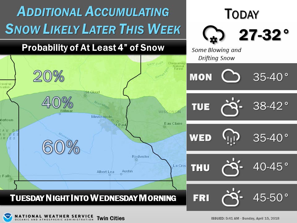
The spring snowstorms won't end Sunday. Additional snow accumulations are looking more likely for Tuesday night into Wednesday morning.


TWIN CITIES, MN — Snow and wind have been diminishing across Minnesota Sunday morning. Flight operations resumed as normal at Minneapolis-Saint Paul Airport.
However, the slow movement of the weather system will continue with light snow and gusty northerly winds, according to the National Weather Service.
The blizzard warning has been cancelled and replaced with a winter weather advisory for much of central and southern Minnesota, including the Twin Cities.
Find out what's happening in Southwest Minneapolisfor free with the latest updates from Patch.
(Get real-time news alerts from your local Minnesota Patch.)
Between 2 to 5 inches of additional snowfall will occur in the advisory area. Expect more blowing and drifting snow.
Find out what's happening in Southwest Minneapolisfor free with the latest updates from Patch.
Storm total snowfall from April 13 through 7 a.m. Sunday:
- Minneapolis-Saint Paul Airport: 12.9 inches
- Chanhassen: 13.7 inches
- St. Cloud: 4.4 inches
According to the Minnesota State Climatology Office, while the 11.1 inches measured at MSP did not break the daily snowfall record for April 14 (which is 13.6 inches, from 1983) the total of 22.5 inches for the month so far makes this the snowiest April on record in the Twin Cities, with April records going back 141 years.
The spring snowstorms won't end Sunday. Additional snow accumulations are looking more likely for Tuesday night into Wednesday morning.
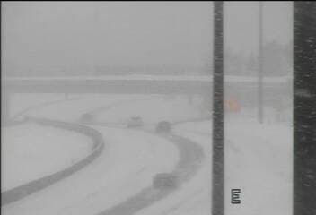
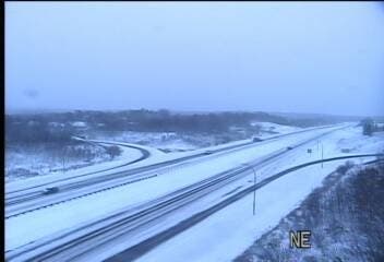
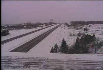
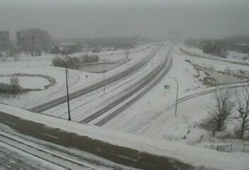
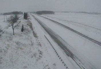
Road conditions as of 8 a.m. Sunday:

Twin Cities forecast, via the National Weather Service:
Saturday Afternoon: Snow. The snow could be heavy at times. Some thunder is also possible. Widespread blowing snow. High near 30. Blustery, with a north northeast wind around 25 mph, with gusts as high as 35 mph. Chance of precipitation is 100 percent. Total daytime snow accumulation of 3 to 7 inches possible.
Saturday Night: Snow. The snow could be heavy at times. Some thunder is also possible. Widespread blowing snow, mainly before 9 p.m. Low around 23. Blustery, with a north northeast wind 15 to 20 mph, with gusts as high as 30 mph. Chance of precipitation is 100 percent. New snow accumulation of 5 to 9 inches possible.
Sunday: Snow, mainly before 2 p.m. High near 31. North northeast wind around 15 mph, with gusts as high as 30 mph. Chance of precipitation is 90 percent. New snow accumulation of 2 to 4 inches possible.
Sunday Night: Snow likely, mainly between 8 p.m. and 2 a.m. Cloudy, with a low around 21. North wind 10 to 15 mph. Chance of precipitation is 60 percent. New snow accumulation of 1 to 2 inches possible.
Monday: A 30 percent chance of snow, mainly before 8 a.m. Partly sunny, with a high near 36. North northwest wind around 10 mph.
Monday Night: Partly cloudy, with a low around 19. Northwest wind 5 to 10 mph.
Tuesday: Sunny, with a high near 38. North wind around 5 mph becoming east in the afternoon.
Tuesday Night: Snow likely after 1am. Mostly cloudy, with a low around 28. East wind 5 to 10 mph. Chance of precipitation is 60 percent.
Wednesday: Snow likely. Cloudy, with a high near 36. Northeast wind around 10 mph. Chance of precipitation is 70 percent.
Wednesday Night: A 30 percent chance of snow before 1 a.m. Mostly cloudy, with a low around 27. Northwest wind 5 to 10 mph.
Traffic images via Minnesota Department of Transportation
Weather images via National Weather Service
Get more local news delivered straight to your inbox. Sign up for free Patch newsletters and alerts.


