Weather
More Snow Tuesday Morning In Twin Cities
After a week of rainy, spring-like weather, a significant snowstorm has arrived in the Twin Cities metro area.

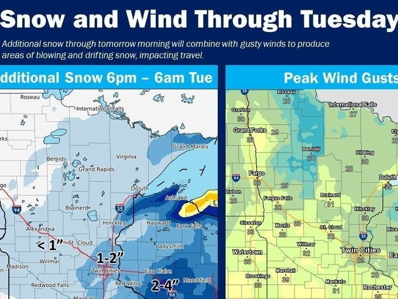
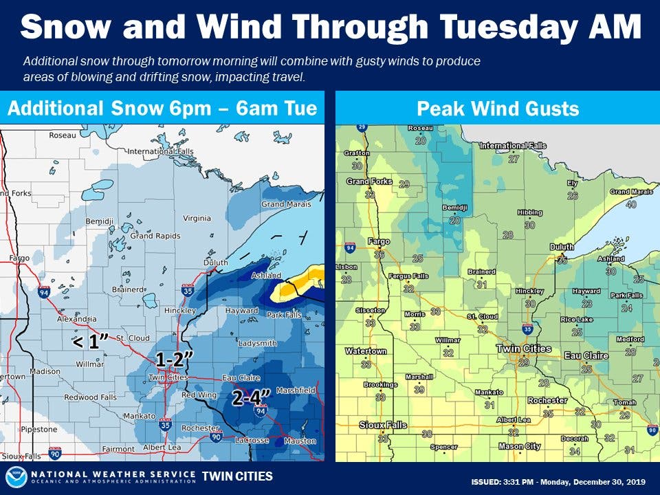
TWIN CITIES, MN — More snow is expected to fall overnight in the Twin Cities. "Snowfall is expected to taper off early Tuesday morning," says the National Weather Service.
"Blowing and drifting snow remains a concern through the evening commute with blustery winds to continue."
According to Minnesota Public Radio, more than 2 inches of snow has reportedly fallen so far in parts of the Twin Cities metro:
Find out what's happening in Southwest Minneapolisfor free with the latest updates from Patch.
More snowfall reports: Richfield 2.3" Roseville 2.5" North St. Paul 4.9"@mnwx
— MPR Weather (@MPRweather) December 30, 2019
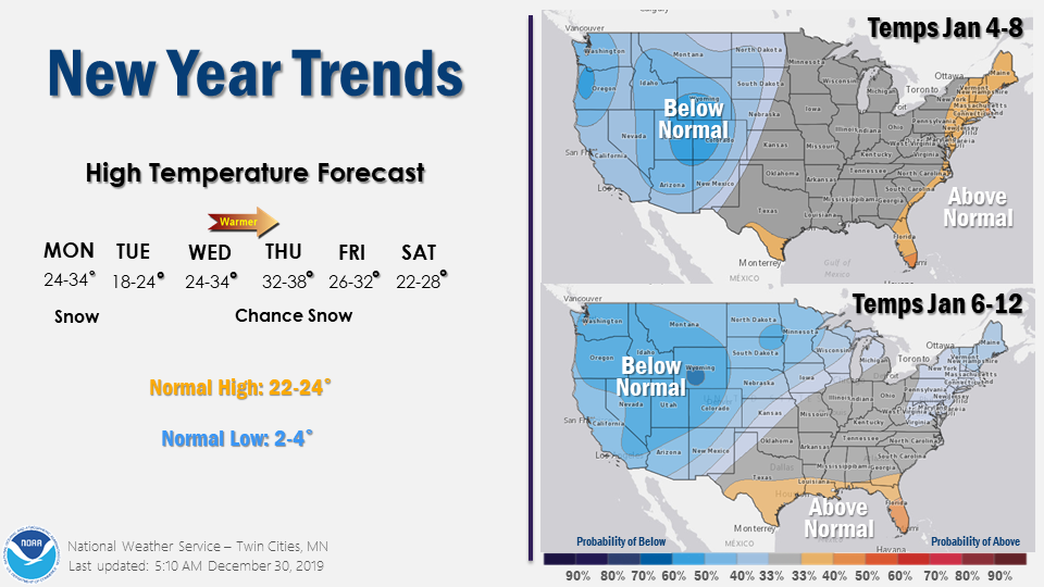
The long-term forecast projects that temperatures will be much colder in mid-January:
Here's the NWS forecast for the Twin Cities metro area:
Monday Afternoon: Snow. Patchy blowing snow after 3 p.m. Temperature falling to around 26 by 5 p.m. Breezy, with a northwest wind 15 to 20 mph, with gusts as high as 30 mph. Chance of precipitation is 100 percent. Total daytime snow accumulation of 3 to 5 inches possible.
Find out what's happening in Southwest Minneapolisfor free with the latest updates from Patch.
Monday Night: Snow, mainly before midnight. Patchy blowing snow before 1 a.m. Low around 20. Blustery, with a northwest wind 15 to 20 mph, with gusts as high as 30 mph. Chance of precipitation is 100 percent. New snow accumulation of 1 to 3 inches possible.
Tuesday: Mostly sunny, with a high near 23. Northwest wind 10 to 15 mph, with gusts as high as 25 mph.
Tuesday Night: Partly cloudy, with a low around 14. West wind around 5 mph becoming south after midnight.
New Year's Day: Partly sunny, with a high near 33. South southwest wind 5 to 10 mph.
Wednesday Night: Mostly cloudy, with a low around 28. South wind around 5 mph.
Thursday: Mostly cloudy, with a high near 38. South wind around 5 mph becoming west southwest in the afternoon.
Thursday Night: A 20 percent chance of snow. Cloudy, with a low around 28. West wind around 5 mph.
Friday: Cloudy, with a high near 31. Northwest wind 5 to 10 mph.
Friday Night: A 20 percent chance of snow. Cloudy, with a low around 21. West northwest wind 5 to 10 mph.
Saturday: A 20 percent chance of snow. Mostly cloudy, with a high near 28. West wind around 10 mph.
Saturday Night: A 20 percent chance of snow. Mostly cloudy, with a low around 18. West wind around 10 mph.
Sunday: Partly sunny, with a high near 27. West northwest wind 10 to 15 mph.
Get more local news delivered straight to your inbox. Sign up for free Patch newsletters and alerts.


