Weather
Minnesota Weather: Travel Not Advised During Winter Storm Warning
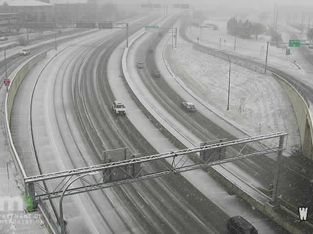
If you're in the Twin Cities Tuesday, avoid driving as much as possible.

TWIN CITIES, MN — A winter storm warning has been issued for counties inside the Twin Cities metro area, including Wright, Hennepin, Anoka, Ramsey, Washington, Carver, Scott, Dakota, St. Croix, and Pierce counties.
The snowfall forecast has increased the possible total in the Minneapolis-St. Paul metro area. Up to 7 inches of snow are possible in the Twin Cities Tuesday, according to the National Weather Service.
Here's what to expect from the storm Tuesday in the Minneapolis-St. Paul metro, per NWS:
Find out what's happening in Southwest Minneapolisfor free with the latest updates from Patch.
- "Heavy snow. Snow accumulations of 4 to 6 inches, with locally higher amounts."
- "Plan on slippery road conditions. The hazardous conditions could impact the evening commute."
- "As precipitation is ending, it may briefly change over to freezing drizzle, though minimal ice accumulations are expected."
NWS warns that "if you must travel, keep an extra flashlight, food, and water in your vehicle in case of an emergency."
Snow is currently overspreading the area. Here is a recent @MnDOT plow camera along Highway 23 near Clara City. Snow will continue through the afternoon in most locations, with rain mixing in south of the Minnesota River valley. #mnwx #wiwx pic.twitter.com/2ZAZx6IRJL
— NWS Twin Cities (@NWSTwinCities) October 20, 2020
Hundreds of snowplow operators will be working during the winter storm to keep road conditions as safe and clear as possible, the Minnesota Department of Transportation said. Motorists should remember to slow down, stay alert, and stay back at least 10 car lengths and use extra caution when near snowplows on the road.
Find out what's happening in Southwest Minneapolisfor free with the latest updates from Patch.
"Motorists need to be prepared for changing road conditions to be sure their drive is safe and uneventful," said Steve Lund, MnDOT maintenance engineer, in a news release. "When driving near snowplows, remember to be patient and give our operators plenty of room to work so that they can improve road conditions and help you get where you need to be."
Drivers should plan on slippery road conditions, especially during the evening commute.
Here's the NWS forecast for the Twin Cities metro area:
Tuesday: Snow, mainly after 11am. The snow could be heavy at times. High near 34. East southeast wind 5 to 10 mph. Chance of precipitation is 100%. Total daytime snow accumulation of 3 to 7 inches possible.
Tuesday Night: Rain and snow, becoming all rain after 9pm, then gradually ending. Steady temperature around 34. Southeast wind 5 to 10 mph becoming west after midnight. Chance of precipitation is 80%. New snow accumulation of less than one inch possible.
Wednesday: A slight chance of rain and snow after 1pm. Mostly cloudy, with a steady temperature around 34. West wind 5 to 10 mph. Chance of precipitation is 20%.
Wednesday Night: A chance of snow before 2am, then a chance of rain and snow between 2am and 4am, then a chance of rain after 4am. Mostly cloudy, with a low around 32. Light and variable wind becoming east 5 to 10 mph after midnight. Chance of precipitation is 30%.
Thursday: Rain. High near 44. East wind 10 to 15 mph. Chance of precipitation is 90%. New precipitation amounts between a half and three quarters of an inch possible.
Thursday Night: Rain likely and possibly a thunderstorm. Mostly cloudy, with a low around 33. Northwest wind 10 to 15 mph. Chance of precipitation is 60%. New precipitation amounts between a quarter and half of an inch possible.
Friday: Mostly cloudy, with a high near 38. Northwest wind 10 to 15 mph.
Friday Night: Mostly cloudy, with a low around 23. Northwest wind 5 to 10 mph.
Saturday: Mostly cloudy, with a high near 35. Calm wind becoming north northeast around 5 mph in the afternoon.
Saturday Night: A 20 percent chance of snow after 1am. Mostly cloudy, with a low around 28. Northeast wind around 5 mph.
Sunday: Rain and snow likely. Mostly cloudy, with a high near 36. East northeast wind around 5 mph. Chance of precipitation is 60%.
Sunday Night: A 40 percent chance of snow. Mostly cloudy, with a low around 27. North wind around 5 mph.
Monday: A 20 percent chance of snow. Mostly cloudy, with a high near 34. Northwest wind 5 to 10 mph.
Get more local news delivered straight to your inbox. Sign up for free Patch newsletters and alerts.


