Weather
Minnesota Weather: 2nd Round Of Snow To Hit Saturday
There will be a break in the snow Saturday morning before the heaviest round arrives Saturday afternoon.


The forecast for Minnesota's historic winter storm remains on track. Rain changed over to snow across the state Friday night and dumped several inches across the Twin Cities metro and most of central Minnesota.
There will be a break in the snow Saturday morning before the heaviest round arrives Saturday afternoon. The snow intensity will subside Saturday night, but light snow will linger into Sunday.
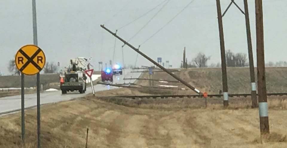
Power outages are possible in Minnesota this weekend as wind gusts reach as high as 40 mph.
Find out what's happening in Southwest Minneapolisfor free with the latest updates from Patch.
Total accumulations of 9 to 15 inches are expected.
(Get real-time news alerts from your local Minnesota Patch.)
Find out what's happening in Southwest Minneapolisfor free with the latest updates from Patch.

In a three year period, officers reported snowy or icy road conditions in more than 55,000 crashes (2013 – 2015), according to the Minnesota Department of Safety. These crashes resulted in 149 traffic deaths and 15,505 injuries.
When it comes to winter driving, take these steps before you head out:
- Clear snow and ice from vehicle windows, hood, headlights, brake lights and directional signals. Drive with lights on for best visibility.
- If the conditions are too poor, do not travel unless necessary.
- Buckle up — it’s your best defense in a vehicle.
- If taking a trip, tell someone at your destination of your expected arrival time and your travel route.
- Make sure you have emergency items such as scraper and brush, small shovel, jumper cables, tow chain and a bag of sand or cat litter for tire traction. Blankets, heavy boots, warm clothing and flashlights are also important. Keeping food and bottled water in the vehicle is also a good idea in the event you become stranded in a snow storm.
Historic April:
The Twin Cities is already in the top 10 for the highest April snowfall total on record as of April 12, according to the NWS. The state also experienced the seventh highest one-day April snowfall on April 3.
Check out the Minneapolis-Saint Paul metro-specific forecast below:
Friday: Snow, mainly after 10 a.m. The snow could be heavy at times. Patchy blowing snow. High near 30. Blustery, with a northeast wind 15 to 25 mph, with gusts as high as 35 mph. Chance of precipitation is 100 percent. Total daytime snow accumulation of 4 to 8 inches possible.
Friday Night: Snow. The snow could be heavy at times. Patchy blowing snow before 11 p.m. Low around 23. Blustery, with a north northeast wind 15 to 20 mph, with gusts as high as 30 mph. Chance of precipitation is 100 percent. New snow accumulation of 3 to 7 inches possible.
Sunday: Snow, mainly before 1 p.m. High near 32. North northeast wind around 15 mph, with gusts as high as 25 mph. Chance of precipitation is 80 percent. New snow accumulation of 1 to 3 inches possible.
Sunday Night: A 40 percent chance of snow before 1 a.m. Mostly cloudy, with a low around 19. North northwest wind 10 to 15 mph
Images via National Weather Service
Get more local news delivered straight to your inbox. Sign up for free Patch newsletters and alerts.


