Weather
MN Weather: Another 'Blast' Of Arctic Air For Next Week
The warmer weather that will arrive this weekend won't last long.

TWIN CITIES, MN — Minnesotans shouldn't get too used to the warm weather that will be here this weekend. More bitter cold will move in soon after.
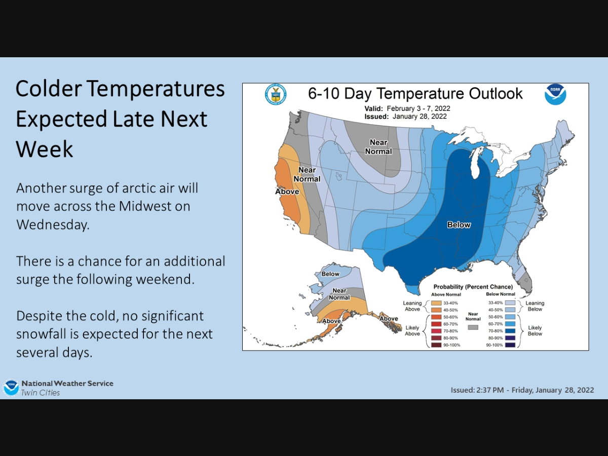
"Another blast of arctic air will move in Wednesday of next week, with an additional round possible the following weekend," the National Weather Service said.
Monday's high will be 32 degrees, but by Wednesday, the high will be 7 degrees.
Find out what's happening in Southwest Minneapolisfor free with the latest updates from Patch.
Here's the full NWS forecast for the Twin Cities metro area:
Saturday: Partly sunny, with a high near 27. South southeast wind 5 to 10 mph becoming west northwest in the afternoon.
Find out what's happening in Southwest Minneapolisfor free with the latest updates from Patch.
Saturday Night: Mostly cloudy, with a low around 10. North northwest wind 5 to 10 mph.
Sunday: Partly sunny, with a high near 20. Northwest wind around 5 mph becoming south southwest in the afternoon.
Sunday Night: Mostly cloudy, with a low around 13. South southeast wind 5 to 10 mph.
Monday: Partly sunny, with a high near 32. South wind around 10 mph.
Monday Night: Mostly cloudy, with a low around 17. South wind 5 to 15 mph becoming west northwest after midnight.
Tuesday: Mostly sunny, with a temperature falling to around 16 by 5pm. West northwest wind 10 to 15 mph, with gusts as high as 25 mph.
Tuesday Night: Partly cloudy, with a low around -2. Northwest wind 5 to 10 mph.
Wednesday: A 20 percent chance of snow. Partly sunny, with a high near 7. North northwest wind 5 to 10 mph.
Wednesday Night: Mostly cloudy, with a low around -10. North northwest wind around 10 mph.
Thursday: Mostly sunny and cold, with a high near 3. North northwest wind 5 to 10 mph.
Get more local news delivered straight to your inbox. Sign up for free Patch newsletters and alerts.


