Weather
MN Weather: High Of 75 Possible Saturday
"The last time we had 70 degrees at St Cloud, Twin Cities, and Eau Claire was October 19 of last year," the National Weather Service said.

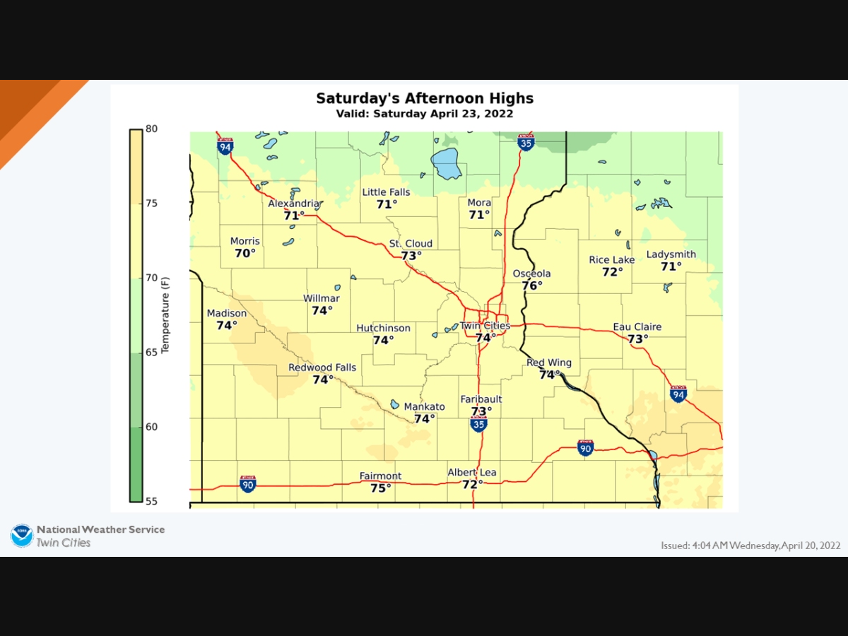
TWIN CITIES, MN — The Twin Cities will finally see temperatures in the mid-70s this weekend, according to the latest forecast from the National Weather Service.
"On Saturday most locations will have highs in the 70s," the NWS said. "The last time we had 70 degrees at St Cloud, Twin Cities, and Eau Claire was October 19 of last year."
Here’s the full NWS forecast from the Minneapolis-St. Paul International Airport:
Find out what's happening in Southwest Minneapolisfor free with the latest updates from Patch.
Wednesday: Rain, mainly between 11am and 5pm. High near 49. Southeast wind around 15 mph, with gusts as high as 30 mph. Chance of precipitation is 100%. New precipitation amounts between a half and three quarters of an inch possible.
Wednesday Night: A 10 percent chance of rain before 7pm. Mostly cloudy, then gradually becoming mostly clear, with a low around 37. West southwest wind 5 to 10 mph.
Find out what's happening in Southwest Minneapolisfor free with the latest updates from Patch.
Thursday: Sunny, with a high near 56. West northwest wind 10 to 15 mph.
Thursday Night: A 20 percent chance of rain after 1am. Partly cloudy, with a low around 42. North northeast wind 5 to 15 mph becoming east after midnight.
Friday: Rain likely, with thunderstorms also possible after 4pm. Mostly cloudy, with a high near 58. Breezy, with an east southeast wind 15 to 25 mph, with gusts as high as 40 mph. Chance of precipitation is 60%. New rainfall amounts of less than a tenth of an inch, except higher amounts possible in thunderstorms.
Friday Night: Rain and possibly a thunderstorm. Temperature rising to around 59 by 4am. Breezy, with an east southeast wind around 20 mph, with gusts as high as 30 mph. Chance of precipitation is 80%. New rainfall amounts between a quarter and half of an inch possible.
Saturday: Rain likely, with thunderstorms also possible after 1pm. Mostly cloudy, with a high near 74. Breezy, with a south wind 20 to 25 mph, with gusts as high as 40 mph. Chance of precipitation is 70%.
Saturday Night: Rain likely and possibly a thunderstorm before 1am, then a chance of rain. Mostly cloudy, with a low around 46. Breezy, with a southwest wind 15 to 20 mph, with gusts as high as 30 mph. Chance of precipitation is 60%.
Sunday: A 30 percent chance of rain, mainly before 1pm. Partly sunny, with a high near 55. Breezy, with a southwest wind 15 to 20 mph, with gusts as high as 30 mph.
Sunday Night: Mostly cloudy, with a low around 37. West wind 10 to 15 mph.
Get more local news delivered straight to your inbox. Sign up for free Patch newsletters and alerts.


