Weather
MN Weather: Messy Thursday On Tap For Twin Cities
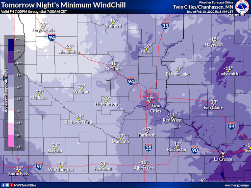
Following Thursday's winter storm, temperatures will quickly drop Friday when the low will fall to 3 degrees below zero.

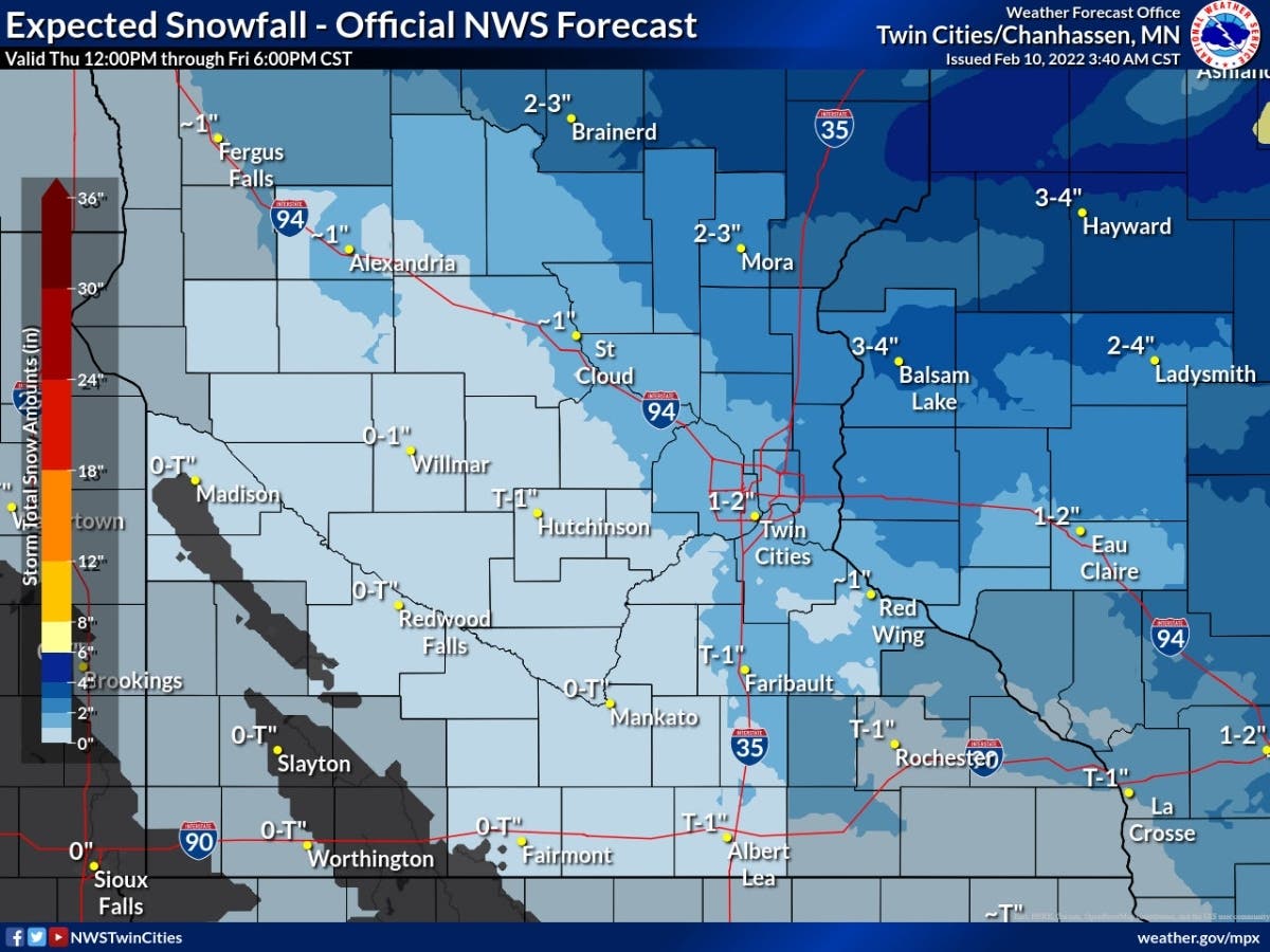
TWIN CITIES, MN — Commuters in the Minneapolis-St. Paul metro area will encounter snow and freezing rain Thursday afternoon. About an inch of new snow could accumulate by the end of the day, along with a new coat of ice.
Temperatures will quickly drop Friday when the low will fall to 3 degrees below zero.
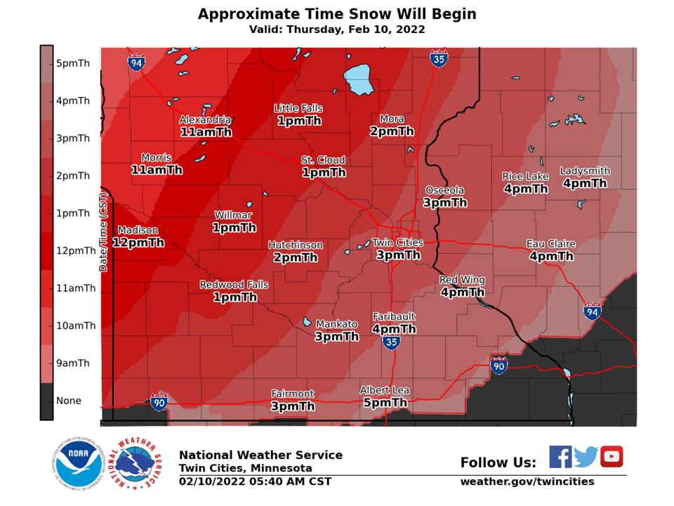
Timing of Thursday's snow
Find out what's happening in Southwest Minneapolisfor free with the latest updates from Patch.
The snow will start at about 3 p.m. in the metro.
Friday's wind chills
Find out what's happening in Southwest Minneapolisfor free with the latest updates from Patch.
Here's the full NWS forecast for the Twin Cities metro area:
Thursday: Snow, mainly after 4pm. High near 35. West wind 5 to 15 mph becoming south in the afternoon. Winds could gust as high as 30 mph. Chance of precipitation is 100%. Total daytime snow accumulation of around an inch possible.
Thursday Night: Rain and snow before 1am, then a slight chance of drizzle between 1am and 4am, then a slight chance of drizzle and snow after 4am. Temperature rising to around 37 by 10pm. Breezy, with a south southwest wind 15 to 20 mph becoming west after midnight. Winds could gust as high as 30 mph. Chance of precipitation is 100%. New snow accumulation of less than a half inch possible.
Friday: A slight chance of drizzle, snow, and freezing drizzle before 10am, then a slight chance of snow between 10am and 1pm, then a chance of flurries after 1pm. Mostly cloudy, with a temperature falling to around 16 by 5pm. Breezy, with a northwest wind 15 to 25 mph, with gusts as high as 35 mph. Chance of precipitation is 20%.
Friday Night: A chance of flurries before 7pm. Partly cloudy, with a low around -3. Wind chill values as low as -13. Blustery, with a north northwest wind 15 to 20 mph decreasing to 10 to 15 mph after midnight. Winds could gust as high as 30 mph.
Saturday: Mostly sunny, with a high near 7. North northwest wind 5 to 10 mph becoming west in the afternoon.
Saturday Night: A 20 percent chance of snow after 7pm. Mostly cloudy, with a low around -4. West southwest wind around 5 mph becoming east northeast after midnight.
Sunday: A 20 percent chance of snow before 7am. Mostly sunny, with a high near 13. North northeast wind around 5 mph becoming south southeast in the afternoon.
Sunday Night: Mostly cloudy, with a low around 3. South southeast wind around 5 mph.
Monday: Mostly sunny, with a high near 22. South southeast wind around 5 mph becoming west southwest in the afternoon.
Monday Night: Partly cloudy, with a low around 10. Southeast wind around 5 mph.
Tuesday: Partly sunny, with a high near 35. Southeast wind 5 to 15 mph.
Tuesday Night: Mostly cloudy, with a low around 22. South southeast wind 5 to 10 mph becoming west after midnight.
Wednesday: Mostly cloudy, with a high near 30. North northwest wind 5 to 10 mph.
Get more local news delivered straight to your inbox. Sign up for free Patch newsletters and alerts.


