Weather
Wednesday Night Storm Shatters Record In The Twin Cities
The massive overnight storm set a new daily precipitation record for the Twin Cities metro.

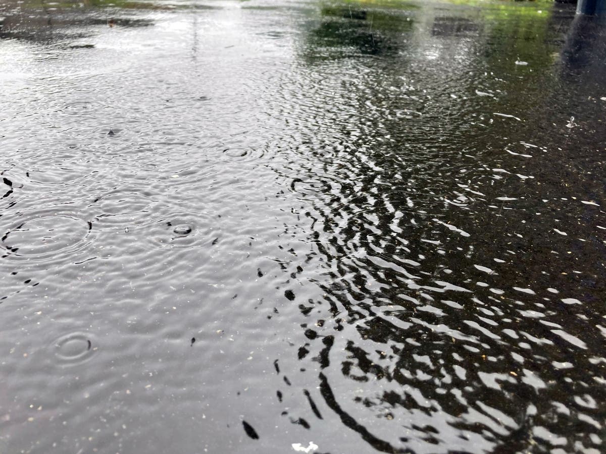
TWIN CITIES, MN — It turns out that Wednesday night's rain deluge in the Twin Cities was historic. The storm set a new daily precipitation record for the metro.
A total of 1.94 inches of rain was recorded at the Minneapolis-St. Paul International Airport, according to the National Weather Service. That number broke the previous May 11 record of 1.55 inches set in 1935.
The storm overnight caused hundreds of power outages, property damage, and plus urban flooding.
Find out what's happening in Southwest Minneapolisfor free with the latest updates from Patch.
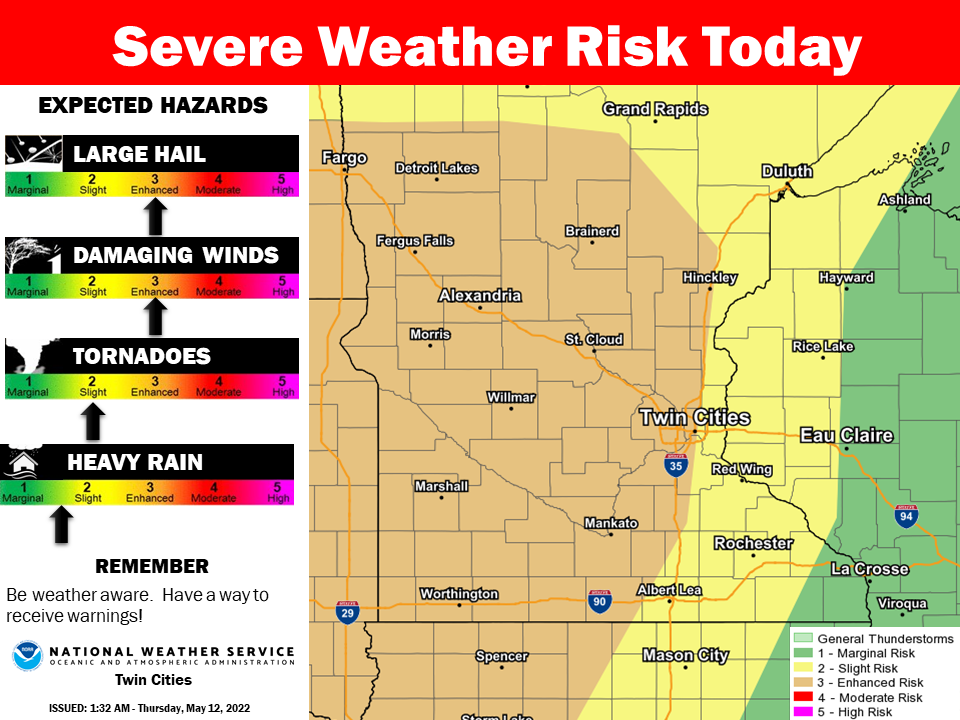
More storms are possible Thursday in the metro and across central Minnesota.
"Another Enhanced Risk for Severe Weather is expected today, with some elevated storms in western Minnesota possible early in the morning and a better chance for more widespread severe weather during the afternoon and evening," NWS said.
Find out what's happening in Southwest Minneapolisfor free with the latest updates from Patch.
"All hazard types are possible, with strong winds expected to be the biggest concern right now."
Here’s the full NWS forecast from the Minneapolis-St. Paul International Airport:
Thursday: Patchy fog before 8am. Otherwise, mostly sunny, with a high near 89. East northeast wind 5 to 10 mph becoming south southeast 10 to 15 mph in the afternoon. Winds could gust as high as 30 mph.
Thursday Night: Showers and thunderstorms likely, mainly before 1am. Some of the storms could be severe. Partly cloudy, with a low around 65. Southeast wind 10 to 15 mph becoming south southwest in the evening. Winds could gust as high as 30 mph. Chance of precipitation is 60%. New rainfall amounts of less than a tenth of an inch, except higher amounts possible in thunderstorms.
Friday: Mostly sunny, with a high near 79. West southwest wind 10 to 15 mph.
Friday Night: Mostly clear, with a low around 57. West southwest wind 5 to 10 mph.
Saturday: Sunny, with a high near 79. South southwest wind 5 to 15 mph.
Saturday Night: A 20 percent chance of showers before 1am. Partly cloudy, with a low around 54. West northwest wind 5 to 10 mph.
Sunday: A 20 percent chance of showers after 1pm. Sunny, with a high near 72. West wind 5 to 15 mph.
Sunday Night: Mostly clear, with a low around 51. West northwest wind 5 to 15 mph.
Monday: Sunny, with a high near 66. Northwest wind 10 to 15 mph, with gusts as high as 30 mph.
Monday Night: Mostly clear, with a low around 47. North northeast wind 5 to 15 mph.
Tuesday: Mostly sunny, with a high near 67. North wind 5 to 10 mph.
Tuesday Night: A 20 percent chance of showers. Partly cloudy, with a low around 50. East wind 5 to 10 mph.
Wednesday: A 30 percent chance of showers. Partly sunny, with a high near 67. Southeast wind around 10 mph.
Get more local news delivered straight to your inbox. Sign up for free Patch newsletters and alerts.


