Weather
Saturday Will Feature Rain, Thunder, Fog, And Even Snow In MN
Saturday will feature all kinds of weather in the Twin Cities metro area, except the dry kind.

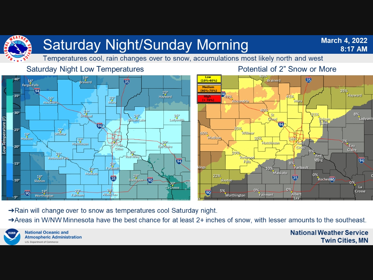
TWIN CITIES, MN — Saturday will feature all kinds of weather in the Twin Cities metro, except the dry kind. Expect rain, fog, thunder — and yes — even snow later on.
"As Saturday's system departs we expect a period of snow for parts of the area as the temperatures fall back below freezing," the National Weather Service said.
Sunday will be considerably milder, with no precipitation and a high near 33.
Find out what's happening in Southwest Minneapolisfor free with the latest updates from Patch.
Here's the full NWS forecast for the Twin Cities metro area.
Friday: Mostly cloudy, with a high near 38. East southeast wind around 15 mph.
Find out what's happening in Southwest Minneapolisfor free with the latest updates from Patch.
Friday Night: Rain, mainly between 1am and 4am. Patchy fog after 3am. Low around 33. East southeast wind 10 to 15 mph. Chance of precipitation is 80%. New precipitation amounts between a tenth and quarter of an inch possible.
Saturday: A chance of rain and thunderstorms, then rain and possibly a thunderstorm after 1pm. Widespread fog, mainly before 10am. High near 45. East wind 5 to 10 mph. Chance of precipitation is 100%. New rainfall amounts between a half and three quarters of an inch possible.
Saturday Night: Rain, snow, and freezing rain before 2am, then freezing rain likely, possibly mixed with snow. Some thunder is also possible. Low around 28. Blustery, with a north northeast wind 10 to 20 mph becoming northwest after midnight. Winds could gust as high as 30 mph. Chance of precipitation is 100%. Little or no ice accumulation expected. New snow accumulation of less than a half inch possible.
Sunday: Mostly cloudy, with a high near 33. West northwest wind 10 to 15 mph.
Sunday Night: Mostly cloudy, with a low around 19. North northwest wind 5 to 10 mph.
Monday: Mostly cloudy, then gradually becoming sunny, with a high near 29. Northwest wind 5 to 10 mph.
Monday Night: Mostly clear, with a low around 17. West northwest wind 5 to 10 mph becoming southwest after midnight.
Tuesday: Mostly sunny, with a high near 39. West wind 10 to 15 mph.
Tuesday Night: Partly cloudy, with a low around 20. West wind 5 to 10 mph.
Wednesday: Partly sunny, with a high near 32. Northwest wind 5 to 10 mph.
Wednesday Night: A 30 percent chance of snow. Mostly cloudy, with a low around 20. North northeast wind around 5 mph.
Thursday: A 50 percent chance of snow. Mostly cloudy, with a high near 28. North northeast wind 5 to 10 mph.
Get more local news delivered straight to your inbox. Sign up for free Patch newsletters and alerts.


