Community Corner
Storm Update: Downgraded, But Snow is Still Coming in NH
Hazardous weather watch alert issued for the Seacoast; First day of Spring storm path still uncertain, according to NWS.

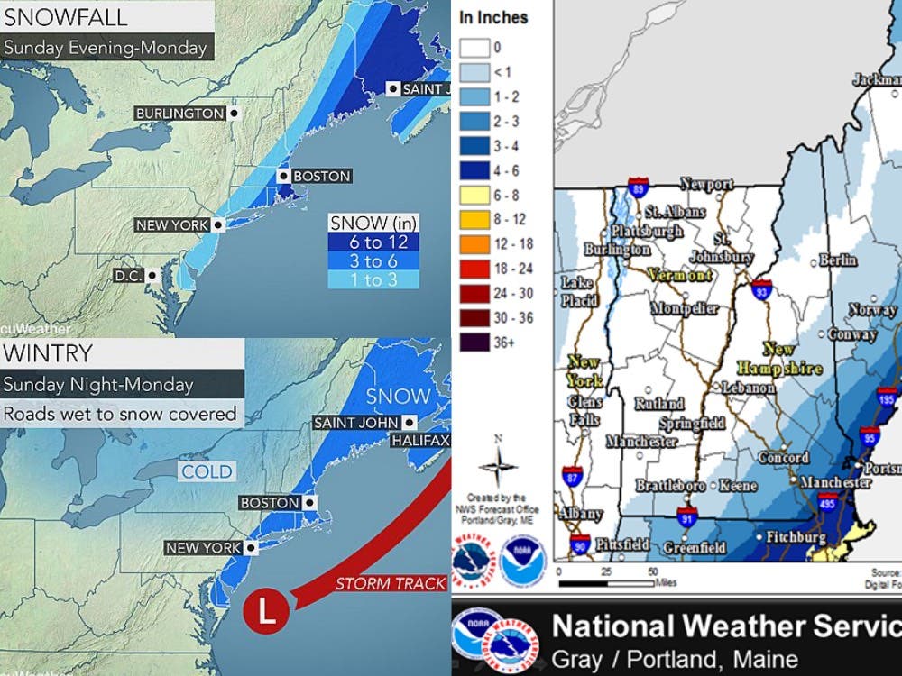
The National Weather Service has issued a “Winter Storm Watch” for the first day of Spring storm at 9:38 a.m. on March 20, 2016, warning residents along the Seacoast of New Hampshire of up to six inches of snow tonight through tomorrow morning.
The low-pressure system will form tonight along Long Island and then pass through the Gulf of Maine on Monday. The most snow will fall along or near the coastline.
“There is a very high amount of uncertainty with the exact track and strength of this system,” according to the NWS. “Hence, a winter storm watch will remain in effect.”
Find out what's happening in Amherstfor free with the latest updates from Patch.
AccuWeather.com is warning of travel and commuter issues tonight and tomorrow morning, due to the storm activity.
The storm is expected to run through Monday afternoon with wind gusts of up to 25 mph.
Find out what's happening in Amherstfor free with the latest updates from Patch.
Forecast for the next 36 hours
Here’s the latest National Weather Service forecast:
Snow during the evening with temps in the 20s. The snow is expected to continue into Monday morning. The storm is expected to end sometime between noon and 3 p.m.
Snow accumulations are expected to run between an inch in Concord and the capital region, about two inches in Amherst, Bedford, Milford, and Merrimack, three inches in Exeter, Londonderry, Salem and Windham, and four to six inches in Hampton, North Hampton, and Portsmouth.
The latest weather forecast is on the front page of every Patch.com website, including the 12 New Hampshire Patch news and community websites.
Graphics courtesy of the NWS and AccuWeather.com.
Get more local news delivered straight to your inbox. Sign up for free Patch newsletters and alerts.