Community Corner
Here Come the Thunderstorms
Forecasters suggest that rain will cool things off in the Granite State … but how does the weekend look?

The National Weather Service issued a Hazardous Weather Outlook today for most of the Granite State with lasting through this evening.
Thunderstorms are possible in the afternoon and evening and some storms could be strong or severe, at times, with damaging wind being the primary threat.
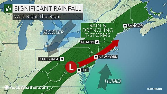
This weather pattern, according to AccuWeather.com, should bring slightly cooler temps to the region.
Find out what's happening in Bedfordfor free with the latest updates from Patch.
The rain is expected to stick around into Thursday with temperatures in the mid-to-upper 70s. Evening rain is also possible. More seasonable temps remain for the rest of the week and into the weekend.
The forecast
Find out what's happening in Bedfordfor free with the latest updates from Patch.
Sunny and warm for the rest of the day until around 10 or 11 p.m. when showers and thunderstorms are expected. Lows drop down into the mid-60s. As much as a quarter of an inch is expected to fall.
On Thursday, more showers in the morning and evening are expected with highs in the mid-70s. Overnight lows drop down into the upper 50s.
Rain is likely in the morning on Friday and then clearing up with highs in the low 70s. Expect partly cloudy during the evening with highs in the mid-50s.
On Saturday, mostly sunny skies with highs in the mid-70s, and cloudy during the evening, with lows in the mid-50s.
The rain could return on Sunday with temps in the lower 70s. Evening temps drop down into the mid-50s.
Monday is expected to by rainy, too.
Visit your local NH Patch site for the latest, updated weather forecast on the front page.
Get more local news delivered straight to your inbox. Sign up for free Patch newsletters and alerts.