Community Corner
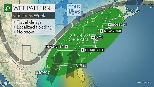
Wet Weather Heading Our Way
But will it be a white Christmas or the warmest Christmas Eve on record for New Hampshire?

The big question on everyone’s mind is will it be a white Christmas or not this year?
Well, unless the Snow Miser throws snowballs at his brother, the Heat Miser, it’s unlikely. In fact, with the rain coming into the region, followed by a warm front hitting the Northeast and New England on the day before Christmas, it might be the warmest Christmas Eve on record, according to the meteorologists at AccuWeather.com.
Temperatures on Thursday will be 25 to 30 degrees above normal … it will feel like Spring, not Christmas, forecasters predict.
Find out what's happening in Bedfordfor free with the latest updates from Patch.
The forecast
Tonight: Clear and cool with temperatures in the low 20s.
Find out what's happening in Bedfordfor free with the latest updates from Patch.
Monday: Partly sunny skies with highs in the mid-to-low 40s. During the evening, clouds roll in and temps drop down into the 30s.
Tuesday: Showers likely in the morning and afternoon with highs in the upper 40s. Partly cloudy skies and lows in the 30s during the evening.
Wednesday: A 50-50 chance of rain and some sun with highs in the upper 40s with rain continuing at night.
Thursday: A slight chance of showers with highs in the low 60s. During the evening, temps will drop down into the 40s.
For the latest weather forecast including the week ahead and the latest temps and conditions, visit the front page of any Patch.com site across the country, including the 12 New Hampshire news and community websites covering 13 cities and towns in the Granite State.
Get more local news delivered straight to your inbox. Sign up for free Patch newsletters and alerts.