Community Corner
Get Ready for a Weekend Snowstorm
NWS issues hazardous weather outlook for NH due to "colossal" East Coast storm; 1-6-inches expected; seacoast gusts could reach 60 mph.

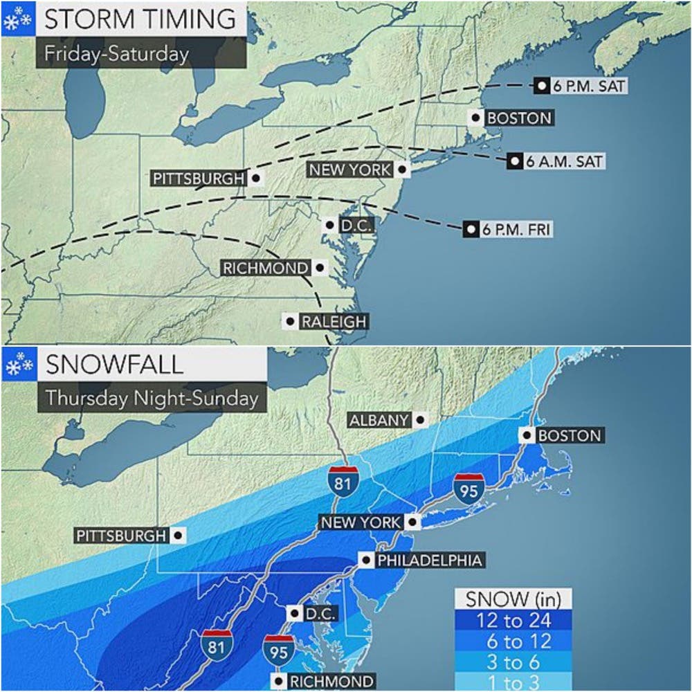
The National Weather Service has issued a hazardous weather outlook for southern New Hampshire for a weekend storm that could dump as much as two feet of snow in some parts of the mid-Atlantic states and anywhere from one to six inches in southern New Hampshire, as it moves up the coast on Friday.
The track of the “colossal” storm, nicknamed Jonas, is unknown at post time (1:40 p.m. on Jan. 20, 2016).
“While there remains uncertainty regard the exact track of this storm, the potential exists for accumulating snow across southern and coastal sections,” according to the alert.
Find out what's happening in Hampton-North Hamptonfor free with the latest updates from Patch.
The NWS is also warning to watch for the threat of coastal flooding since astronomical tides will reach their monthly peak this weekend. Earlier today, most forecasters were predicting that the worst part of the storm seemed to be tracking south.
Find out what's happening in Hampton-North Hamptonfor free with the latest updates from Patch.
AccuWeather.com is suggesting that Granite Staters should expect one to three inches at the very least, from the Lakes Region south, with three to six inches in very southern part and Seacoast sections of the state, which would include Nashua, Windham, Salem, Hampton, and North Hampton.
Gusts of up to 60 mph are expected along the coast.
NH Patch will update this forecast as more information becomes available.
And don’t forget: The latest weather forecast including temperatures and conditions are live on the front of every Patch.com news and community websites, including the 12 covering New Hampshire.
Graphic credit: AccuWeather.com
Get more local news delivered straight to your inbox. Sign up for free Patch newsletters and alerts.