Community Corner
Messy Weather Mix Coming this Weekend
All the nice weather New Hampshire has been enjoying is about to go away.

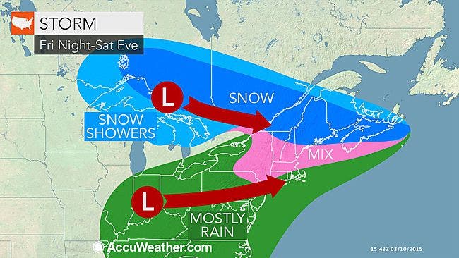
The National Weather Service has issued a hazardous weather outlook for Thursday due to a cold front coming into the region and for Friday and Saturday, for a mix of freezing rain and snow, according to AccuWeather.com.
The NWS hazardous weather outlook was issued for the entire state, as well as most of New England.
The cold front will send temperatures into the mid-to-upper-30s on Thursday and then low teens during the evening. The sun is expected to return on Friday and with it, slightly warmer temperatures.
Find out what's happening in Londonderryfor free with the latest updates from Patch.
But then, clouds and colder temperatures roll in during the afternoon and evening, along with scattered freezing rain showers and snow on Saturday morning and evening.
“A couple of inches of snow and sleet can occur before a change to mostly rain,” according to forecasters.
Find out what's happening in Londonderryfor free with the latest updates from Patch.
Snow and freezing rain may hang around into Sunday, according to the NWS.
“A pattern of see-saw-like temperatures will follow next week,” according to AccuWeather.com.
Get more local news delivered straight to your inbox. Sign up for free Patch newsletters and alerts.