Community Corner
River E. Coli Levels Return to Normal
Tests by the Souhegan Watershed Association show levels returning to "more acceptable, normal levels."

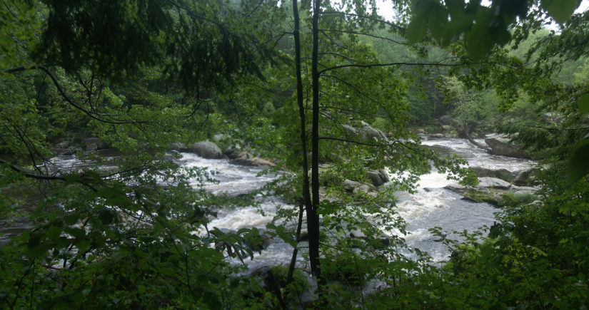
E. coli levels in both the Merrimack and Souhegan Rivers returned to a more acceptable, normal level this week according to tests done by the Souhegan Watershed Association as part of their regular ongoing water quality testing program, according to a press statement.
Since the beginning of June Tuesday morning tests were conducted after heavy rainstorms. Heavy rainstorms are responsible for increasing the bacteria levels in the rivers. And both rivers had generally unacceptable levels of E. coli during that time. This week no rain preceeded the tests and the E. coli levels came down.
The Merrimack River between Manchester and Tyngsborough normally tests as very clean for bacteria levels – and this week, without rain, it returned to normal. The average bacteria level for the river monitored at eleven sites came out to 26. Numbers less than 88 are considered healthy for swimming in NH rivers. None of the eleven sites tested had a count higher than that. Goffs Falls, a popular eddy, was 45.
Find out what's happening in Merrimackfor free with the latest updates from Patch.
The Souhegan River is a much smaller river and therefore more responsive to rain events that wash bacteria into the river from natural riverbanks and from storm drains and parking lots directed to the river. After heavy rains the Souhegan generally shows unhealthy increases in the bacteria levels. This week the average count in the upper, faster moving stretch, from New Ipswich to Wiltonwas a healthy 25. From Milford to Merrimack the river meanders back and forth, slows down, warms up, and bacteria counts generally increase. This week the average count in this section was an unhealthy 190.
Although there are no public beaches on the Souhegan, swimmers congregate at a number of ‘swimming holes’ that are tested. Water Loom Pond in New Ipswich , the Boston Post Road Canoeport in Amherst, Indian Ledges, Turkey Hill Bridge, and Watson Park in Merrimack all tested at acceptable levels. The Horseshoe in Wilton tested at 124, not perfect but generally OK for healthy adults . The actual results for each particular site are available at souheganriver.org.
Find out what's happening in Merrimackfor free with the latest updates from Patch.
The flow on both rivers is still slightly higher than its expected, historical average, but all of the 30 monitors taking samples Tuesday morning noted how much lower the water was from the prior test dates after the heavy rains.
Monitors noted the abundance of flowering plants and animal tracks along the riverbanks, but also noted the abundance of mosquitoes. Monitors also pick up trash left by careless kids and fishermen at some of the sites. The boat access at Thorntons Ferry in Merrimack is a popular ATV area and particular offender.
Besides the 30 monitors that have adopted their sites and deliver their samples and data, certified lab personnel in the Greenville, Milford, Merrimack, Manchester, and Nashua waste treatment facilities perform the tests for dissolved oxygen and E. coli bacteria.
Tests are collected every two weeks during the summer. The next test will be done on July 28; results will be available the following day.
Here are this week’s results:
E-COLI MONITORING RESULTS FOR TESTS TAKEN ON JULY 14, 2015
SOUHEGAN RIVER SITES:
- Billy Ward Pond, Ashburnham #1 3.1, #2 <1.0
- SoR 333 Water Loom Pond, New Ipswich 5.2
- SoR 320 Highbridge, New Ipswich 14.6
- SoR 309 Above Greenville Mill Pond, Greenville 43.2
- SoR 296 Downtown Greenville upstream of WWTP 18.3
- SoR 291 Green Bridge off Rte 31 below Greenville WWTP 33.6
- SoR 218 Below the Horseshoe, Wilton 123.6
- SoR 210 Downtown Wilton 387.3
- SoR 201 Pine Valley Mill, West Milford 156.5
- SoR 170 Behind Hayward Field, West Milford NA
- SoR 155 Souhegan Valley Boys and Girls Club, Milford 172.3
- SoR 146 Swing Bridge, Milford 228.2
- SoR 133 Riverside Cemetery, Milford 150.0
- SoR 130 Behind Lorden Plaza, Milford 133.3 (DUP 88.2)
- SoR 122 Amherst Country Club 198.9
- SoR 116 Amherst Conservation land Fairway Road, Amherst NA
- SoR 095 Boston Post Road Canoeport, Amherst 83.6
- SoR 070 Seaverns Bridge, Merrimack 86.0
- SoR 057 Indian Ledges, Merrimack 59.1
- SoR 034 Turkey Hill Bridge, Merrimack NA
- SoR 001 Watson Park, DW Hwy, Merrimack 38.9
- Beaver Brook, Amherst 160.7
MERRIMACK RIVER SITES:
1. Mer 600 Above Amoskeag Dam, Manchester 28.2
2. Mer 590 Arms Park, Manchester 8.4
3. Mer 570 Goffs Falls, Litchfield 44.8
4. Mer 560 Depot Street, Merrimack 33.1
5. Mer 550 Upstream of Souhegan River, Merrimack NA
6. Mer 540 Thorntons Ferry, Merrimack 27.9
7. Mer 530 Greeley Park, Nashua 34.5
8. Mer 520 Taylors Falls Bridge, Nashua 21.1
9. Mer 510 Sagamore Bridge, Hudson 26.5
10. Mer 500 Pheasant Lane Mall, Hudson NA
11. Mer 490 Upstream of Tyngsboro Bridge 10.9
Flow on Upper Souhegan was 51 CFS and expected flow for that date is 26
Flow on Lower Souhegan was 112 CFS and historic flow for that date is 62
Flow on Merrimack was 2020 CFS and historic flow for that date is 1970 (very fluctuating flows)
RAINFALL - Clear
Temperatures: Souhegan 22C; Merrimack 25C
Get more local news delivered straight to your inbox. Sign up for free Patch newsletters and alerts.