Community Corner
A Wet Start to the Weather Week
Details on when the showers will start and end, and how the rest of the weather looks in New Hampshire.

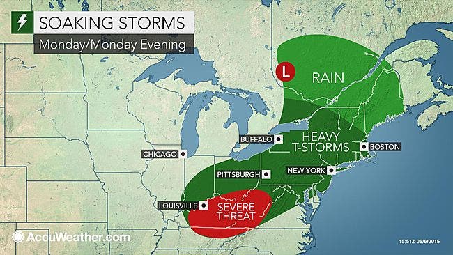
Accuweather.com is warning of “soaking storms, drenching downpours, and heavy thunderstorms” at the beginning of this week and potentially running through Tuesday, according to the site’s latest forecast video.
A cold front will trigger the storms and there could be potential flooding in low lying and urban areas. Sunny skies will return by Wednesday, according to forecasters, and continue off and on through the weekend.
The Granite State forecast
Find out what's happening in Merrimackfor free with the latest updates from Patch.
Tonight, expect partly cloudy skies with lows in the mid-to-upper-40s with a light breeze.
On Monday, there will be a 50 percent chance of rain with highs in the low 70s and light winds. Temperatures will drop down into the low 60s during the evening.
Find out what's happening in Merrimackfor free with the latest updates from Patch.
Expect similar weather on Tuesday with slightly higher temps until the rain moves out during the evening.
On Wednesday, the sun returns, with highs in the 80s and lows in the 60s during the evening.
There’s a slight chance – 30 percent – of more showers on Thursday with highs in the mid-80s and clouds at night.
On Friday, more sun, with a slight chance the showers could return during the weekend.
Get more local news delivered straight to your inbox. Sign up for free Patch newsletters and alerts.