Community Corner
Milford FD Warns of Hurricane Sandy Impacts
The Milford Fire Department update on the storm expected to belt the area Monday.

It is becoming clear that the area will have potentially serious impacts from Hurricane Sandy, the Milford Fire Department notes in a Sunday update on the storm.
High winds Monday are expected to continue into Tuesday morning. Outages are likely, local and state emergency management officials say, urging Granite Staters to plan accordingly.
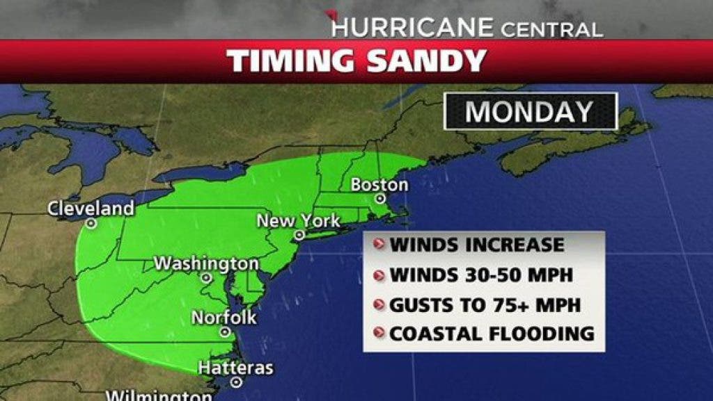
Some points on the storm, via the National Weather Service and conveyed to Milford residents today:
Find out what's happening in Milfordfor free with the latest updates from Patch.
• Heaviest rainfall/strongest winds will occur from Monday afternoon through early Tuesday morning.
• Wind gusts 50-60 mph, possibly some 70 mph gusts in southern area and expected sustained winds 30-40 mph.
• Ocean waves up to 20-25 feet; on beaches expect battering waves and beach erosion
• Rainfall 1 to 3 inches in a short period of time.
• Possible coastal flooding with expected surge of around 2 feet around time of high tide midday Monday and 2 to 3 feet around midnight Monday night.
Resources and additional preparedness tips are available at:
Find out what's happening in Milfordfor free with the latest updates from Patch.
Ready.gov, NH.gov/readynh, as well as weather.gov.
Milford FD recommends area residents plan for possible outages, and be wary of possible obstructions in roadways, including debris and possible high water from flooding.
Get more local news delivered straight to your inbox. Sign up for free Patch newsletters and alerts.