Weather
Massive Inbound Snow Storm Will ‘Shut Everything Down,’ Forecaster Says
New Jersey is forecast to receive at least 1 foot of snow in this weekend's storm, according to the latest forecast.


UPDATE: AccuWeather Chief Meteorologist Jonathan Porter says the incoming storm will tracking into New Jersey Sunday will “shut everything down.”
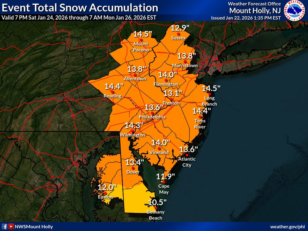
The National Weather Service has released an updated map estimating total snow accumulation in connection with the weekend storm. According to the map released Thursday afternoon, New Jerseyans should expect between 9 and 18 inches of snow to fall from Saturday night to Monday.
“This storm will have a variety of dangerous and life-threatening hazards,” Porter said Wednesday evening. “The combination of freezing rain, ice and heavy snow, followed by a deep freeze, increases the risk of widespread travel shutdowns, extended business and commerce disruptions and interruptions to daily life.”
Find out what's happening in Across New Jerseyfor free with the latest updates from Patch.
The forecast is subject to change as the winter weather event nears.
See the map below, issued at 1:35 p.m. Thursday.
Find out what's happening in Across New Jerseyfor free with the latest updates from Patch.
All of the Garden State will be under a Winter Storm Watch Saturday evening through Monday afternoon, according to the National Weather Service.
The National Weather Service, in a Thursday morning briefing, estimated that the "low end" accumulation is a minimum of 10 inches of snow for the entire region.
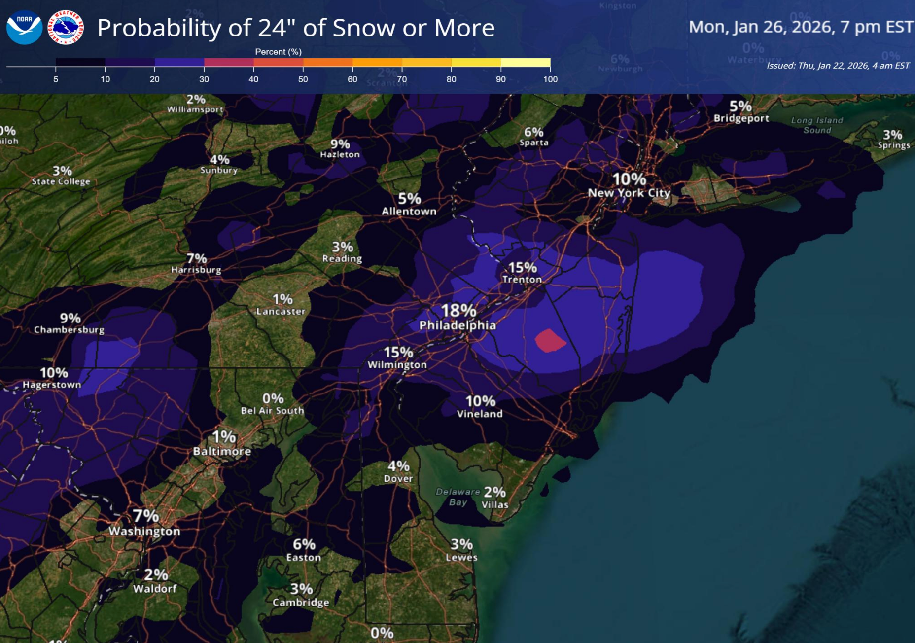
In a "reasonable worst case scenario" some areas could see 2 feet of accumulation. There is an 18 percent chance for 24 inches or more in these areas:
Sleet, freezing rain and plain rain could mix in Sunday afternoon, likely in the Philadelphia metro area and south.
"While this could decrease snow totals some, exactly where mixing occurs remains uncertain, and confidence remains high in significant snow accumulations," the National Weather Service said.
Statewide impacts are anticipated, including hazardous commutes, slippery roads, power outages and possible building damage.
The storm will also be joined by frigid conditions, adding to the danger, forecasters say.
"Bitter cold is expected to continue after the winter storm has passed, with temperatures unlikely to rise above freezing through Wednesday," the National Weather Service.
Patch will continue to share updates as the storm forecast continues to be solidified. Check back for new information.
Get more local news delivered straight to your inbox. Sign up for free Patch newsletters and alerts.